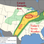
Plethora of East Great Plains Severe Weather This Week
04/14/2026, 12:34 pm EDT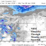
Cold Risks to Midwest and Northwest Great Plains
04/19/2026, 9:48 am EDT
Climate Impact Company Week 2-4 Outlook
North America
Issued: Thursday, April 16, 2026
Highlight: Turning cooler and staying that way through first third of May.
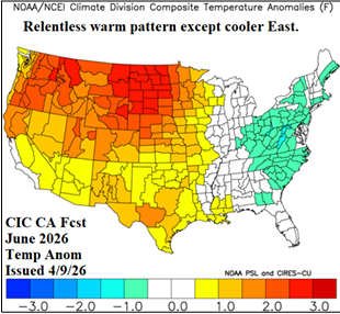
Charts of the day: June temperature outlook STRONGLY favors heat Northwest.
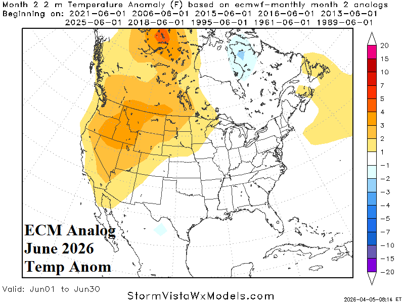
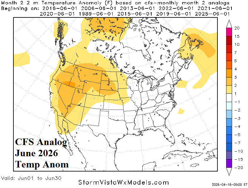
Discussion: The latest ECM and CFS V2 temperature analog forecasts for June are agreeable with hot risk in the Northwest/West U.S. and temperate eastward. The Climate Impact Company constructed analog has wider aerial coverage of the western warmth and a cooler East U.S. solution.
Week-2 Ahead Forecast valid April 26-May 3, 2026: Cooler pattern starts May.
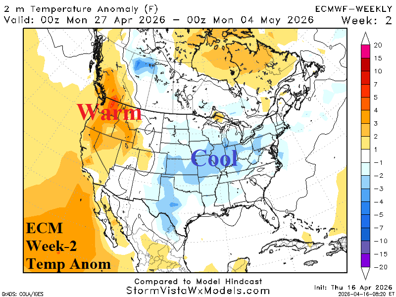
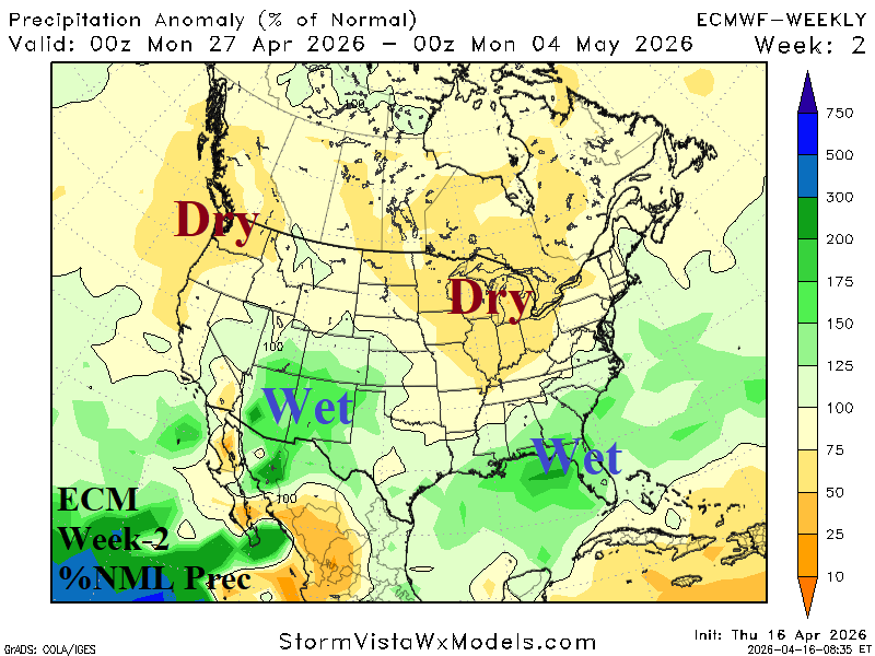
Discussion: -AO/-NAO inspired East U.S. trough cools the nation except for warmth strengthening in the Northwest. The Northwest and Midwest are dry. Wet weather shifts south most effectively over the Southwest and Southeast U.S. where precipitation is needed due to drought.
Week-3 Ahead Forecast valid May 3-10, 2026: No warm-up.
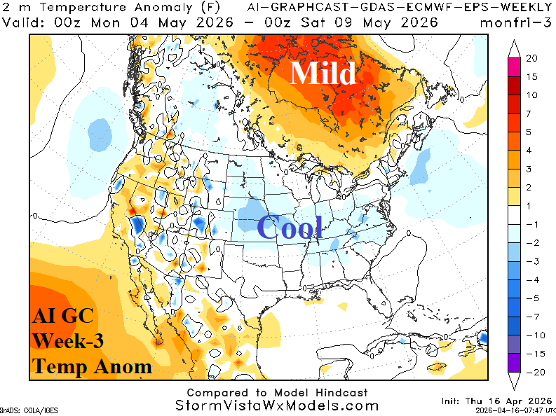
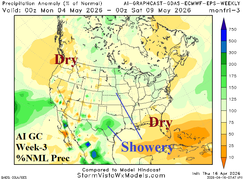
Discussion: The cool pattern is likely to continue as the Madden Julian oscillation (MJO) albeit weak stays in phase_2 which prevents warming. A showery regime is centered on Texas.
Week-4 Ahead Forecast valid May 10-17, 2026: Mid-south/Midwest U.S. wet weather.
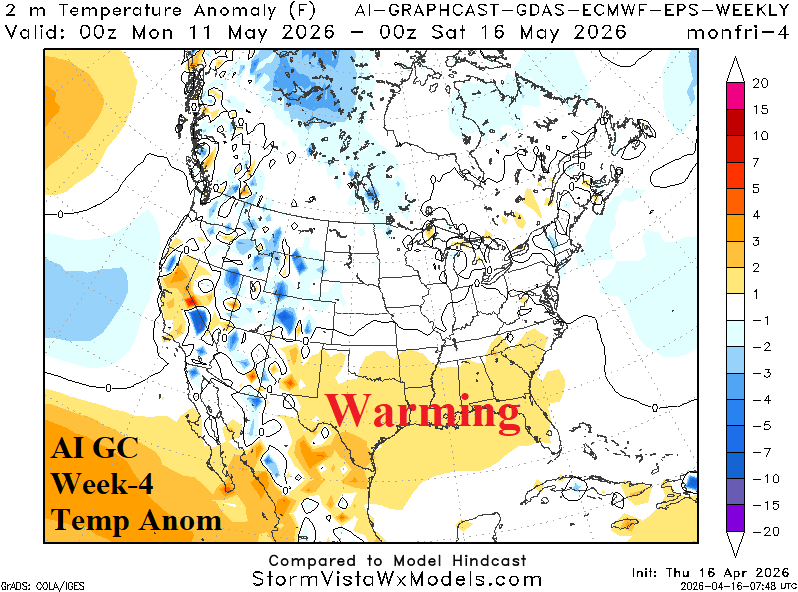
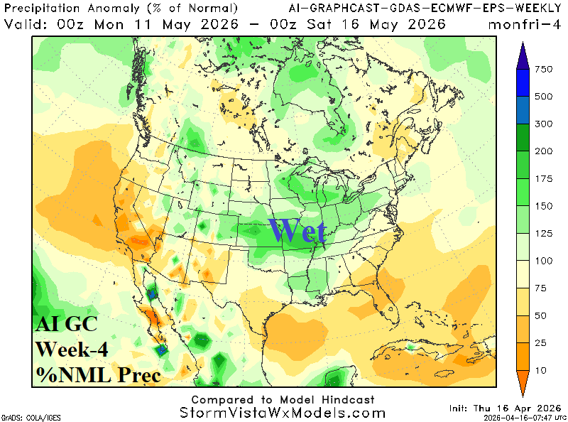
Discussion: AI Graph Cast is utilized as ECM/CFS V2 are too strong with a Northeast U.S. high pressure ridge. Some warming occurs, across the Gulf States and the West/Southwest could be warmer. Mid-south/Midwest U.S. rains are likely and suppress anomalous warm risk.