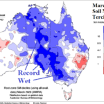
Soaking Wet Soils Central/South Australia as Summer Ends
04/12/2026, 12:42 pm EDT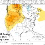
Analogs Agreeable to Very Warm Northwest U.S. in June, Temperate to Cool East
04/16/2026, 10:42 am EDT![]()
Climate Impact Company Daily Feature
Issued: Tuesday, April 14, 2026
Highlight: Plethora of severe storms and flooding rainfall events remainder of this week.
Discussion: Negative Pacific North America (-PNA) pattern assures a cool regime in the West clashing with very warm temperatures in The Central and East to cause daily severe weather outbreaks into the weekend. Today, severe thunderstorms are forecast by NOAA/SPC from Texas to the Midwest States pulsing eastward to New England (Fig. 1). The greatest tornado risk is located from Des Moines, IA to Chicago, IL. Tornado risk is evident in Oklahoma. Areas hit hard by rainfall this spring season receive additional heavy rains with attendant flood risk across southern Michigan (Fig. 2). Severe storms regenerate tomorrow across the southern and eastern Great Plains adding the Midwest and extending eastward to Pennsylvania (Fig. 3). Tornado risk will return to Oklahoma tomorrow. Excessive rainfall and flood risk extends from Dallas, TX to Detroit, MI tomorrow (Fig. 4). On Thursday, expect an upgrade from strong to severe thunderstorm risk in the Ohio Valley (Fig. 5). Additionally, flooding rainfall (risk) may be introduced in parts of the severe thunderstorms risk area. By Friday, another tornado outbreak with attendant flooding rainfall is projected for the Eastern Great Plains (Fig. 6-7). Early season impressive heat for PJM-East abates by the weekend with a cool push early-to-middle next week (Fig. 8). A low confidence forecast for another brief warm period follows. The U.S. gas population weight HDD forecast shifts less warm due to the evolution of -AO/-NAO pattern during the medium/extended range forecast (Fig. 9). Note that CDD’s continue to trail HDD despite the very warm weather across the East this week.
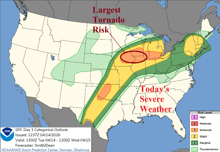
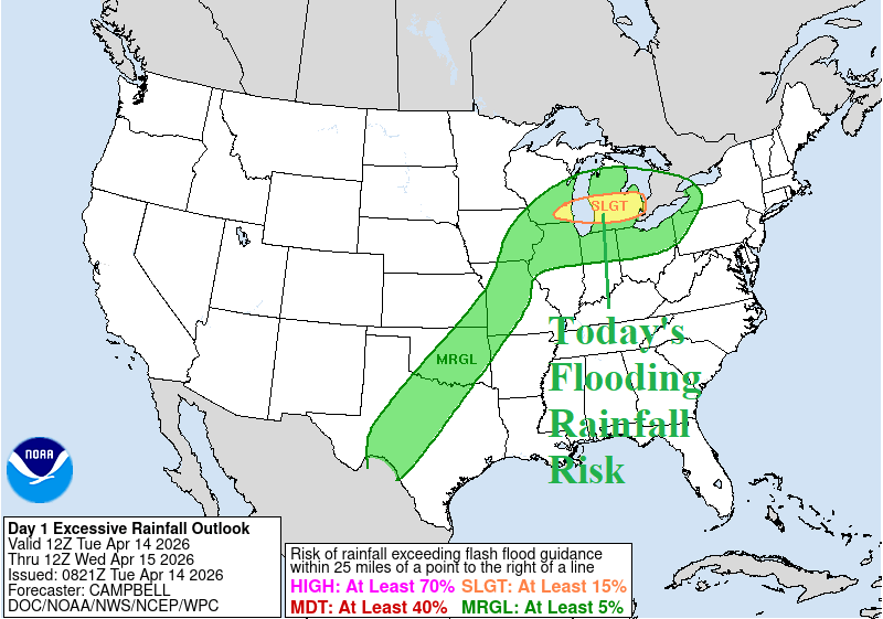
Fig. 1-2: NOAA/SPC severe weather risk areas for today and the NOAA/WPC excessive rainfall/flood risk zones.
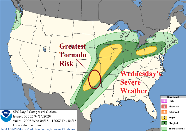
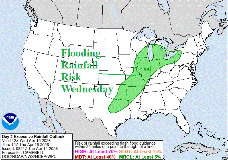
Fig. 3-4: NOAA/SPC severe weather risk areas for tomorrow and the NOAA/WPC excessive rainfall/flood risk zones.
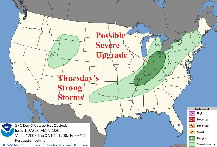
Fig. 5: NOAA/SPC strong thunderstorm risk areas for Thursday.
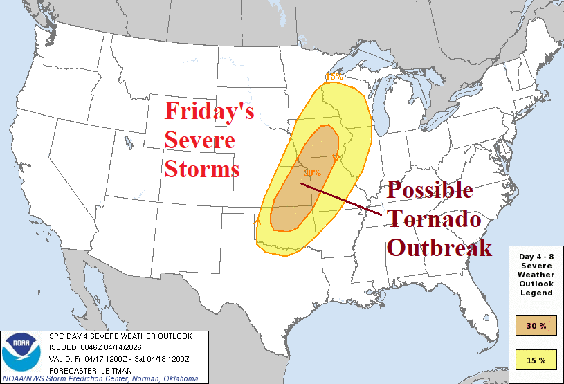
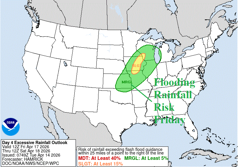
Fig. 6-7: NOAA/SPC severe weather risk areas for Friday and the NOAA/WPC excessive rainfall/flood risk zones.
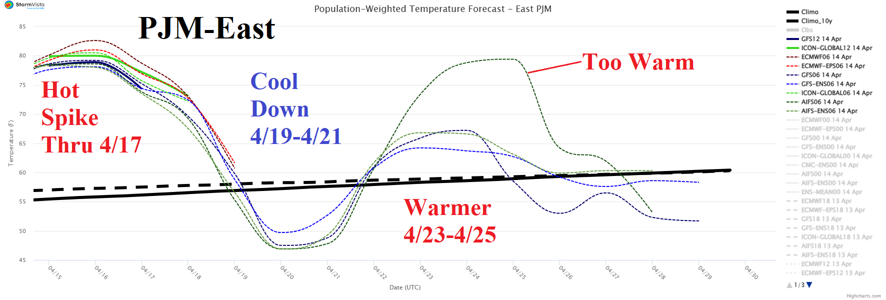
Fig. 8: The PJM-East daily average temperature forecast for the next 15 days.
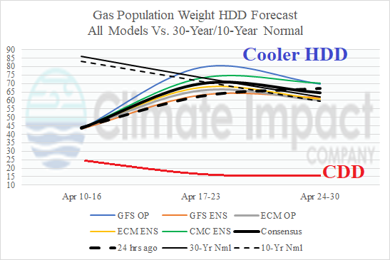
Fig. 9: Comparing gas population weight HDD and population weight CDD forecasts through late April.