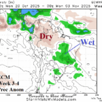
Is Brazil Rain Ahead Later This Month?
10/01/2025, 5:54 am EDT
Titanic Hot High-pressure Ridge Mid-October for Australia!
10/07/2025, 5:22 am EDT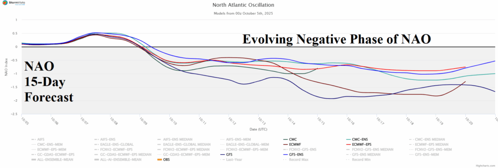
Climate Impact Company U.S. Sunday Report
Issued: Sunday, October 5, 2025
Highlight: Very warm pattern may give into emerging -NAO to cool North and East in the extended range. Tropics not interesting.
Fig. 1: The North Atlantic oscillation 15-day forecast indicates an evolving moderate to strong negative phase usually favoring cooler weather East U.S.
Discussion: The latest North Atlantic oscillation (NAO) 15-day forecast reveals an evolving moderate-to-strong negative phase (Fig. 1) usually causal to a blocking high pressure over Greenland and a compensating upper trough into the Northeast U.S. Forecast models have resisted that forecast solution over the weekend, however, at 12Z today, the GFS follows the -NAO guide. The 12Z GFS U.S. medium range forecast maintains the extremely warm pattern in the 6-10-day period (Fig. 2) followed by a -NAO inspired cooler change across the North in the 11-15-day sequence which could be quite cool by late period (Fig. 3).
At midday, the 12Z GFS U.S. rainfall forecast through the middle third of October reveals patchy rains from the Great Basin eastward to Kentucky plus Florida in the 1-7-day outlook (Fig. 4). Wet weather emerges in the Southwest U.S. with an extension to the Upper Midwest States while Florida stays wet in the 8-14-day period (Fig. 5).
In the tropics, Tropical Disturbance 95L is forecast to become a named storm this week possibly reaching hurricane strength by WED/THU in the central tropics. Eventually, this storm turns north of Puerto Rico and then northeastward and out to sea. The 12Z GFS indicates a potential tropical system traveling northward out of the Caribbean Sea possibly affecting southeast Florida later in the 11-15-day period.
In the extended range, AI models are cooler Northeast/East for later October while ECM has a slight warm bias.
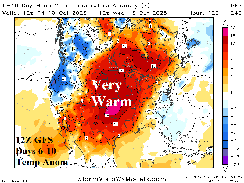

Fig. 2-3: The 12Z GFS medium range temperature anomaly forecast.

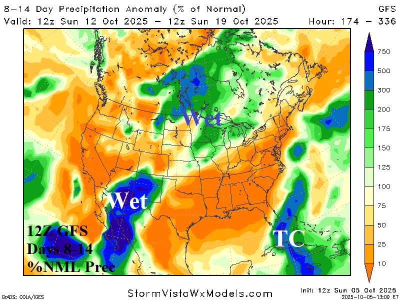
Fig. 4-5: The 12Z GFS 14-day percent of normal rainfall forecast.