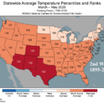
2nd Warmest Spring on Record in U.S. Trailing Only 2012
06/10/2026, 1:42 pm EDT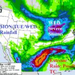
Major Rainfall Event East Texas to Louisiana/Mississippi This Week
06/15/2026, 4:55 am EDT
Climate Impact Company Week 2-4 Outlook
Australia
Issued: Sunday June 14, 2026
Highlight: Persistent positive phase southern annular mode causes Australia wet weather, delays drier El Nino effect.
Charts of the day: 30-day/7-day percent of normal precipitation across Australia.
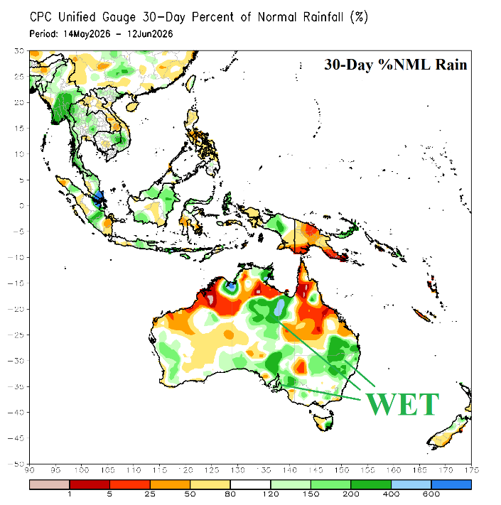
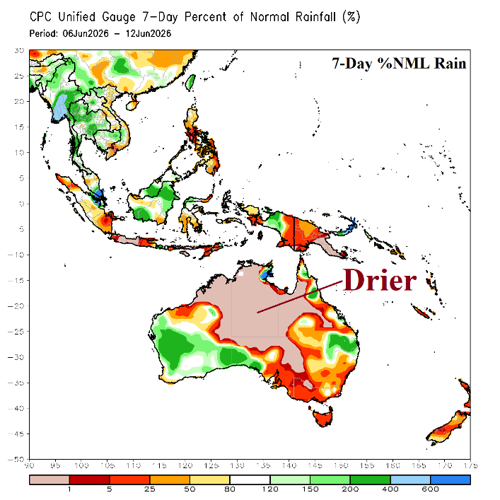
Discussion: After an extremely dry climate in the East during April, late meteorological autumn shifted wetter across Central and East Australia. During the past week, a drier regime has returned.
Week-2 (June 21-28, 2026): Stretch of rain northwest to southeast across the continent; Very warm north of the rain.
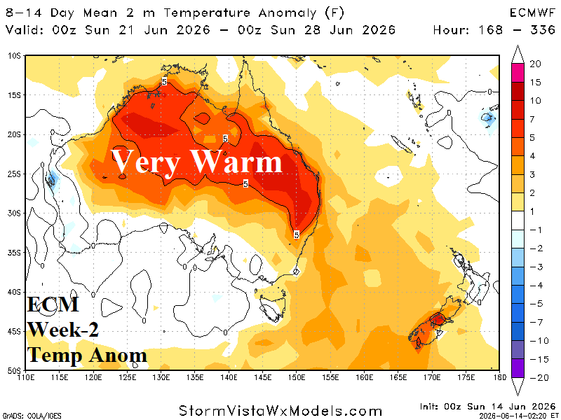
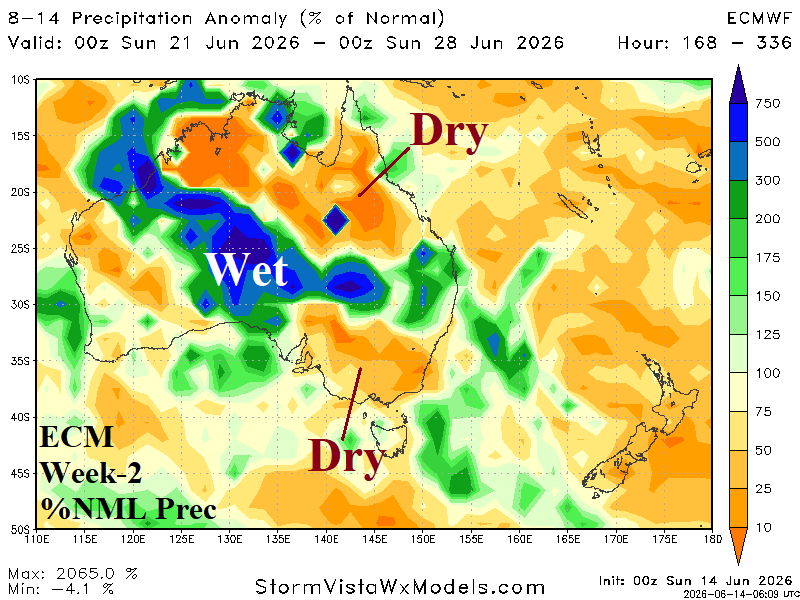
Discussion: Very warm weather stretches across most of Australia late June except normally cool on the South Coast. A streak of wet weather is forecast from the northwest coastal region southeastward across south-central continent and into Northern New South Wales. *Week-2 rainfall forecast-skill scores best results? ECM Operational.
Week-3 (June 28-July 5, 2026): Mostly near normal temperature; Wet bias South.
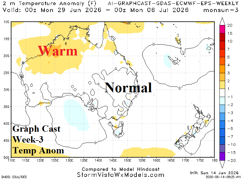
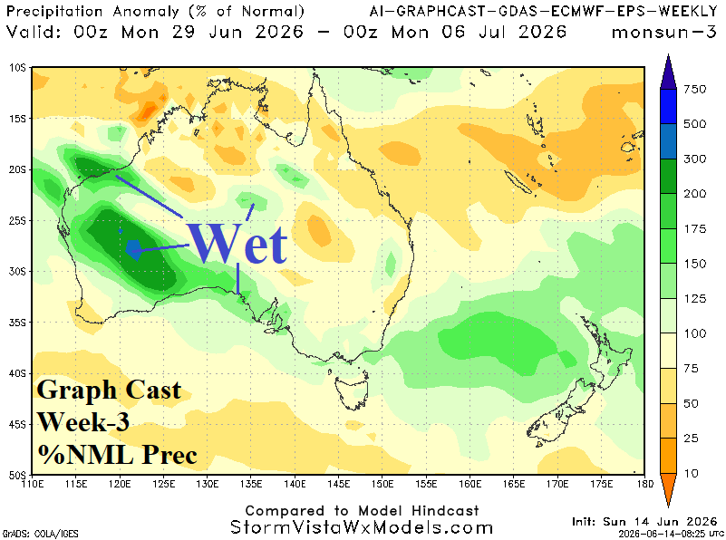
Discussion: Utilizing AI Graph Cast which maintains wet risk for parts of (mainly) Southern Australia as the middle third of meteorological winter arrives. Temperatures are generally near normal although with significant day-to-day fluctuations.
Week-4 (July 5-12, 2026): Warmer North.
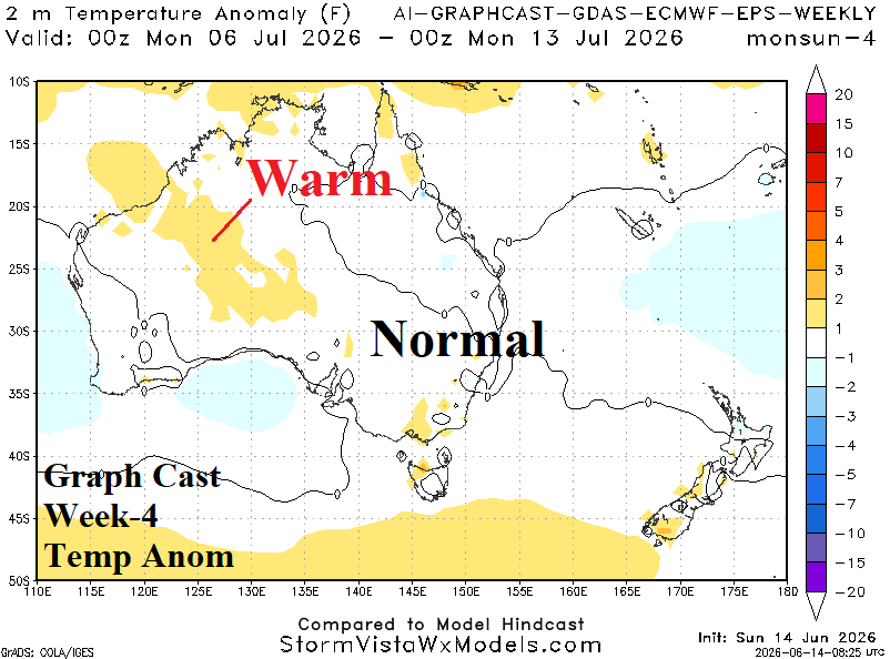
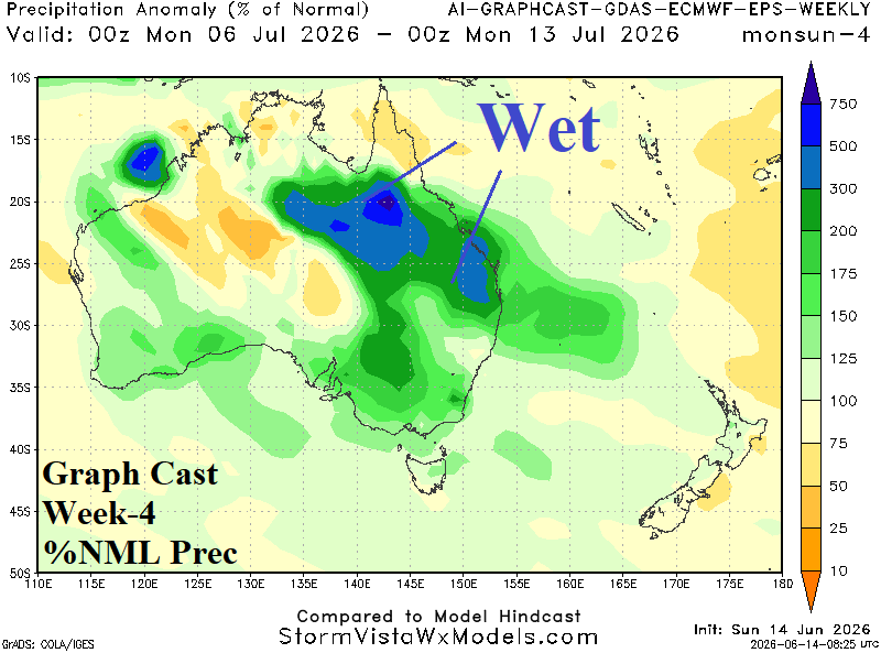
Discussion: If +SAM lingers, additional wet weather in the East is likely. El Nino dryness is a late winter/early spring concern.