
Evolving -NAO Pattern Could Cool East U.S. in Extended-range
10/05/2025, 1:27 pm EDT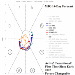
Transitional MJO Weakens Strong -GLAAM; Highly Amplified Mid-latitude Pattern to Ease
10/13/2025, 7:11 am EDT
Climate Impact Company Week 2-4 Outlook
Australia
Issued: Tuesday, October 7, 2025
Highlight: MJO shifts east, allows hot/dry Australia pattern, especially in the East. Wetter/less hot later October.
Charts of the day: SEP-25 soil moisture and recent rainfall.

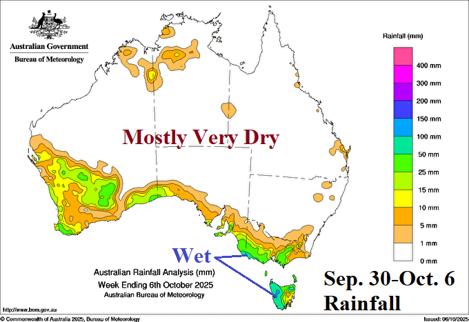
Discussion: Much of Australia is observing wetter than normal soils according to Australia Bureau of Meteorology. During the past 7 days, much of Australia was dry with a few exceptions on the southwest and southeast coast.
Week-2 Ahead Forecast valid October 12-19, 2025: Building hot high pressure ridge.


Discussion: A building high pressure ridge delivers a hot mid-October to Australia. On the northern fringe of the ridge, monsoon rain affects northwest/north continent. However, East/Southeast Australia is very dry.
Week-3 Ahead Forecast valid October 19-26, 2025: East Australia hot/dry scare.
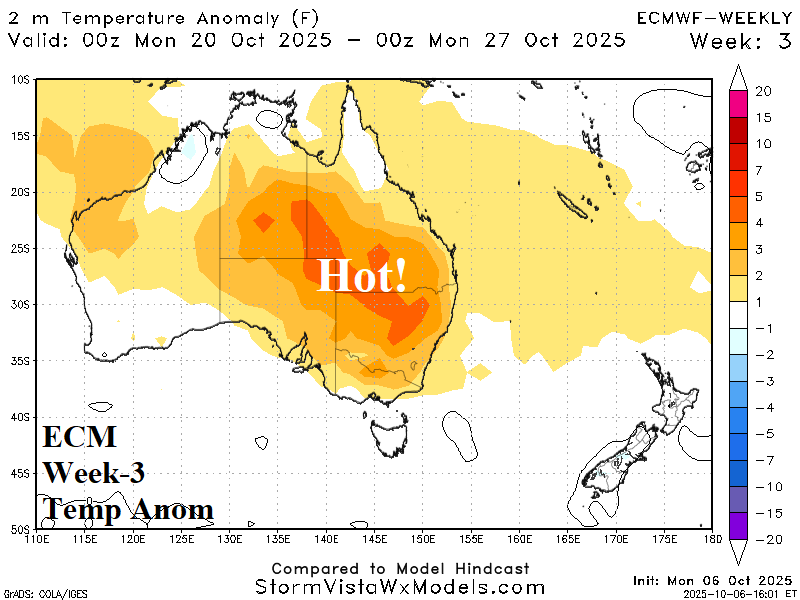

Discussion: Titanic upper ridge shifts to eastern continent. Hot and dry weather is widespread across East Australia. The wetter regime widens across western continent.
Week-4 Ahead Forecast valid October 26-November 2, 2025: Southeast Australia maintains anomalous heat.
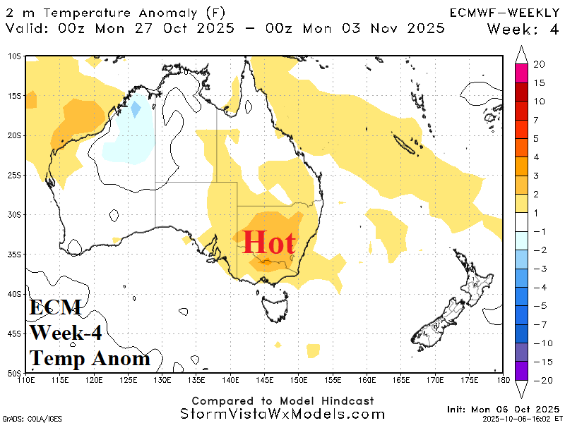
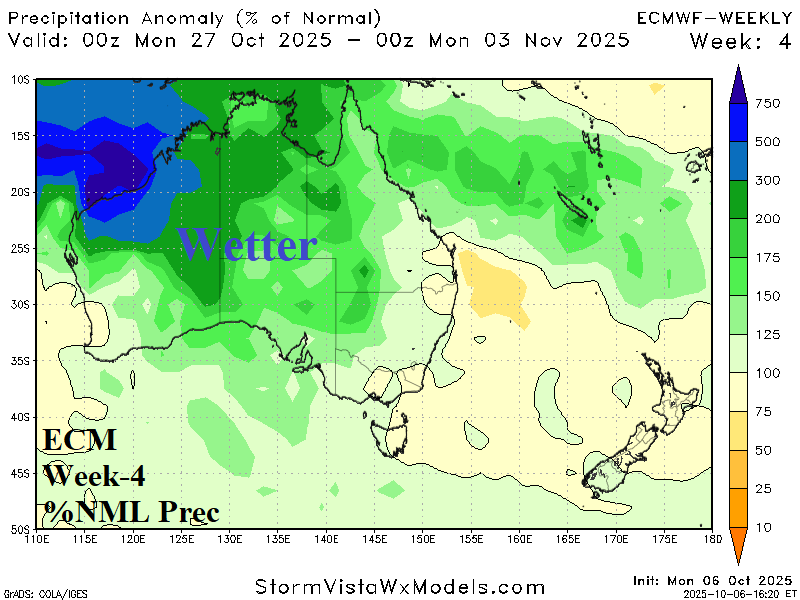
Discussion: The ridge is breaking down, and wet risk widens. However, Southeast Australia maintains anomalous heat and mostly dry weather.