
Titanic Hot High-pressure Ridge Mid-October for Australia!
10/07/2025, 5:22 am EDT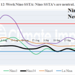
Nino SSTA Neutral Despite Onset of La Nina Announcement by NOAA
10/14/2025, 9:21 am EDT
Climate Impact Company U.S. Medium Range Report
Issued: Monday October 13, 2025
Highlight: Warm Central/East; Cool West forecast continues.
Chart of the day: Transitional MJO weakens the strong -GLAAM regime; Highly amplified mid-latitude pattern may ease.
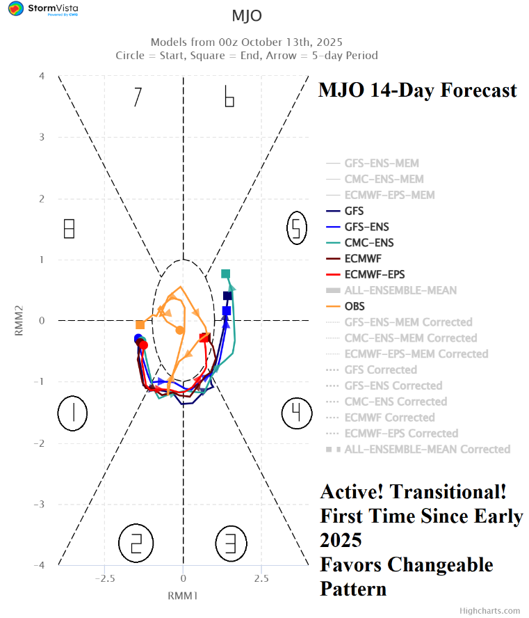
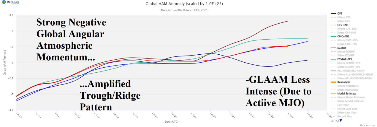
Discussion: For the first time since earlier in the year, the convection phase of the Madden Julian oscillation (MJO) is moderately intense AND transitional. Implied is the slow demise of a tendency for a highly amplified trough/ridge pattern in the middle latitudes as supported by the 15-day global atmospheric angular momentum (GLAAM) forecast which maintains the negative index but with less amplitude.
Medium-range 6-10 Day Forecast Valid October 18-22, 2025 (24-hour change right)
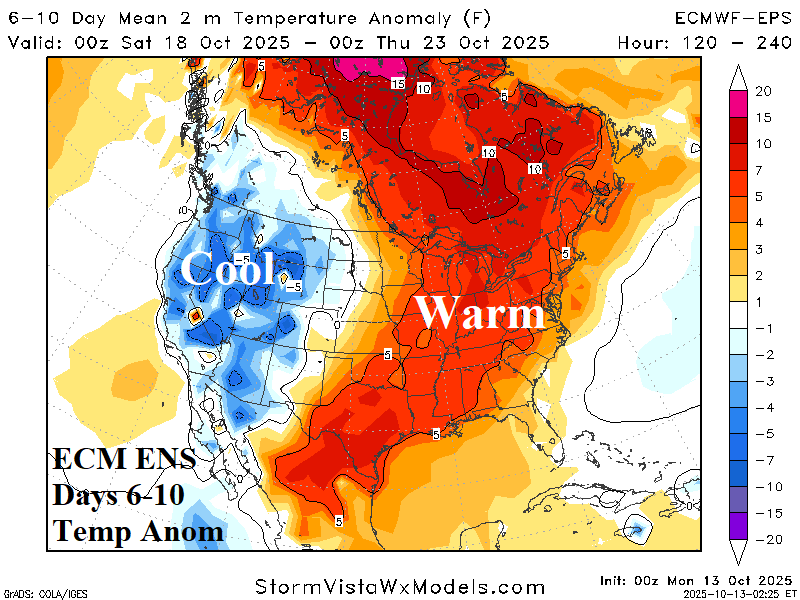

Discussion: The ECM ENS stays very warm Central into the East while the West is chilly. The outlook is slightly warmer across the Northeast.
Medium-range 11-15 Day Forecast Valid October 23-27, 2025 (24-hour change right)
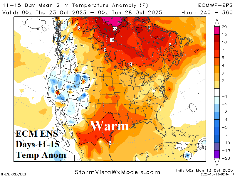
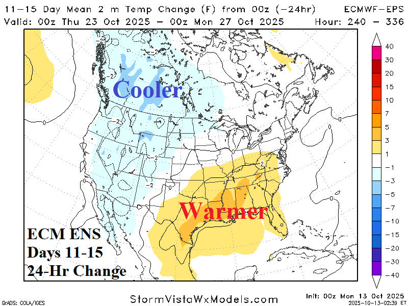
Discussion: The warm pattern persists although less amplified. The West stays cool. The Southeast shifts much warmer while West Canada shifts cooler.
U.S. Medium-range Precipitation Forecast

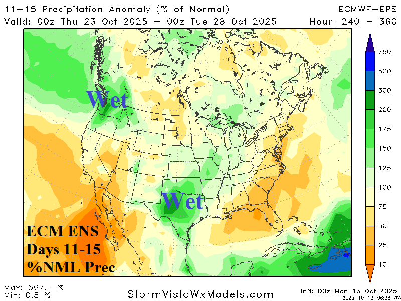
Discussion: The Midwest trend is much wetter since weekend forecasts with rain and snow in the Northwest U.S. to the Canadian Prairies in the 6-10-day period. The 11-15-day forecast is wetter in Texas.
Days 16-20 Extended range Temperature Forecast valid October 28-November 1, 2025

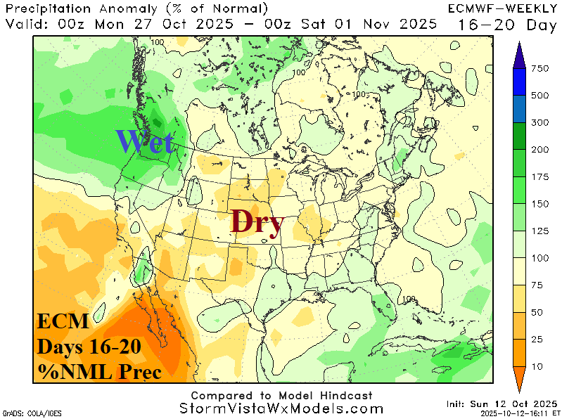
Discussion: The extended range continues to look familiar with anomalous warmth across Canada stretching into the Central U.S. As indicated earlier, there is some support for a pattern change.