
Are Central U.S. Forecasts Too Wet?
04/08/2026, 5:20 am EDT
Soaking Wet Soils Central/South Australia as Summer Ends
04/12/2026, 12:42 pm EDT
Climate Impact Company Midday Update
Issued: Friday April 10, 2026
Highlight: Climate signals support cooler Quebec/New England (ECM) 11-15-day forecast.
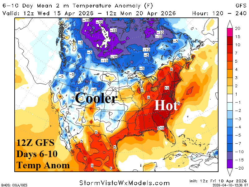
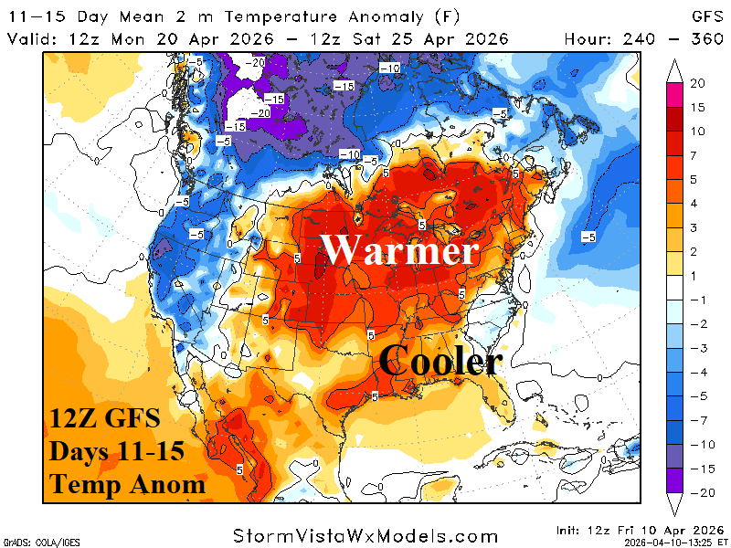
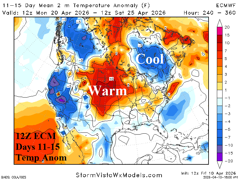
Fig. 1-2: The 12Z GFS medium-range temperature anomaly forecast.
Discussion: At midday, the 12Z GFS maintains the heat spike early in the 6-10-day period in the East with a gradual (warm) fade to follow. The 6-10-day outlook was adjusted cooler in West-central U.S. (Fig. 1). The Midwest U.S. rainfall amounts were less impressive. In the 11-15-day period, the 12Z GFS was warmer in the Midwest to Ontario without support (Fig. 2). The 12Z ECM has support for a much different cooler pattern in Quebec to New England (Fig. 3).
Note: The NOAA/CPC North Atlantic oscillation (NAO), arctic oscillation (AO), and Madden Julian oscillation (MJO) projection for the 11-15-day period support cooler changes in the East U.S. likely to be included in Sunday night/Monday morning medium-range forecasts.
| HDD EIA End | Forecast | 12-Hour Change | 24-Hour Change | 30-Year Normal | 10-Year Normal |
| 4/16 | 45.4 | +0.4 | -0.6 | 85.9 | 83.1 |
| 4/23 | 60.7 | +7.3 | +5.9 | 73.5 | 71.3 |
| 4/30 | 50.0 | -8.6 | -7.4 | 62.0 | 59.5 |
Table 1: The midday 12Z GFS U.S. gas population weight HDD projections into late April.