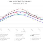
+ABNA Index Dominates North America Climate Signals
06/01/2026, 9:07 am EDT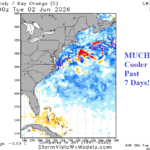
Western North Atlantic SSTA Cool Off Sharply
06/03/2026, 8:49 am EDT
Climate Impact Company U.S. Medium Range Report
Issued: Tuesday June 2, 2026
Highlight: West and North U.S. warmth continues; Cooler East extended range.
Ahead: Global DEC/JAN/FEB 2026-27 El Nino climate forecasts.
Chart of the day: Mid-June pattern change.
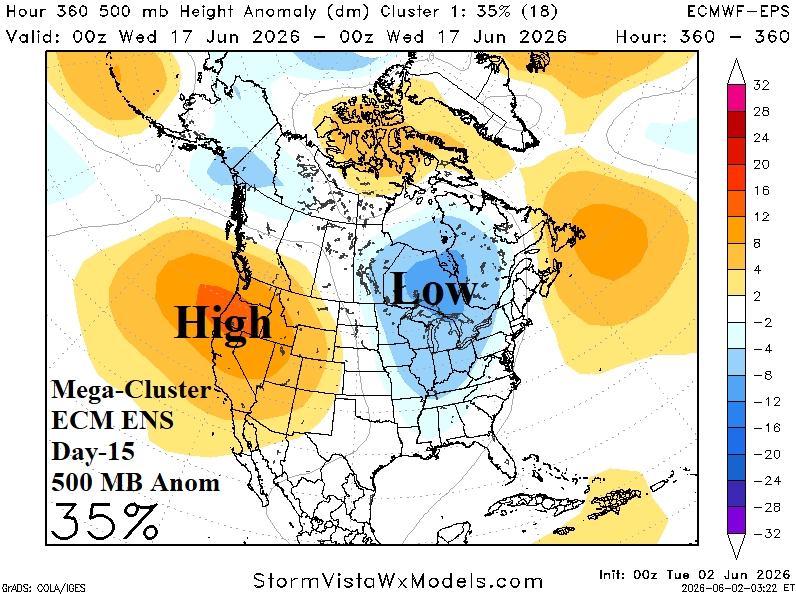
Discussion: The Madden Julian oscillation (MJO) shifts across the warm eastern equatorial Pacific during the next 1-2 weeks. U.S. climatology during an MJO phase_7 to phase_8 transition favors a cooler East U.S. regime. Although not super confident, the most likely (ECM ENS mega-cluster ensemble) upper air pattern in 15 days is a new upper trough centered on Ontario to deliver cooler weather into the East U.S.
Medium-range 6-10 Day Forecast Valid June 7-11, 2026 (ECM ENS and 24-hour change)
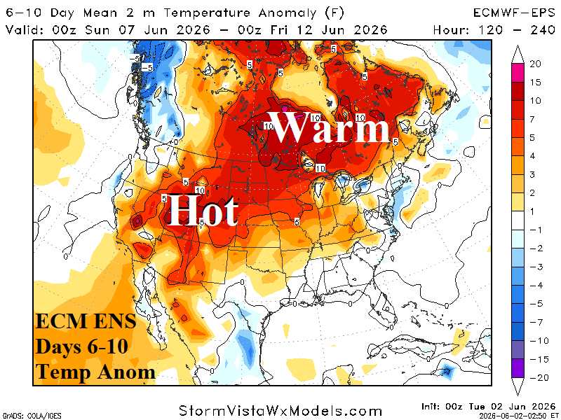
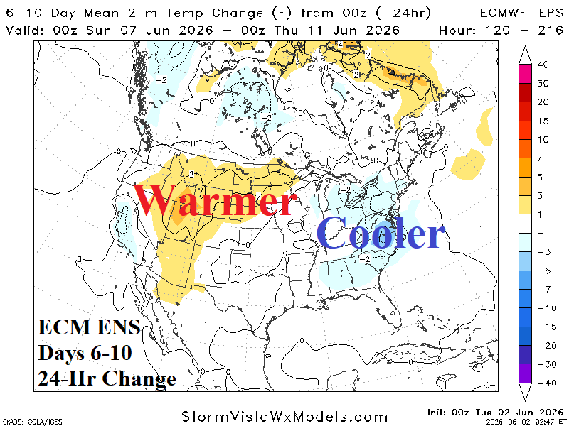
Discussion: Much cooler early period East while the Interior Northwest/West stays very warm.
Medium-range 11-15 Day Forecast Valid June 12-16, 2026 (ECM ENS and 24-hour change)
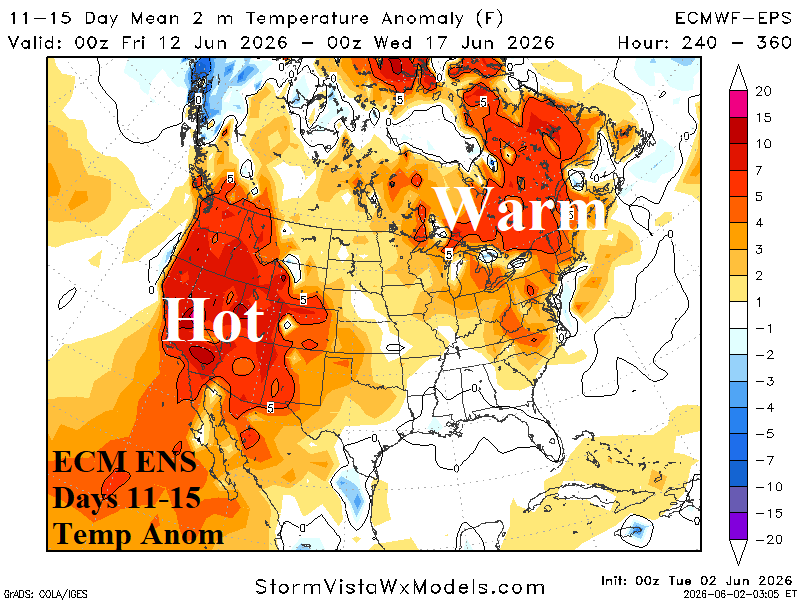
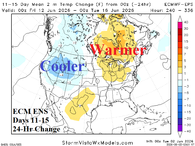
Discussion: Warmth returns to the Northeast Corridor while California observes significant heat. The Interior Northwest is less warm.
U.S. Medium-range Precipitation Forecast
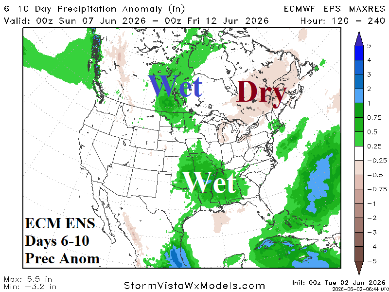
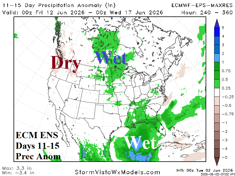
Discussion: Wet weather remains anchored across much of the Gulf States and the Northern Great Plains to the Eastern Canadian Prairies.
Days 16-20 Extended range Temperature Forecast valid June 17-21, 2026
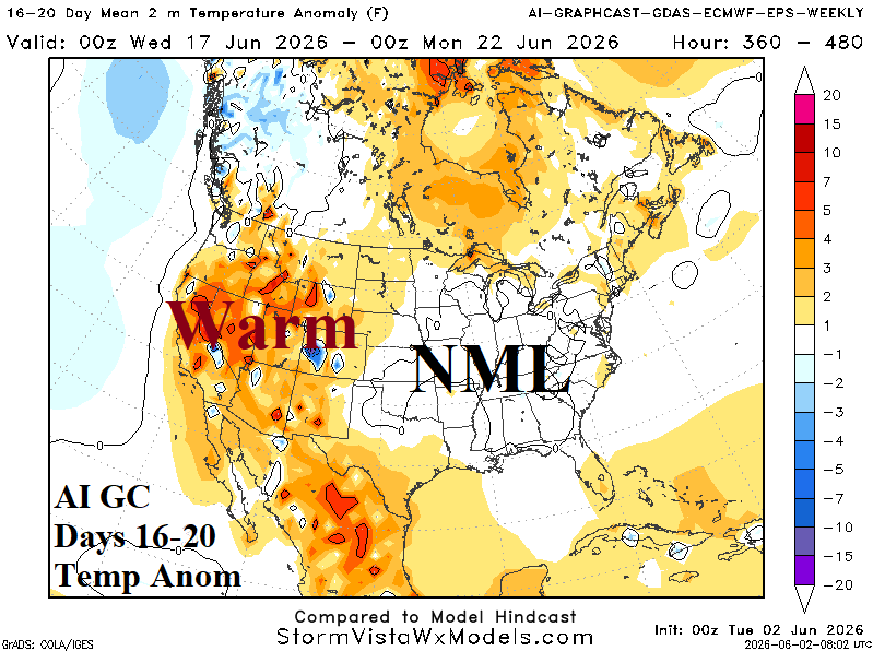
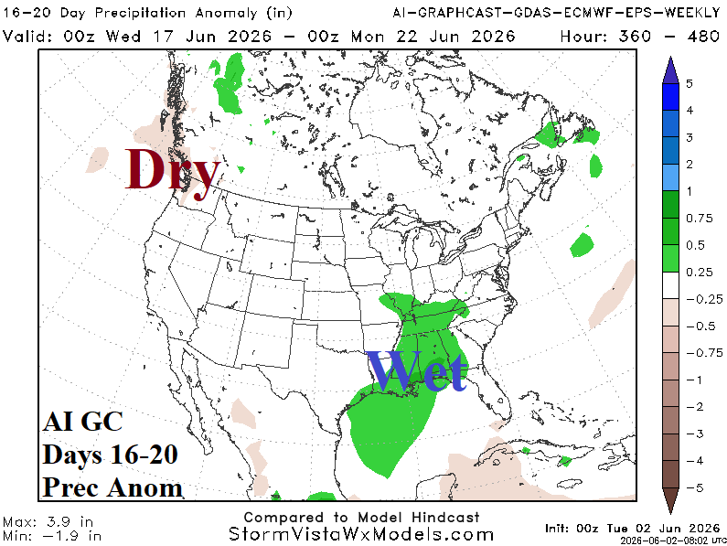
Discussion: The Gulf States are staying wet suppressing anomalous heat risk. The wet weather and clouds spread north leaving most of the East near normal temperature while anomalous warmth anchors in the West.