Mid-June U.S. Pattern Change
06/02/2026, 7:45 am EDT
El Nino Dry Climate Not Yet in Australia
06/04/2026, 2:46 pm EDT
Climate Impact Company North Atlantic Basin 10-Day Monitor
Issued: Wednesday June 3, 2026
Highlight: East Pacific becomes active; Sell-off West Atlantic SSTA.
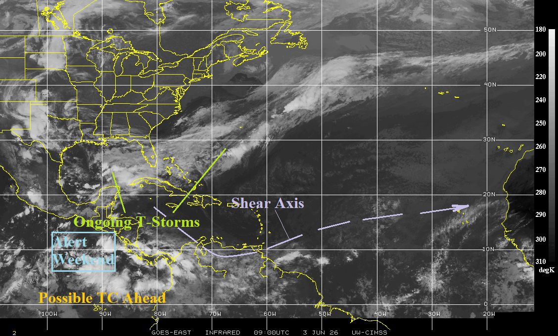
Fig. 1: The morning North Atlantic basin weather satellite view.
Discussion: Thunderstorm activity is widespread across the Gulf of Mexico extending east of the Bahamas (Fig. 1). However, tropical cyclone development is unlikely due to the presence of upper shear. In the East Pacific, percolating convection southeast of Mexico is likely to organize and become a tropical cyclone over the weekend. Tropical depression 1 well southwest of Baja California is forecast to become a tropical storm (Amanda) later today. The western portion of the North Atlantic basin except for the Gulf of Mexico is shifting dramatically cooler. SSTA are extremely cool off the Northeast (Fig. 2). The 7-day change is sharply cooler (Fig. 3). Usually, large areas of cool SSTA bias the local climate cool.
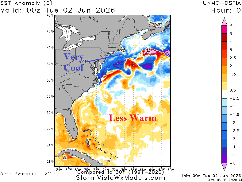
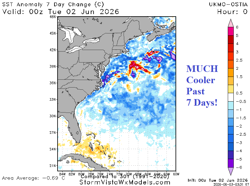
Fig. 2-3: Daily SSTA analysis across the Western North Atlantic basin and 7-day change.