
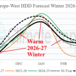
Warm U.S. AND Europe HDD Forecasts Winter 2026-27
09/08/2026, 5:25 am EDT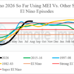
Latest Multivariate ENSO Index Report
09/13/2026, 12:11 pm EDT
Climate Impact Company Early U.S. Report
Issued: Thursday September 10, 2026
Highlight: Tropical trouble brewing days 11-15; West Coast SSTA warming; CDD’s drop off September 18-24.
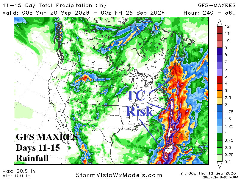
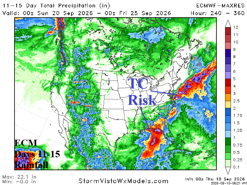
Fig. 1: GFS/ECM MAX RES U.S. rainfall forecast for the 11-15-day period.
Discussion: GFS and ECM are interested in generating heavy rain associated with a tropical cyclone during the 11-15-day period in the eastern Gulf of America and the Atlantic Seaboard (Fig. 1-2). The consistency of this longer-range forecast is increasing. Reliability increases substantially if the threat appears in the 6-10-day forecast by early next week. However, for now, as calendar summer ends, an uptick in the dormant North Atlantic tropical cyclone season is expected.
Warming/cooling of ocean temperatures off the U.S. West Coast are commonly regulated by the amount of up-welling of deep cold waters to the surface driven by north to northwest wind flow around the Northeast Pacific semi-permanent high- pressure system. However, the recent rapid warming in the coastal waters off the West Coast (Fig. 3) is likely related to El Nino. Warming waters have tendency to favor hotter weather as implied by widespread Heat Advisories and Extreme Heat Warnings affecting California and the Southwest U.S. (Fig. 4).
The warming waters off the U.S. West Coast have dramatic implications for the coastal economic zone (ECZ) as wildlife are greatly affected. Common fisheries shift north and algae blooms form which can inhibit (or destroy) maritime life.
Despite the coastal warming and presence of two marine heatwaves (MHW), the decade-long cool phase of the Pacific decadal oscillation (-PDO) remains intact. There is a tendency for troughing of the jet stream across the cooler waters which can cause a wet regime on the Wet Coast. Once the cool season arrives, the -PDO influence on Super El Nino subtropical latitude storm tracks should increase the risk of prohibitive precipitation this winter season in California.
Streaks of wet weather affect much of the U.S. east of the Continental Divide during the next 7 days (Fig. 5). Heaviest rain is across the Upper Midwest which includes severe thunderstorms tomorrow. Florida and vicinity stay in a wet pattern while wet weather affects the Eastern U.S. Saturday.
U.S. population weight CDD forecasts continue a summerlike signature through next week indicating above normal late season cooling demand (Fig. 6). However, the CDD projection is notably cooler for the week of September 18-24.
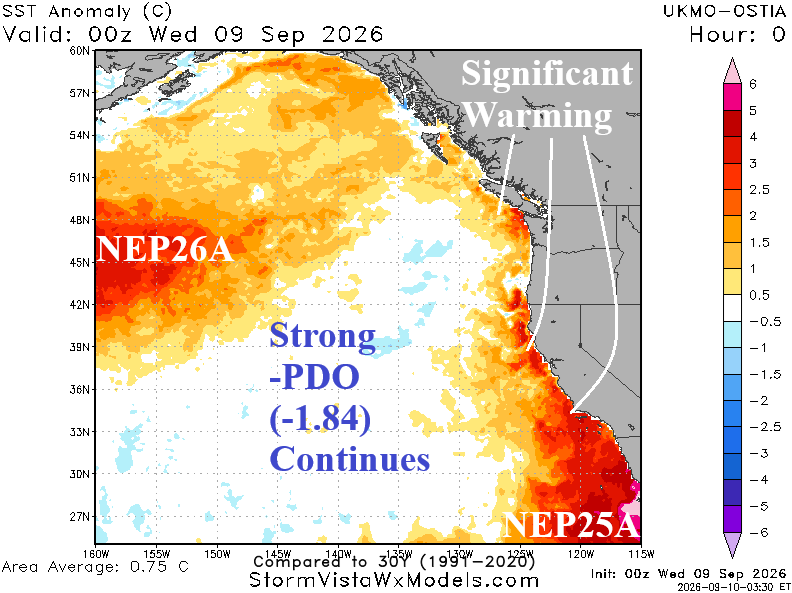
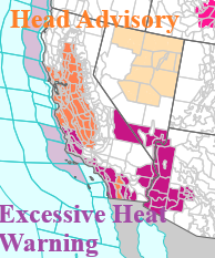
Fig. 3-4: Northeast Pacific daily SSTA analysis and current NOAA/NWS weather watch, warning, and advisories for California and vicinity.
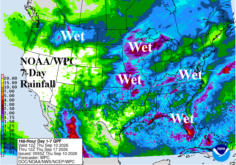
Fig. 5: NOAA/WPC quantitative precipitation forecast for the next 7 days.
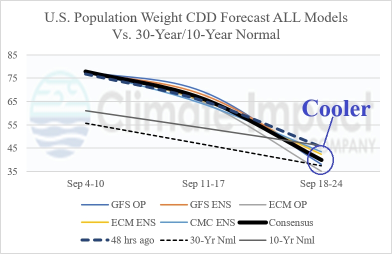
Fig. 6: Utilizing all models and their consensus and comparing with 48 hours ago and 10-year/30-year climatology, the U.S. population weight CDD outlook.