
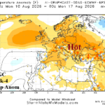
Hot/Dry Weather Regenerates Eastern Europe/Western Russia in August
07/17/2026, 1:51 pm EDT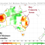
Queensland and Western Australia Dry-to-Drought Development
07/22/2026, 5:24 am EDT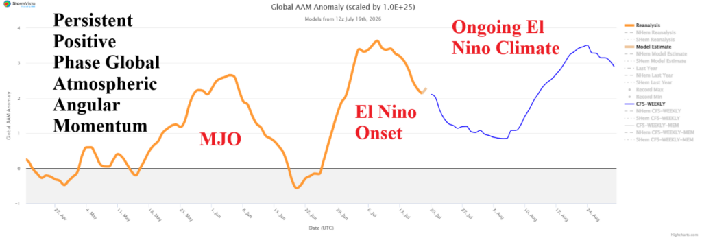

Climate Impact Company Early U.S. Notes
Highlight: GLAAM/GWO heavy influence on global weather patterns; SPP region hardest hit by heat ahead; TD 2 soon to become TS Bertha which becomes a north/northwest Gulf of America problem.
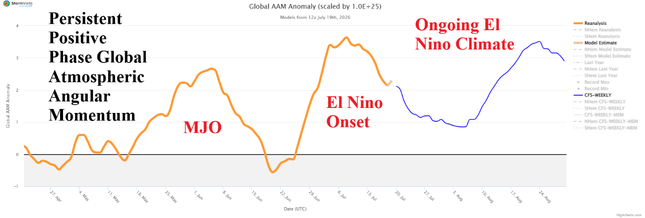
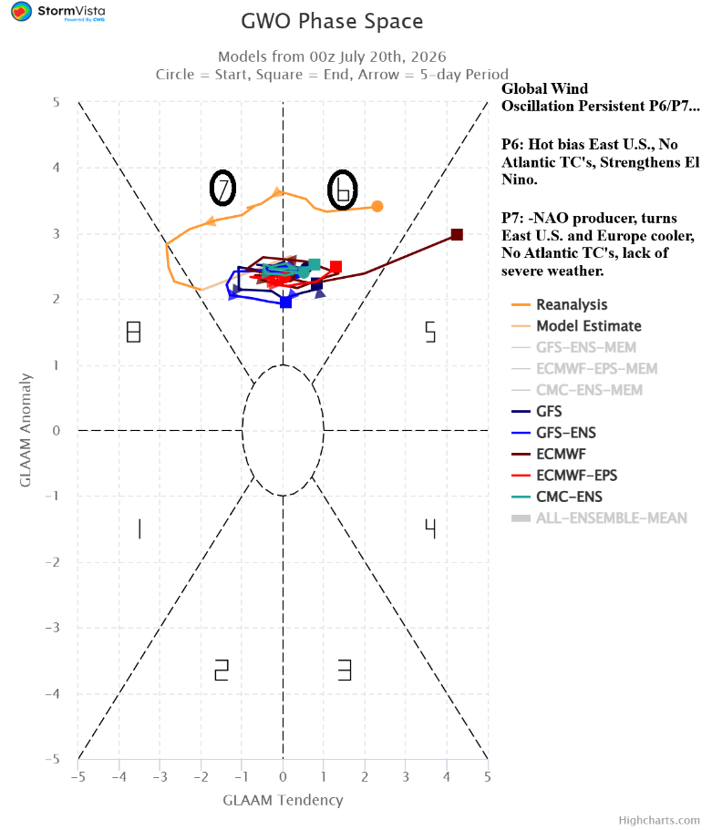
Fig. 1-2: The global angular momentum 60-day observations and 15-day forecast plus 30-day global wind oscillation observations and 15-day forecast.
Discussion: The big picture weatherwise finds increasing influence of strong El Nino characteristics on the U.S. weather pattern. Positive phase global atmospheric angular momentum (+GLAAM) linked to a large increase in tropical convection across the warming waters of the equatorial Pacific has arrived likely to remain persistent throughout the El Nino episode (Fig. 1). +GLAAM influence is most influential between phase_6 and phase_7 and expected to remain steady in that way into August (Fig. 2). Effects on U.S. weather by phase_6 include a hot bias in the East as recently observed followed by a cooler change (in the East) during phase_7, as expected this week while anomalous heat pushes westward. Both P6 and P7 are hostile to North Atlantic tropical cyclone development in the deep tropics. P6 and P7 are each supportive of intensifying El Nino.
Short-term high impact weather as the climatological peak heat of summer arrives is plentiful. Air Quality Alert for dust/smoke from Canadian Wildfires has settled on the Midwest (Fig. 3). The Midwest States maintain the issue in the 5-day forecast with the dust cloud (also) shifting east to the Northeast States but weakening. A large heatwave hinders the Central Great Plains to the Mid-south U.S. briefly subsiding this week and regenerating by the weekend lasting into early August. The area involved, the SPP region, observes their hottest stretch of summer 2026 by far (Fig. 4).
Tropical Storm Warning is expanding across the northeast Gulf of America. Tropical Depression 2 is forecast to upgrade to Tropical Storm Bertha today and track west-northwest to west and through the northwest Gulf of America oil infrastructure. NOAA/NHC indicates a strengthening tropical storm during this trek. HMON tropical cyclone model indicates a potential hurricane. Once Bertha forms, forecast confidence increases. However, light shear and warmer than normal surface water suggests a problem for the north/northwest Gulf of Mexico this week!
The NOAA/WPC 5-daay rainfall outlook projects widespread heavy rainfall this week including the Intermountain West due to the wet monsoon with some of that moisture working into the Central Great Plains to cause severe weather midweek (Fig. 5). Heavy rain with daily flooding risk is centered on Virginia while slowly evolving heavy rain is near the Gulf of America Coast due to Bertha.
The latest U.S. population weight CDD forecast indicates a significant cooler projection next week compared to yesterday’s forecast although still hot for early August (Fig. 6).
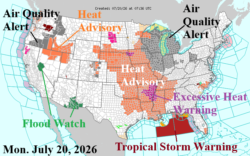
Fig. 3: NOAA/NWS weather watch, warning, and advisory areas.
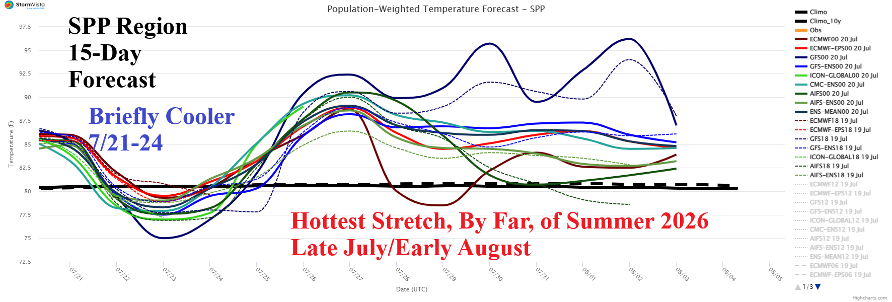
Fig. 4: The SPP region 15-day population weight daily average temperature forecast.
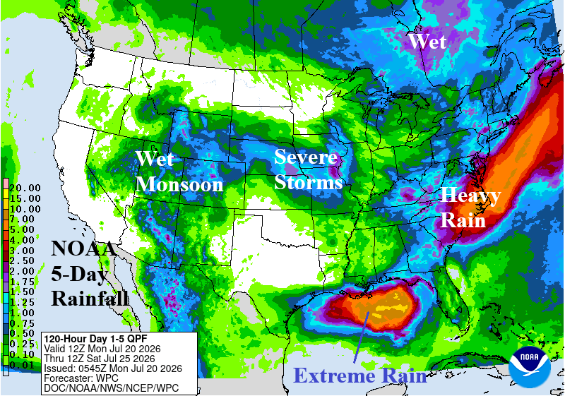
Fig. 5: NOAA/WPC 5-day quantitative precipitation forecast for the U.S.
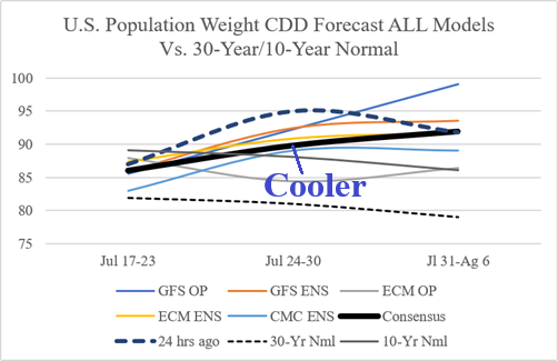
Fig. 6: The U.S. population weight CDD forecast utilizing all models.