
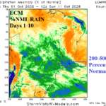
Compare ECM and AI WXNEXT V3 10-day Rainfall Forecast for Brazil
10/01/2026, 5:14 pm EDT
Climate Impact Company Early U.S. Report
Issued: Friday October 2, 2026
Highlight: Flooding ongoing with Midwest River areas despite end of rainfall. Long duration dryness to follow. Heavy rain pattern Southeast U.S.
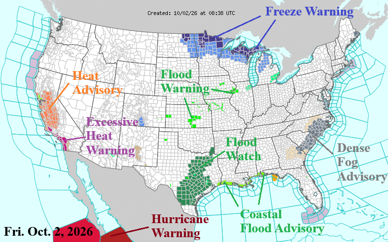
Fig. 1: Latest NOAA/NWS weather watch, warning, and advisory areas.
Discussion: Ongoing river flooding in the Midwest and Mid-south U.S. is ongoing while Flood Watch areas remain in effect for South and East-central Texas (Fig. 1). The NOAA 5-day Significant River Flood Forecast indicates risk of river flooding will continue in Iowa and Texas while imminent in parts of East Nebraska to Northern Missouri (Fig. 2). Early season chill in the Upper Midwest as Freeze Warning’s are issued for the northwestern Great Lakes region. Heatwave conditions blast interior and coastal California. Excessive Heat Warning’s are issued between Los Angeles and San Diego. Offshore California, ocean warming is immense as Marine Heatwave NEP25A is expanding and forecast to continue intensifying due to El Nino influence during Q4/2026 (Fig. 3). Despite the recent flooding rainfall, the Central/Midwest U.S. shifts into a long duration dry pattern beginning this weekend (Fig. 4). All the U.S. wet weather shifts to the Southeast U.S. and Florida in the latest NOAA/WPC 7-day outlook (Fig. 5). Prohibitive rain is indicated on the immediate Gulf Coasty but no tropical cyclone activity. The latest U.S. gas population weight HDD forecast indicates a much warmer trend for next week, still lower than CDD couth (Fig. 6).
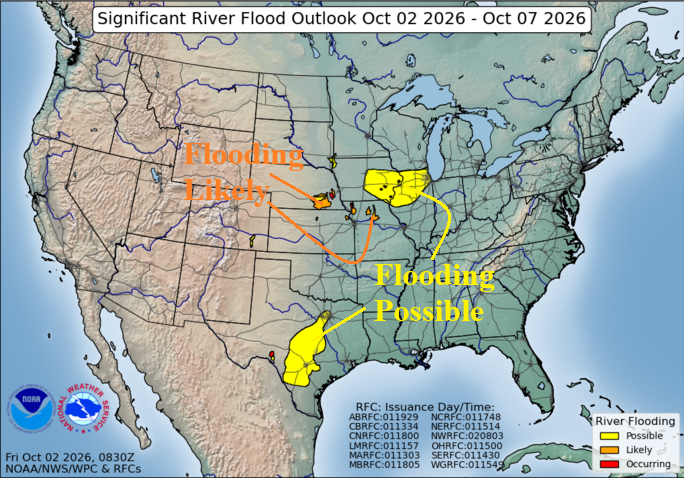
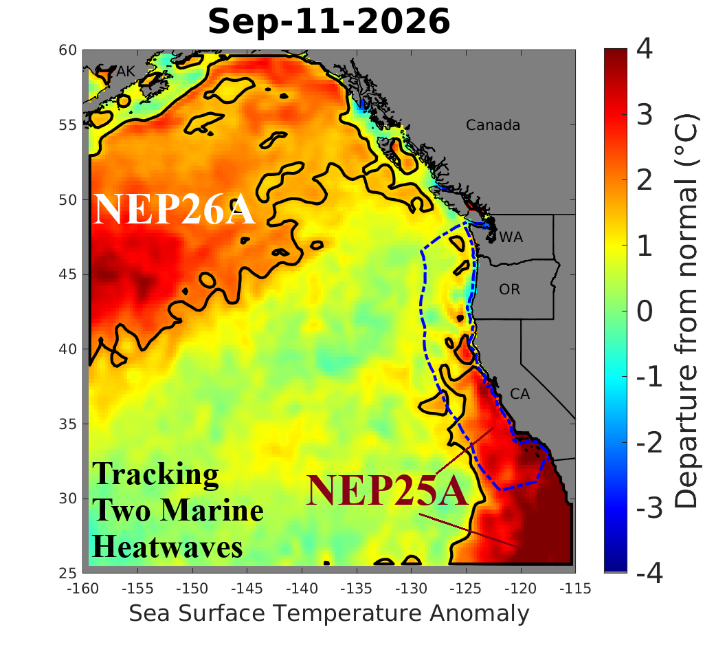
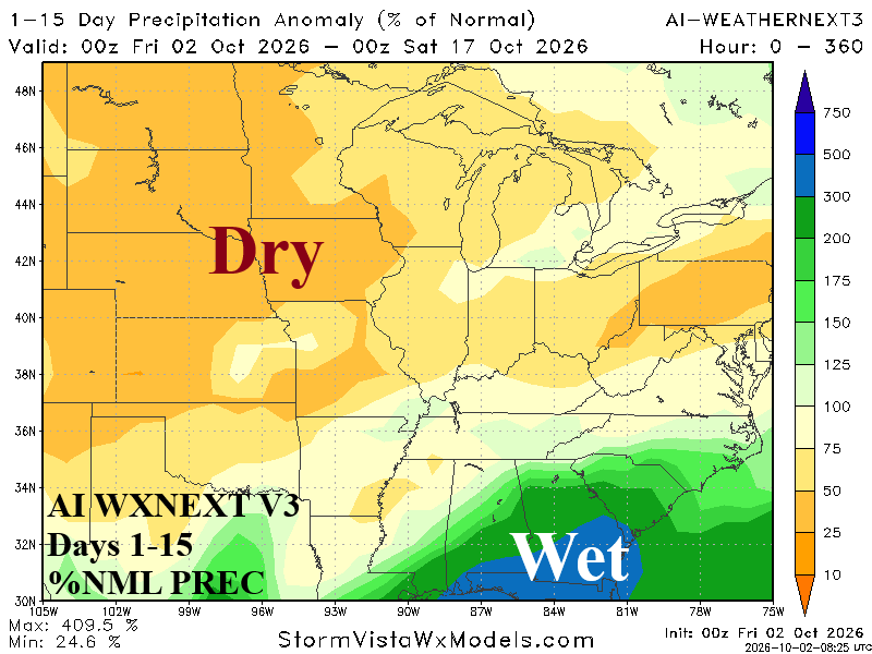
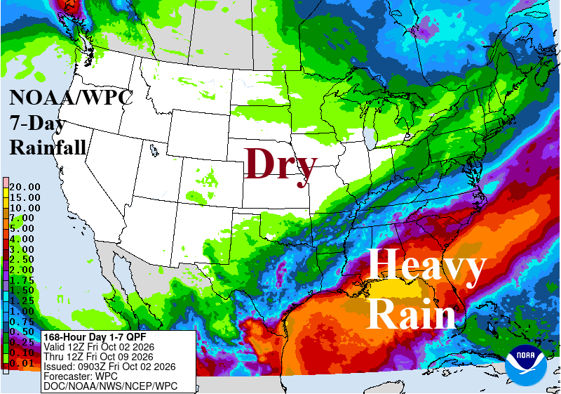
Fig. 2-5: NOAA 5-day Significant River Flood Forecast, oceanic warming in the Northeast Pacific, 15-day arid forecast for the Great Plains, and NOAA/WPC 7-day rainfall forecast for the U.S.
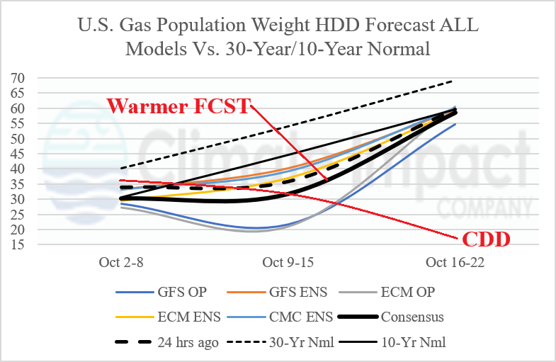
Fig. 6: U.S. gas population weight HDD forecast utilizing all models, their consensus, and comparison with 24 hours ago and 10/30-year normal.