
Latest U.S. CDD Forecast Maintain Late Calendar Summer Heat
09/03/2026, 8:49 am EDT
Looking Wetter Great Plains Ahead
09/07/2026, 4:33 pm EDT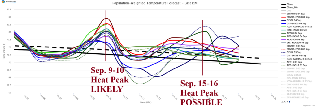

Climate Impact Company PJM-East Report
Issued: Friday, September 4, 2026
Highlight: PJM-East heat spikes lingering into September.
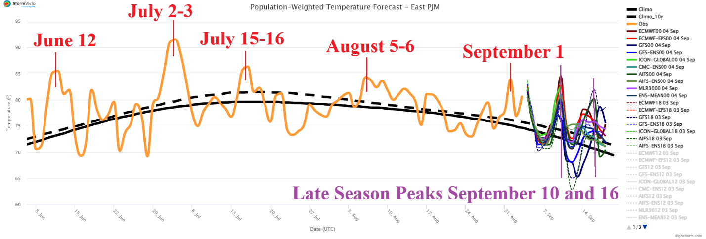
Fig. 1: The 90-day 2026 history of population weight daily temperature across the PJM-East sector and 15-day outlook utilizing all models.
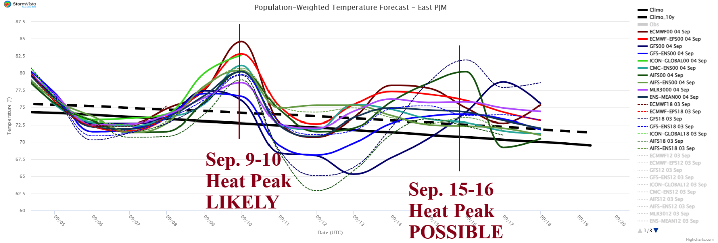
Fig. 2: Utilizing all models, the 15-day population weight daily average temperature forecast for PJM-East.
Discussion: PJM-East (in fact all of PJM) was hit hard, again, by heatwave conditions this week. The amplified heat stress is the 5th event of the summer season in PJM-East (Fig. 1). Uncommon (and un-welcomed) peak heat events in September are likely to continue although with less amplitude. Utilizing all models, another very warm peak is projected for later next week (Fig. 2) when for 2 days, Washington, DC is near or slightly above 90F (Fig. 3). Forecast confidence is below average however another very warm 2-day event is possible mid-September. The ongoing problem, well into September, is a hostile hot weather heat source centered on the Mid-south U.S. which, at any time, can pulse modified heat eastward reaching the Mid-Atlantic region (Fig. 4). The dividing line between heat from the west and cooler weather to the north is frequently in the Mid-Atlantic region (or farther south) in this pattern. The dividing line is a location for severe thunderstorms as indicated today and tomorrow (Fig. 5-6).
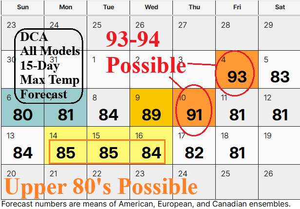
Fig. 3: Utilizing all models, the 15-day MAX/MIN forecast for Washington, DC.
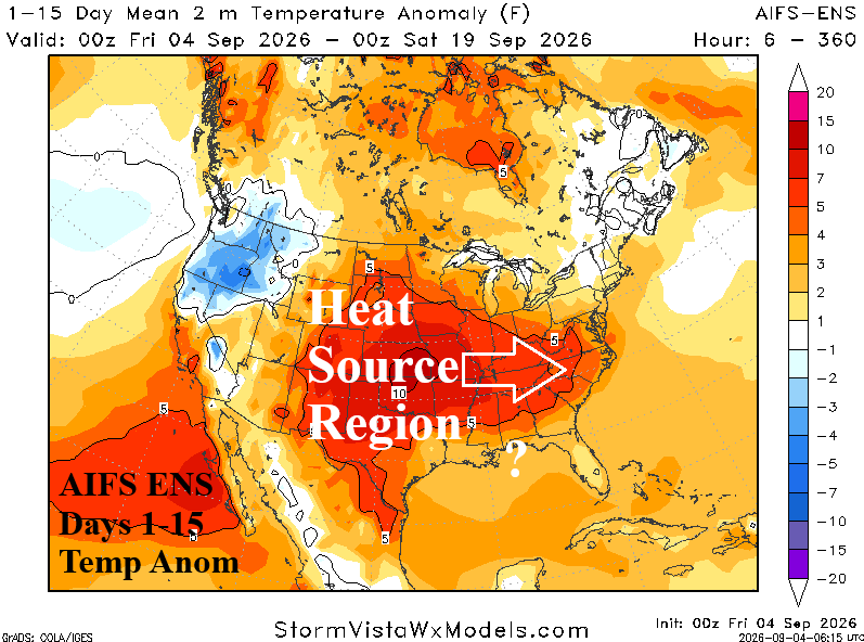
Fig. 4: AIFS ENS identifies the ongoing heat source region in the Mid-south U.S. through the next 15 days.
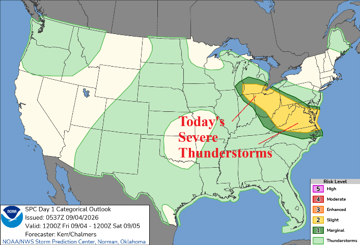
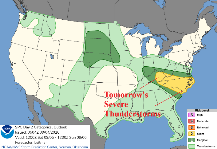
Fig. 5-6: NOAA/SPC severe weather outlooks for today and tomorrow.