
PJM-East Heat Spikes Lingering Into September
09/04/2026, 5:28 am EDT
Warm U.S. AND Europe HDD Forecasts Winter 2026-27
09/08/2026, 5:25 am EDT

Climate Impact Company Labor Day Agriculture Report
Issued: Monday, September 7, 2026
Highlight: Great Plains shifting wetter; South/Southeast Europe rains, most of region stays warmer than normal.
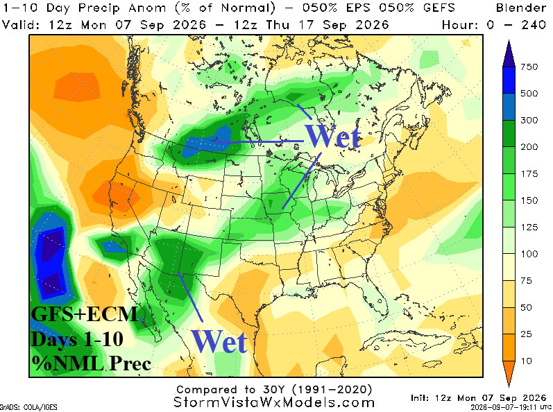
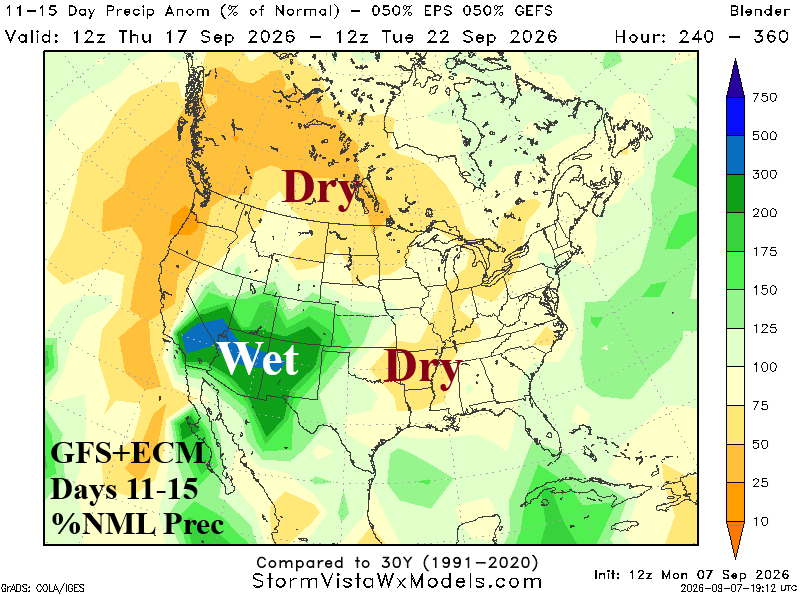
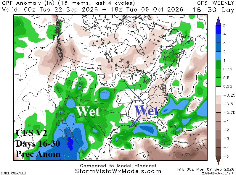
Fig. 1-3: GFS and ECM combined to produce the 10-day, and 11-15-day percent of normal rainfall forecast across the U.S. plus the CFS V2 16-30-day outlook.
Discussion: GFS and ECM combined are reasonably similar during the next 10 days. Indicated is a northeastward tilt of wet monsoon weather in the Southwest States toward and across the Great Plains (Fig. 1). In the 11-15-day period, forecast confidence is low due to widely divergent opinions from GFS and ECM. The 11-15-day forecast consensus is wet Southwest States to Western Plains and drier (again) Mid-south (Fig. 2). The Canadian Prairies average wetter than normal the next 10 days followed by a dry period for days 11-15. In the extended range, the wet risk in the Central U.S. remains as an extension to the very wet Southwest U.S. Monsoon (Fig. 3).
In Europe, excessive heat is easing, but warmer than normal late calendar summer is widespread (Fig. 4). The anomalous warmth on the South Coast may be overdone due to the generally showery outlook due to persistent low pressure in the Mediterranean Sea (Fig. 5). In the 16-30-day outlook, ECM favors wet weather on the South/Southeast Coast of Europe with near to drier than normal and warmer than normal weather to the north (Fig. 6).
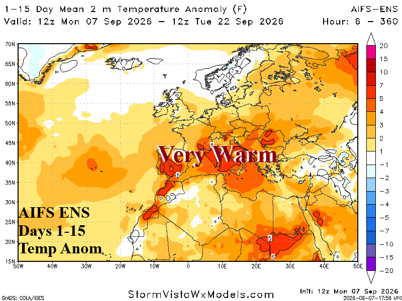
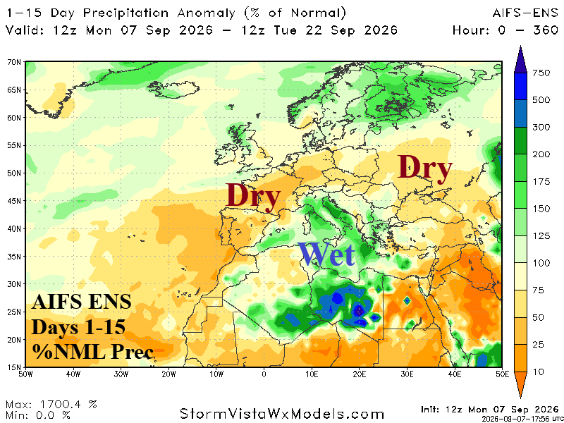
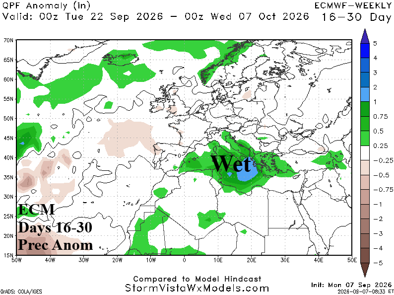
Fig. 4-6: AIFS ENS 15-day temperature anomaly and percent of normal rainfall forecast plus the ECM 16-30-day rainfall anomaly outlook.