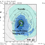
All Eyes on Re-Intensifying Narelle Next Week Possibly Turning Toward Northwest Australia Coast
03/20/2026, 12:47 pm EDT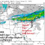
Tonight’s Ohio Valley Severe Weather Peak Intensity/Timing
03/26/2026, 12:43 pm EDT
Climate Impact Company Northwest Hydro Report
Issued: Monday, March 23, 2026
Highlight: Record aerial coverage of the Northeast/Southeast Pacific marine heatwave rivals the 2014-16 “warm blob”. What’s the analog climate?
Executive summary: Required is a review of the upper air patterns from the 2014-16 “warm blob” years for the PNA region during APR/MAY and JUN/JUL to help time maximum snowmelt/water runoff in key Southwest Canada HYDRO locations. The 2026 “warm blob” has record strength aerial coverage making the 2014-16 “warm blob: years a reasonable analog. Indicated is potential for an emerging warm high-pressure ridge over Southwest Canada during APR/MAY lingering into mid-summer. The “caveat” is the 2026 “warm blob” does not include the Gulf of Alaska (yet) similar with the 2014-16 analog. Global SSTA forecasts indicate warming of the GOA is delayed until late spring. Suggested is robust warming across Southwest Canada is ahead but later than implied by the analog years.
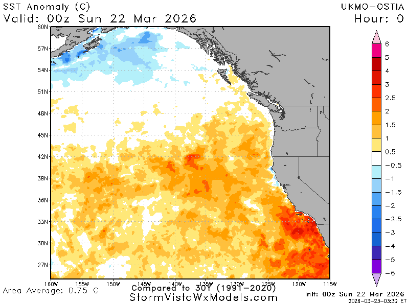
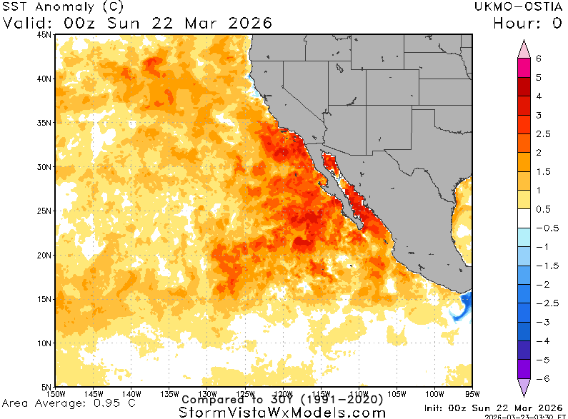
Fig. 1-2: Record aerial coverage of the Northeast to Southeast Pacific marine heatwave (NEP25A).
Discussion: The marine heatwave off the West Coast of North America (Fig. 1-2) has a record aerial coverage rivaling the “warm blob” of middle last decade. The influence on climate is dramatic causal to an impressive upper-level high-pressure ridge (Fig. 3) causing a record warm winter across most of the U.S. (Fig. 4). The anomalous warm water has enhanced any “atmospheric river” patterns to cause above normal snowfall and water content in key Southwest Canada HYDRO locations and prevent (for now) a sharp drought in California. The only analog representing the warm SSTA off the West Coast similar with 2026 is the 3-year period of 2014-16. An analog climate projection for Q2 and Q3 for 2026 based on the 3-year analog indicates an amplified upper ridge across Southwest Canada during APR/MAY (Fig. 5) followed by the ridge remaining in-place but weaker in JUN/JUL (Fig. 6). Implied is POTENTIAL rapid warming and fast snowmelt/water runoff during mid-to-late spring with anomalous warmth, possibly reaching record strength, lingering into mid-summer. There is a caveat to this projection. The 2014-16 “warm blob” was warm in the Gulf of Alaska (GOA) unlike 2026 so far. The IMME global SSTA forecast indicates warming of GOA by late spring/early summer (Fig. 7). Based on the SSTA forecast, the amplified warm ridge scenario affecting Southwest Canada could be delayed until late spring.
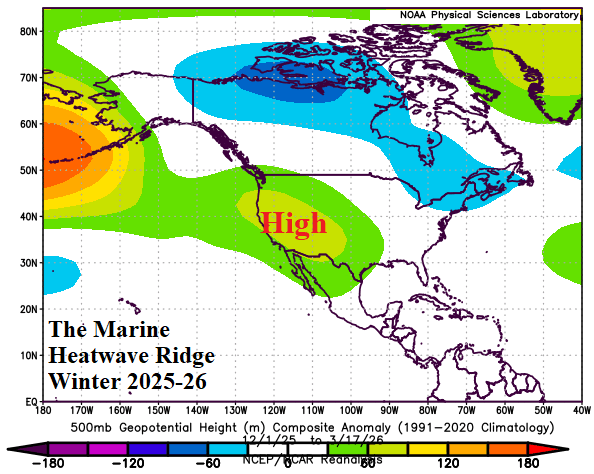

Fig. 3-4: The marine heatwave-induced amplified West U.S. upper ridge causing record winter warmth across much of the western half of the U.S.
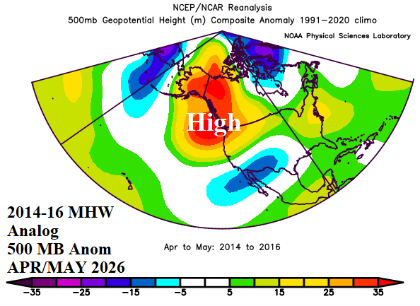

Fig. 5-6: The 2014-16 “warm blob” analog years to project potential 500 MB anomaly scenarios across the PNA region for APR/MAY and JUN/JUL.
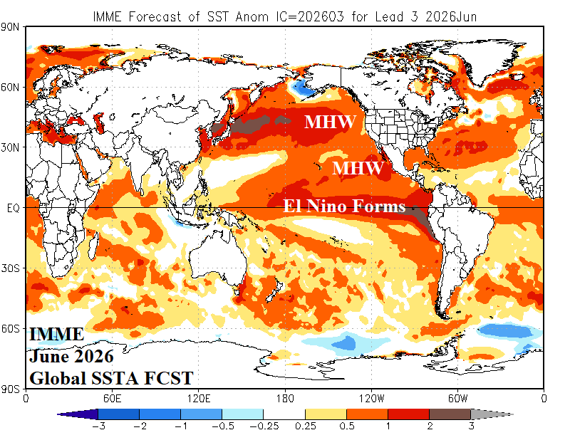
Fig. 7: IMME global SSTA forecast for June 2026 reveals El Nino and warming of the farther northern Northeast Pacific.