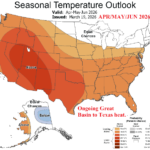
Impressive West U.S. heat/Dryness Until Wet Monsoon Arrives…Latest NOAA Long-lead Outlooks
03/19/2026, 9:19 am EDT
Northwest HYDRO Outlook: Reconsidering the “Warm Blob” Influence
03/23/2026, 8:24 am EDT
Climate Impact Company Week 2-4 Outlook
Australia
Issued: Friday, March 20, 2026
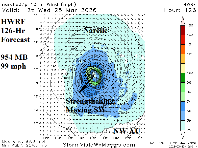
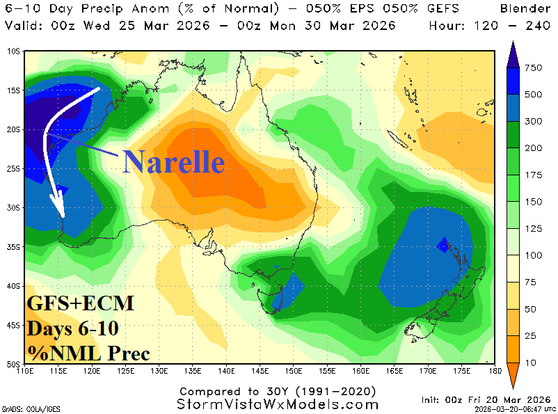
Highlight: All eyes on re-intensifying Narelle next week.
Chart of the day: Narelle tracks across Northern Australia, regains strength off northwestern Australia next week.
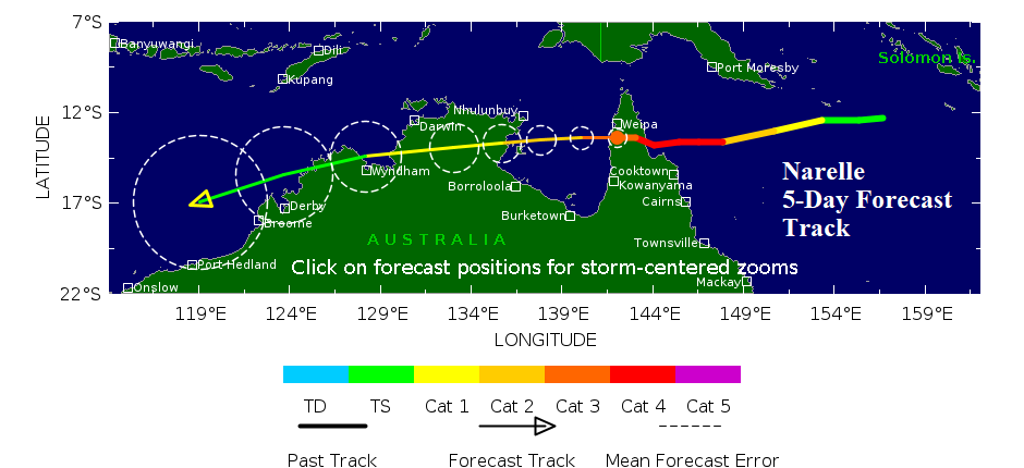
Discussion: Narelle will weaken moving across Northern Australia this weekend. However, HWRF has a re-intensifying tropical cyclone off the northwest coast next week likely to turn southward and stroke the West Coast of Australia later next week. At landfall, Narelle will be a powerful tropical cyclone.
Week-2 Ahead Forecast valid March 29-April 5, 2026: Drier after Narelle.


Discussion: After Narelle, a drier pattern develops for most of the continent. Wet weather lingers on the South Coast of Western Australia and continues in Coastal Queensland.
Week-3 Ahead Forecast valid April 5-12, 2026: Emerging anomalous heat.

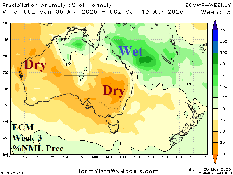
Discussion: In early April, anomalous heat generates across Western Australia and northern portions of New South Wales while much of the continent is dry.
Week-4 Ahead Forecast valid April 12-19, 2026: ECM is too dry.
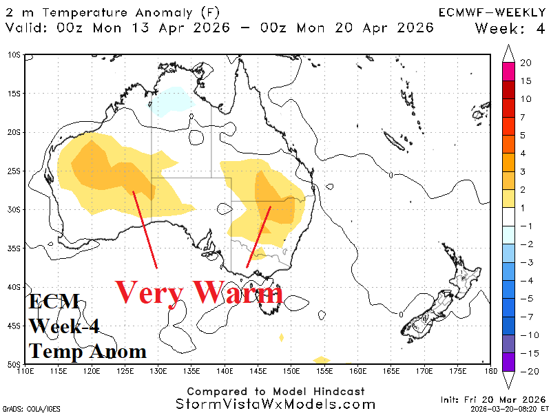

Discussion: ECM is likely too dry in the week-4 forecast.