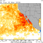
Northwest HYDRO Outlook: Reconsidering the “Warm Blob” Influence
03/23/2026, 8:24 am EDT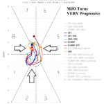
Madden Julian Oscillation is Progressive, Uncertain Influence on U.S. (Potentially) Wet Pattern
03/27/2026, 8:59 am EDT![]()
Climate Impact Company Daily Feature
Issued: Thursday, March 26, 2026
Highlight: Tonight’s severe weather, choppy PJM-East temperature pattern, and does low latitude wet weather develop? -SOI develops; Inspires El Nino.
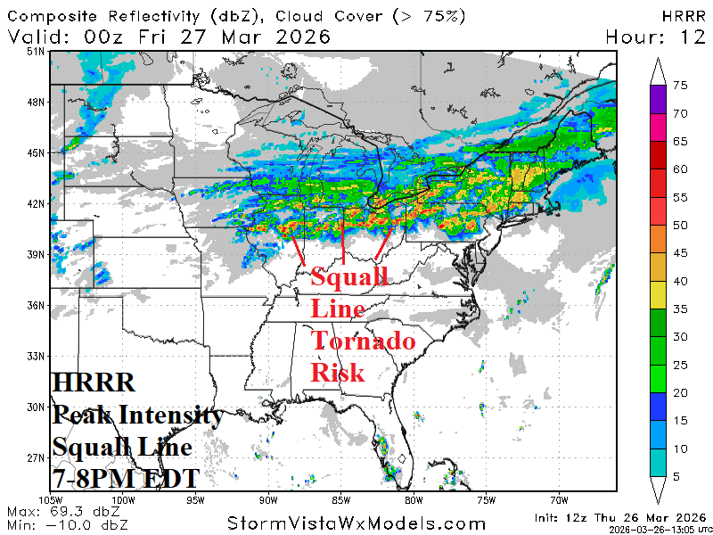
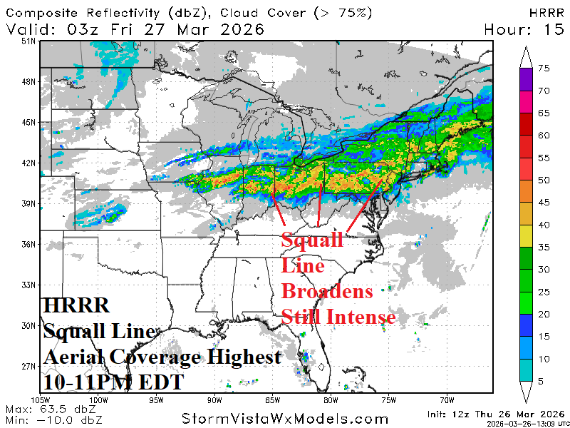
Fig. 1-2: HRRR projects peak intensity of today’s developing severe weather squall line early this evening broadening later this evening.
Discussion: The Ohio Valley eastward to Pennsylvania is within a significant level of severe weather risk for later today and tonight. HRRR projects strongest radar returns between 7-8PM EDT specifically for North-central Illinois and Indiana to Northern Ohio toward Pittsburgh, PA. In this stretch and slightly southward is the greatest risk of tornadoes (Fig. 1). By late evening, the squall line is slightly less intense although aerial coverage broadens through the northern Mid-Atlantic States to southern New England (Fig. 2). Severe storms are likely to linger too late in the evening. The squall line shifts south and weakens later tonight.
Although much of the U.S. observed an exceptionally mild winter, occasional cold spikes have affected the East. The warm/chilly fluctuations are (clearly) evident during the past 30 days across PJM-East (Fig. 3). The 15-day forecast projects continued high fluctuating temperature patterns.
The medium/extended-range forecasts are generally trying to turn Mexico (and Texas) wetter than normal. If so, an ongoing source region for Central U.S. rainfall continues and the extreme very warm/dry pattern of March so far abates. While some rain is certainly in the forecast, the tropical forcing too generate low-latitude significant rainfall is weak. Consequently, favoring drier Texas to Mexico forecasts is suggested (Fig. 4).
Finally, the southern oscillation index (SOI) has shifted to negative phase. 15-day SOI forecasts (Fig. 5) maintain the negative phase which will inspire the atmosphere to shift toward El Nino while the eastern equatorial SSTA steadily warm.
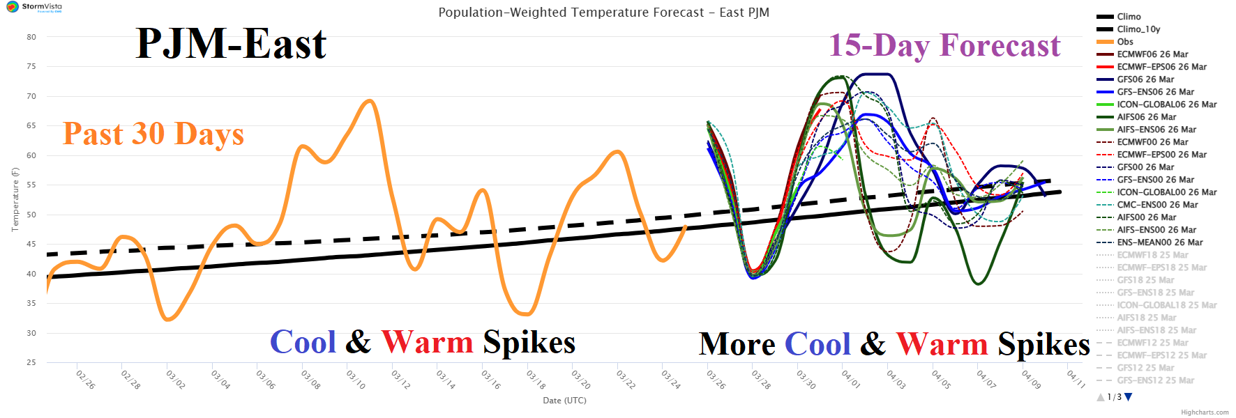
Fig. 3: The PJM-East 15-day population weight daily average temperature forecast plus the observed past 30 days.

Fig. 4: The GFS 15-day precipitation anomaly forecast across the U.S.
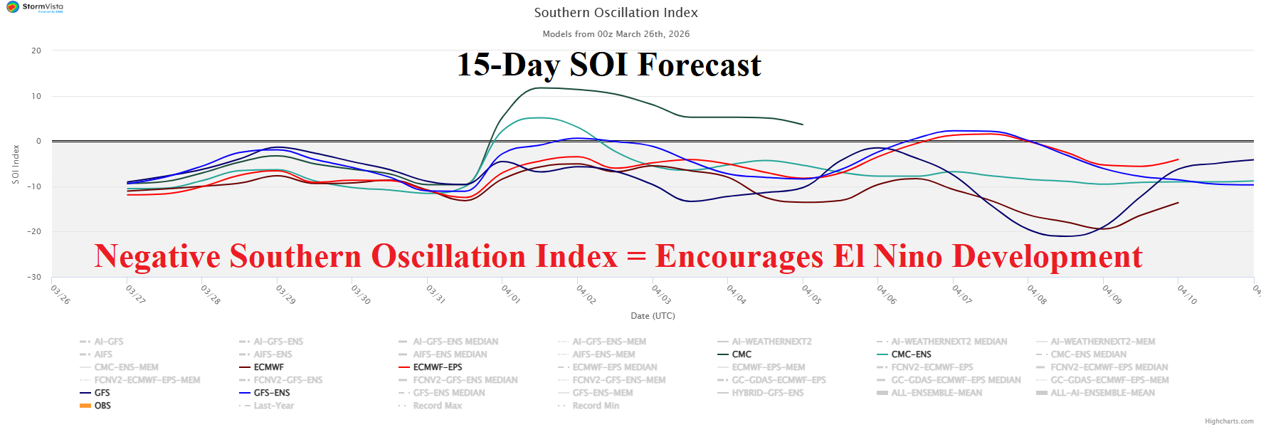
Fig. 5: The 15-day southern oscillation index forecast.