El Nino Alert Ahead!
01/13/2026, 6:08 am EST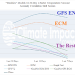
“Weeklies” Skill Scores for North America
01/16/2026, 10:23 am EST![]()
Climate Impact Company Daily Feature
Issued: Thursday, January 15, 2026
Highlight: Regional stratospheric warming expands westward from Russia causing a colder pattern in Europe which could reach East U.S. late month.
Discussion: During the past 7, 14, and 30 days, ECM ENS is the most skillful 2-meter temperature forecast for the 6-10-day and 11-15-day forecast. Currently, ECM ENS indicates the cold regime across Western Europe is slowly intensifying in the medium range while expanding westward (Fig. 1-2). Some models (GFS and ECM) are colder (Fig. 3). The evolving cold air mass and attendant westward expansion is associated with regional stratospheric warming (also) shifting westward from Russia in the 6-10-day period across Europe to the North Atlantic in the 11-15-day period (Fig. 4-5). Of interest is farther westward drift of stratospheric warming centered on Quebec on day-15 (Fig. 6). Collectively, the stratosphere is cold due to an intense polar vortex on the Alaska side of the North Pole. However, regional stratospheric warming as observed over Canada during early December causing an arctic outbreak into the East U.S. and during mid-to-late January across Eurasia (also) causing a very cold regime, should bias eastern North America cold to very cold to close January as indicated by AI 4CastNet V2 ECM ENS (Fig. 7). If the stratospheric trend continues in early February, a colder North America pattern continues (Fig. 8) rather than the warm-up indicated by many other models.
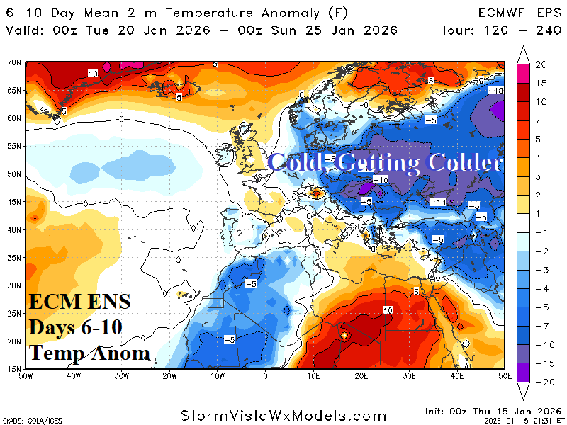

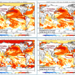
Fig. 1-2: ECM ENS medium range temperature anomaly forecast for Europe.
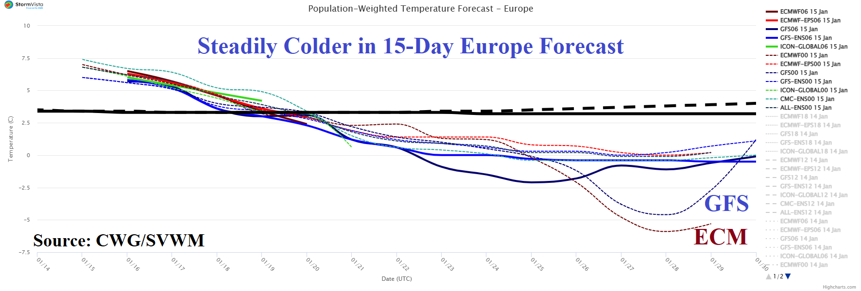
Fig. 3: The 15-day population weight forecast for Europe.
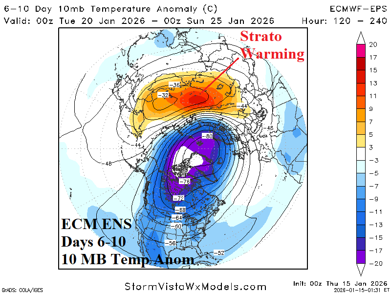
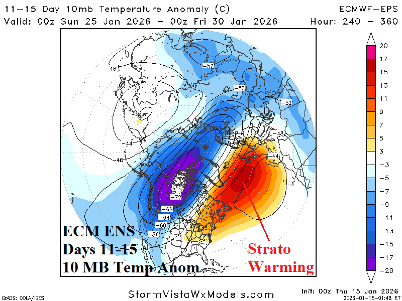
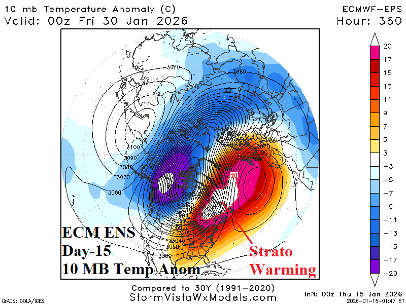
Fig. 4-6: The 15-day population weight forecast for the PJM Sector.
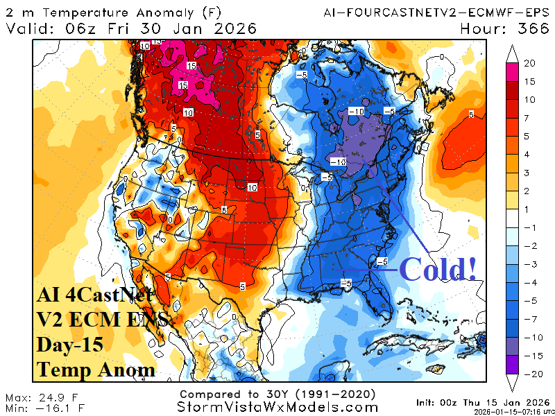
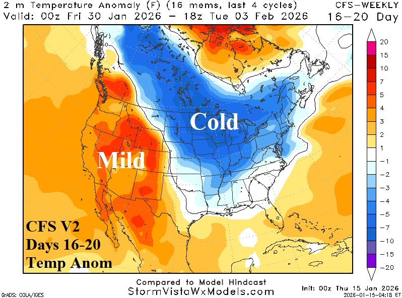
Fig. 7-8: The day-15 U.S. temperature anomaly forecast by AI 4CastNet V2 ECM ENS and CFS V2 16-20-day outlook.