Europe Dry-to-Drought Risk Expansion; Middle East Shifts Stormy
03/13/2026, 5:10 am EDT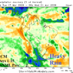
A Deluge of Rain for Argentina Ahead
03/17/2026, 8:00 am EDT
![]()
Climate Impact Company Sunday Global Weather/Climate Report
Issued: Sunday March 15, 2026
Highlight: PDSI analogs show problematic historical character for U.S. agriculture during the warm season; Dry/warm 10-day stretch for central/southern Great Plains. Black Sea region is drier.
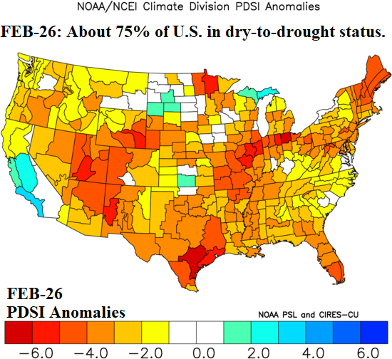
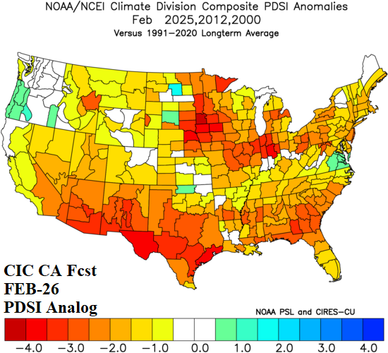
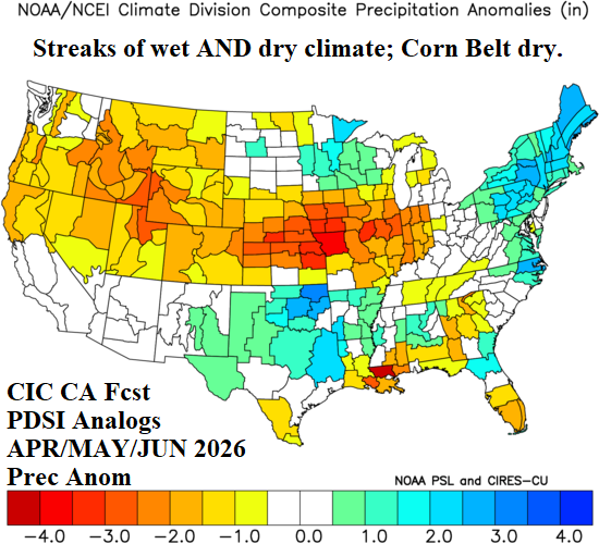
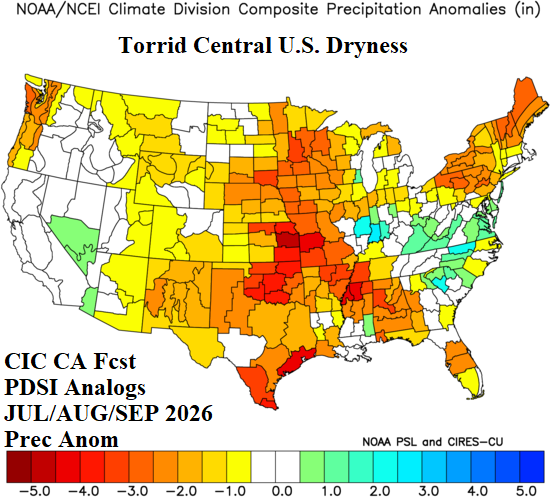
Fig. 1-4: Current U.S. Palmer drought severity index anomalies and a comparative analog (above) and using the analog, typical following Q2 and Q3 U.S. rainfall patterns.
Discussion: About 75% of the U.S. is in a dry-to-drought soil moisture condition as meteorological spring arrives (Fig. 1). Combining the month of February during 2000, 2012, and 2025 yields a similar Palmer drought severity index (PDSI) regime to FEB-26 (Fig. 2). During the analog years, an early year La Nina climate fades as observed in early 2026. The precipitation patterns for APR/MAY/JUN, during the PDSI analog years, indicated streaks of heavy rain across Oklahoma/Texas and the Upper Midwest with dryness in-between across the U.S. Corn Belt (Fig. 3). During JUL/AUG/SEP, widespread prohibitive dryness developed (Fig. 4). Unlike the PDSI analog years, El Nino is expected during Q3/2026 likely altering the Q3/2026 rainfall expectation. The concern (during Q3/2026) is East Coast rains and a wet Southwest U.S. Monsoon with dryness in-between across the Central U.S. Of importance is the trend indicated by NOAA/CPC probabilistic rainfall forecasts for summertime when updated on Thursday to validate stronger East and Southwest U.S. rainfall risk which would leave U.S. agriculture in a dry zone.
The U.S. precipitation outlooks feature dry and warm-to-hot persistence across the Southwest U.S. spreading into the central and southern Great Plains during the next 10 days (Fig. 5). In the 11-15-day period, wet weather developing in Mexico extends northward into Texas and possibly the southwestern Great Plains (Fig. 6). In early April, “weeklies” models agree on a wetter Central U.S. pattern developing.
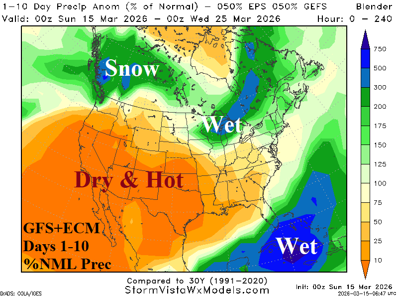
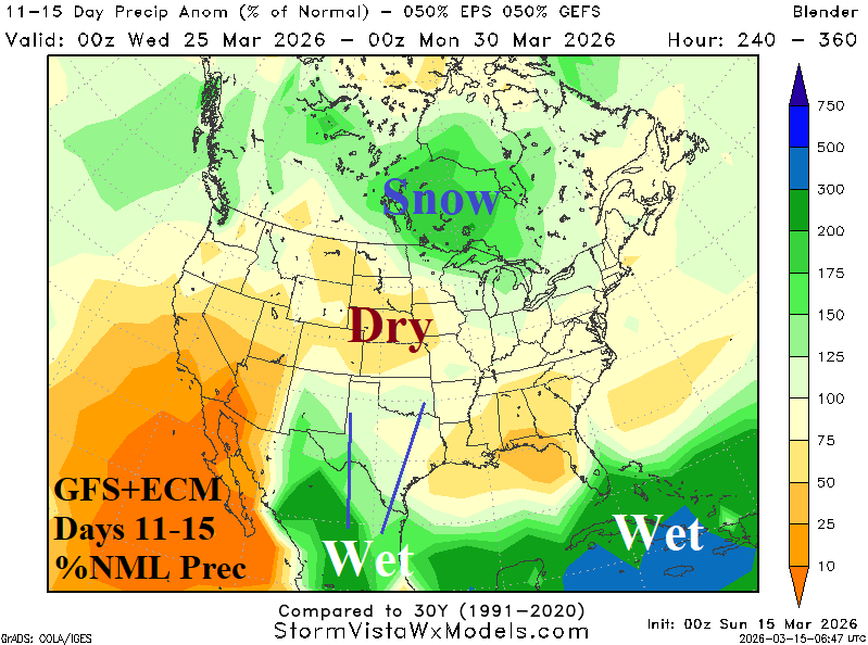
Fig. 5-6: Combining equally the GFS and ECM to project percent normal precipitation in the 1-10-day and 11-15-day periods.
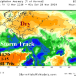
The Europe/Western Russia 7-day percent of normal precipitation analysis reveals ongoing strengthening dryness in Eastern Europe, Southwest Russia, and the Black Sea region (Fig. 7). The outlooks continue to indicate a vigorous Mediterranean Sea/North Africa to The Middle East storm track during the next 10 days with widespread dryness to the north across Europe and into Southwest Russia (Fig. 8). The dry zone is also somewhat warmer than normal. In the 11-15-day period, the storm track broadens northward and may reach parts of the Black Sea region (Fig. 9). In the 16-30-day period, the “weeklies” models are suggesting some of the rain in the Southern Storm Track shifts northward into the Black Sea region and Southwest Russia.
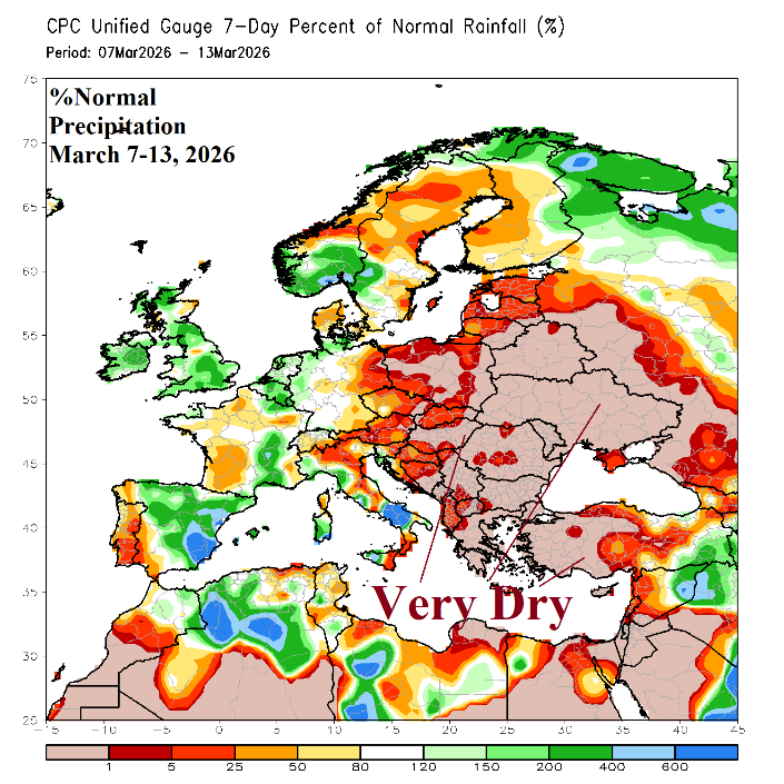
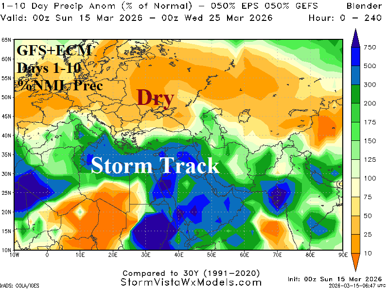
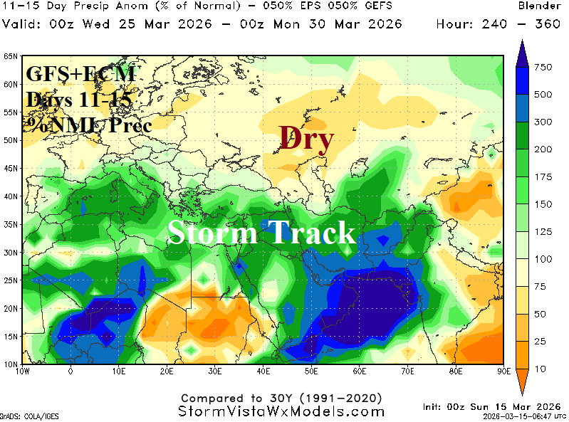
Fig. 7-9: NASA GRACE-based South America ground water anomaly analysis and mega-cluster “most likely” 15-day percent of normal precipitation forecast.