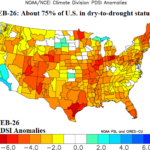
PDSI Analogs Show Problematic Historical Character of Rainfall for U.S. Agriculture During Warm Season
03/15/2026, 9:39 am EDT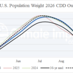
The 2026 U.S. Population Weight CDD Forecast
03/19/2026, 8:18 am EDT
Climate Impact Company Early AG Market ALERT
Issued: Tuesday March 17, 2026
Highlight: A deluge of rain for Argentina ahead, needed rainfall Black Sea region days 11-15.
Discussion: El Nino is on the way! Expect a wetter climate forecast for Brazil and Argentina in the latest month 1-4/season 1-4 ahead forecast issued later today. During the past week, a mix of heavy rain and very dry weather dominates Brazil and Argentina. The arid zone is centered on Uruguay and vicinity while the most persistent rain is across North to Central Argentina (Fig. 1). The latest 15-day percent of normal rainfall forecast by ECM unloads heavy rain on Argentina (Fig. 2). The wet forecast is supported, at least through the next 10 days, by an upper-level low-pressure trough off the Chilean Coast where SSTA continue much above normal adding to the risk of potential significant rainfall.
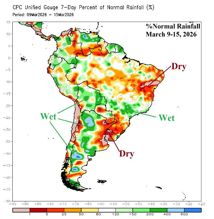
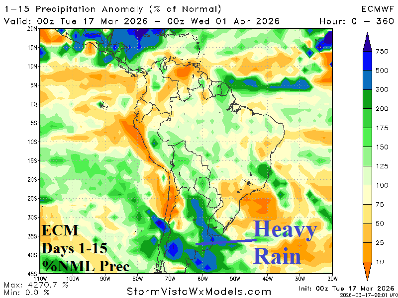
Fig. 1-2: The 7-day percent normal rainfall observations across South America and ECM 15-day forecast.
The recent arid weather pattern in the Black Sea region continues while parts of Western Europe have gained some rainfall and the Middle East is shifting (steadily) wet (Fig. 3). The 10-day outlook maintains the dry pattern (Fig. 4). However, the 11-15-day forecast indicates some helpful rain reaches the Black Sea region supported by a weak upper trough (Fig. 5).
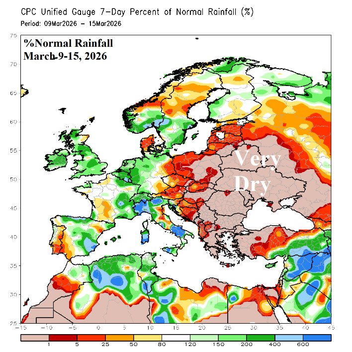
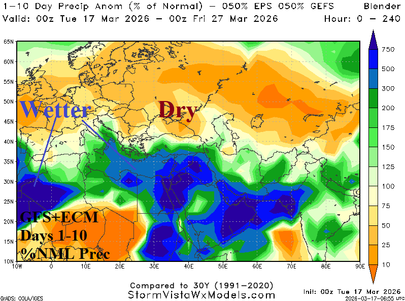

Fig. 3-5: The Europe/Western Russia 7-day percent of normal rainfall observations and GFS+ECM 10-day rainfall outlook plus the ECM 11-15-day forecast.