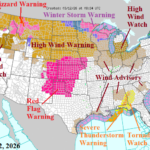
High Wind Events Northern U.S. Through Early Next Week
03/12/2026, 5:33 am EDT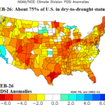
PDSI Analogs Show Problematic Historical Character of Rainfall for U.S. Agriculture During Warm Season
03/15/2026, 9:39 am EDT
Climate Impact Company AG Hot Spot
Issued: Friday March 13, 2026
Highlight: Europe dry-to-drought expansion; Middle East shifts stormy.
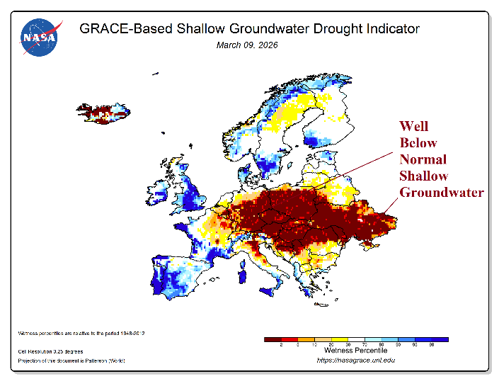
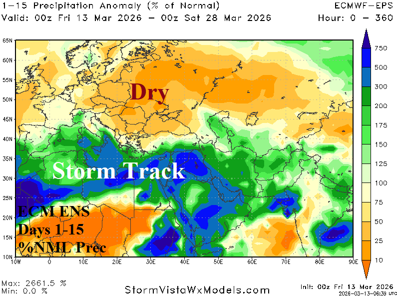
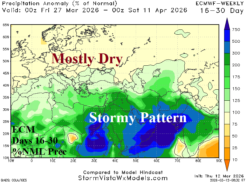
Fig. 1-3: The NASA GRACE-based shallow groundwater anomalies across Europe and the ECM ENS 15-day/ECM 16-30-day percent of normal rainfall forecast.
Discussion: The NASA GRACE-based shallow ground water anomaly analysis reveals well below normal levels from Central Europe eastward into Southwest Russia (Fig. 1). The dry condition is likely to continue and worsen. The ECM ENS 15-day percent of normal rainfall forecast indicates an evolving storm track stretching across the Mediterranean Sea and reaching the Middle East (Fig. 2). The wet weather pattern which also affects North Africa is supported by an elongated upper-level low-pressure trough. The wet weather pattern reaches the Middle East and is a factor in the ongoing major armed conflict in that area. North of the persistent storm track, Central Europe to Western Russia including the Black Sea region is much drier than normal. In the 16-30-day period, ECM projects the pattern to persist becoming increasingly focused on the Middle East while Europe to Western Russia including the Black Sea region remains mostly dry (Fig. 3). Consequently, dry-to-drought risk for Central Europe to Southwest Russia is increasing.