
Active Madden Julian Oscillation, Equatorial Pacific Subsurface Upper Ocean Heat Levels Off, and Below Average Snow Cover
11/02/2026, 6:49 am EST

Climate Impact Company U.S. Sunday Report
Issued: Sunday, November 8, 2026
Highlight: November storms, some periodic cooler weather, but overall early season heating demand is below normal (and typical of an El Nino climate). However, late November colder support is developing.
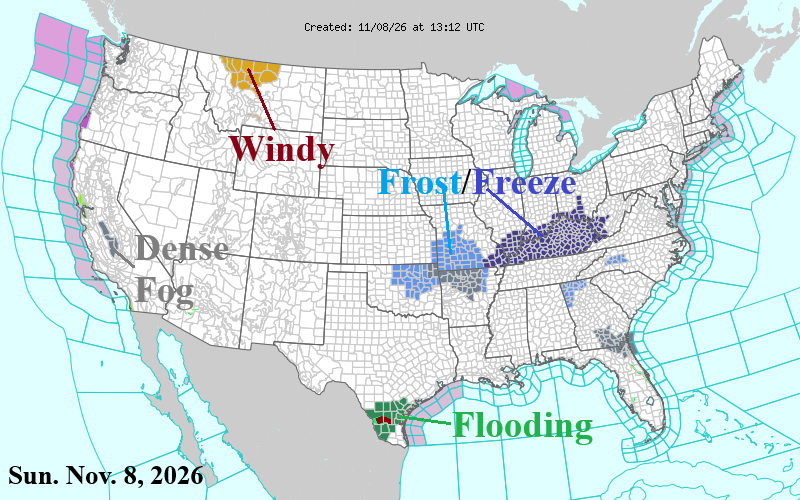
Fig. 1: NOAA/NWS weather watch, warning, and advisory areas.
Discussion: Early November has been on a record warm pace east of the Continental Divide. However, some marginal chill appears to start the week in the Midwest with morning temperatures dipping to near or slightly below freezing (Fig. 1). Despite the cool mornings, nationally, the U.S. stays warm through midweek. By Wednesday night, low pressure organizes in Ohio, and a following cool air mass is evolving in the Upper Midwest. The evolving upper trough pushes cooler air into the Southeast by Thursday while the Great Lakes region turns borderline cold although the warm Great Lakes will moderate the air mass. By Friday, chilly weather from the Great Lakes to the Gulf Coast, coolest anomalies farther south while a chilly rain drifts across New England (Fig. 2). Snow is likely, mainly mountain areas this storm.
Utilizing ECM, an atmospheric river style precipitation pattern is likely this week for the West Coast of Canada to the Coastal Northwest States (Fig. 3). Otherwise, the West is dry and warmer than normal this week. Southern Texas begins the week rainy with some ongoing flooding.
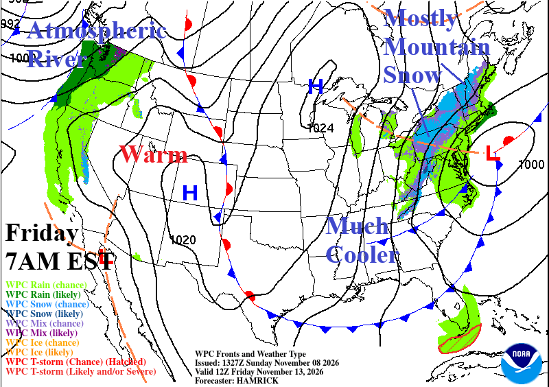
Fig. 2: NOAA/WPC frontal positions forecast for Friday morning.
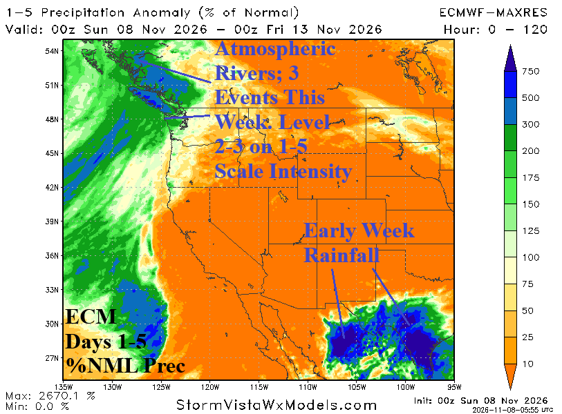
Fig. 3: ECM 5-day percent normal precipitation across the West U.S.
In the 6-10-day period, the upper air pattern is AMPLIFIED featuring deep troughs on each coast. In the East, the upper trough delivers cool air. The warm Western Atlantic and Great Lakes moderates the air mass in northern latitudes while coolest anomalies are realized in the Southeast (Fig. 4). The upper trough in the West forces a persistent atmospheric river pattern that shifts south to California during the period (Fig. 5). In the 11-15-day period (Fig. 6-7), the upper trough is buried in the Southwest U.S. forcing a southerly surge of moisture into the Great Plains as the storm track expands. The southwest flow aloft into the East causes a warm weather return.
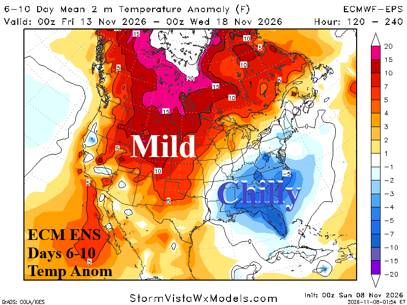
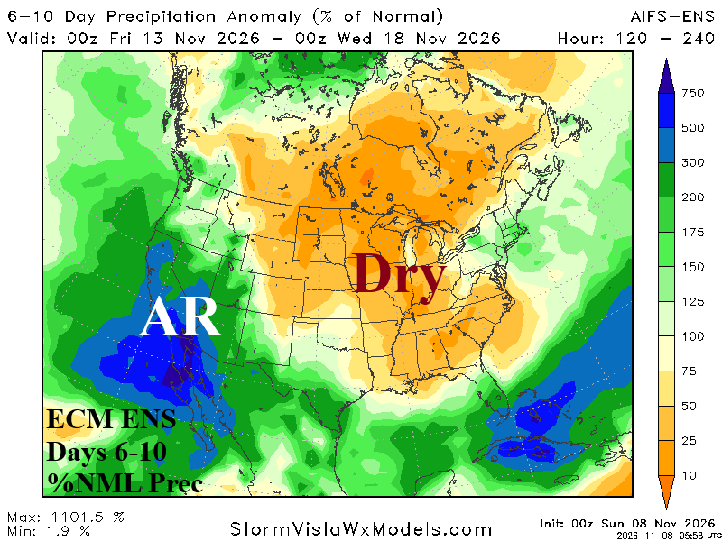
Fig. 4-5: ECM ENS 6-10-day temperature anomalies and percent normal precipitation forecast.
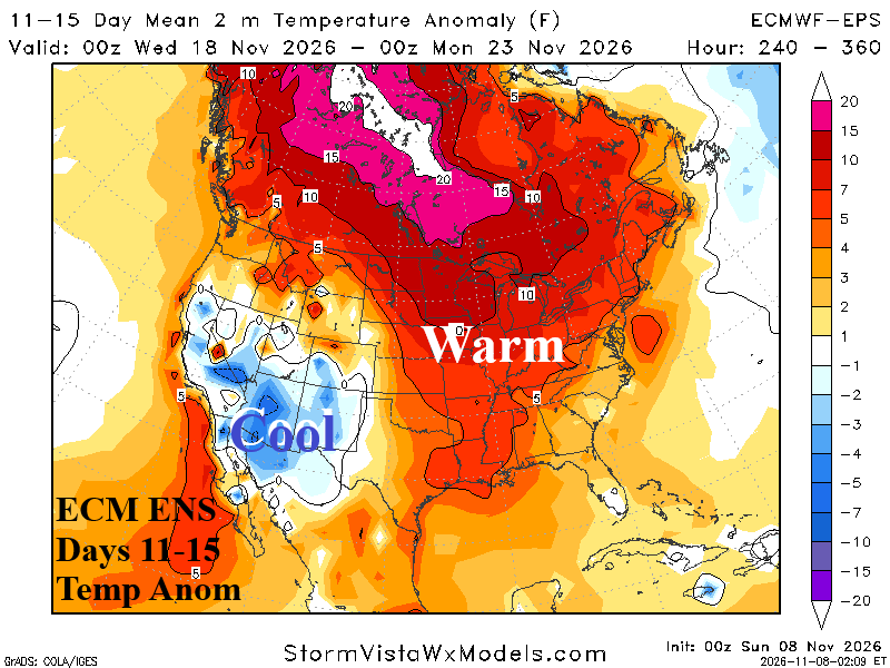
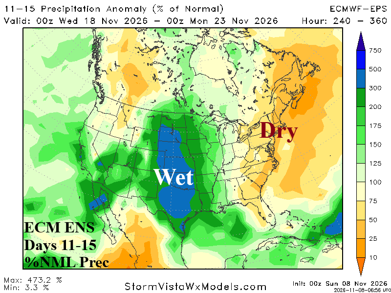
Fig. 6-7: ECM ENS 11-15-day temperature anomalies and percent normal precipitation forecast.
Despite some periods of cooler weather, the U.S. gas population weight HDD projections stay warmer than the 10-year normal through Thanksgiving Day (Fig. 8). The week 3-5 HDD projections are mixed but trending colder (Fig. 9). Notable is the colder AI solutions. 3 of 5 late November East Pacific oscillation (EPO) forecasts are negative supporting potential for a “polar vortex” pattern to close the month. Additionally, negative arctic oscillation (-AO) is expected suggesting high latitude blocking. The potential for a chilly end to November is increasing.
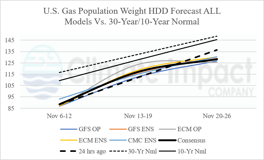
Fig. 8: U.S. gas population weight HDD forecast utilizing all operational models, their consensus, and comparison with 24 hours ago and 30-year/10-year climatology.
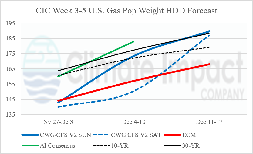
Fig. 9: The U.S. gas population weight HDD forecast for week 3-5 ahead utilizing CWG analog based CFS V2 projections and CIC estimates based on ECM and AI “weeklies” forecasts.
.