
Wetter Pattern Change Midwest U.S. Ahead
10/27/2026, 9:09 am EDT
Climate Impact Company Midday Update
Issued: Friday October 30, 2026
Highlight: Despite stronger +PNA/-NAO pattern during the medium range, the cold stratosphere across Canada motivates warm surface temperatures.
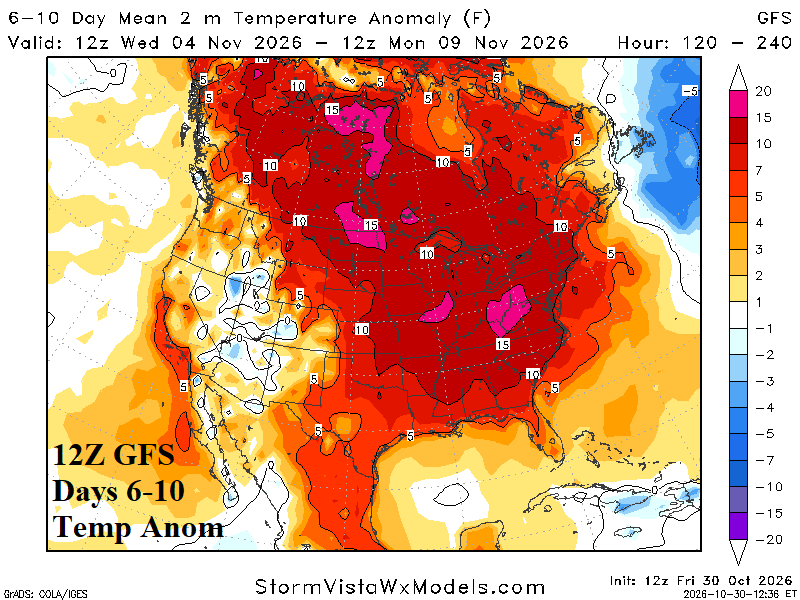
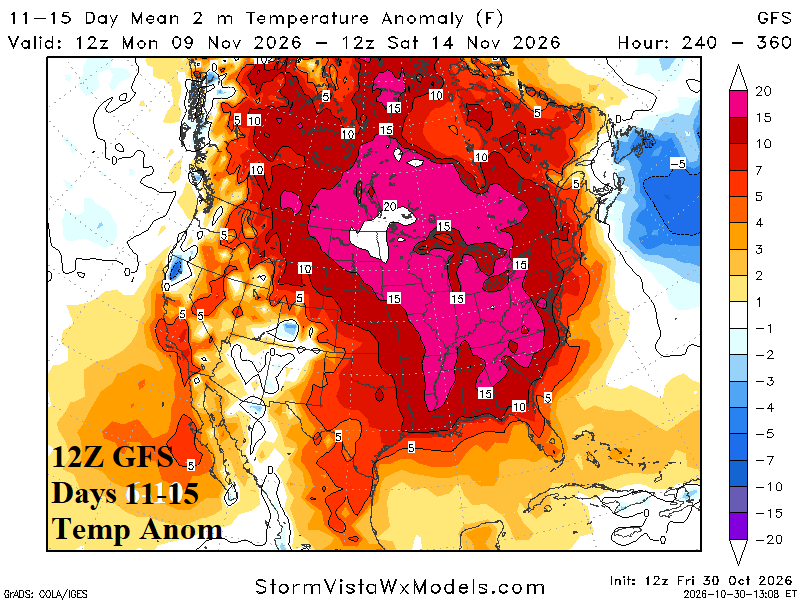
Fig. 1-2: The 12Z GFS U.S. medium range temperature anomalies.
Discussion: NOAA/CPC -AO/-NAO both dip to near -1.0 from this morning qualifying as moderate-strength intensity and about twice as strong as yesterday. The PNA pattern is buoyantly positive. On their own, these climate signals indicate support for a West ridge/East trough during the medium range. The 2-week MJO forecast indicates moderate intensity in phase_2 which is a cool East U.S. signature. Previously, progression to phase_3 was indicated which is a warm signal for the U.S. EPO/WPO are relatively flat suggesting the ridge potential is in the West and trough in the East.
At midday, the 12Z GFS is BOLDLY warm in the 6-10-day period (Fig. 1). The extremely warm signature is in response to a cold stratosphere aligned across Canada. The stratosphere stays cold across Canada in the 11-15-day period maintaining a warm signature across North America at ground level (Fig. 2).
| HDD EIA End | Forecast | 12-Hour Change | 24-Hour Change | 30-Year Normal | 10-Year Normal |
| 11/5 | 58.2 | -0.3 | -4.7 | 100.5 | 91.6 |
| 11/12 | 48.1 | -40.2 | -40.4 | 116.4 | 109.2 |
| 11/19 | 112.0 | -10.2 | -11.9 | 132.4 | 127.7 |
Table 1: The midday 12Z GFS U.S. gas population weight HDD forecast into middle November.