
Early Season Snow Black Sea Regions Days 11-15
10/25/2026, 12:55 pm EDT
Despite Stronger +PNA/-NAO Forecast, Stratospheric Cooling Over Canada Keeps North America Warm!
10/30/2026, 1:40 pm EDT
Climate Impact Company Early U.S. Report
Issued: Tuesday October 27, 2026
Highlight: MJO inspires changing U.S. precipitation pattern; Maintains warmth.
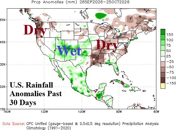
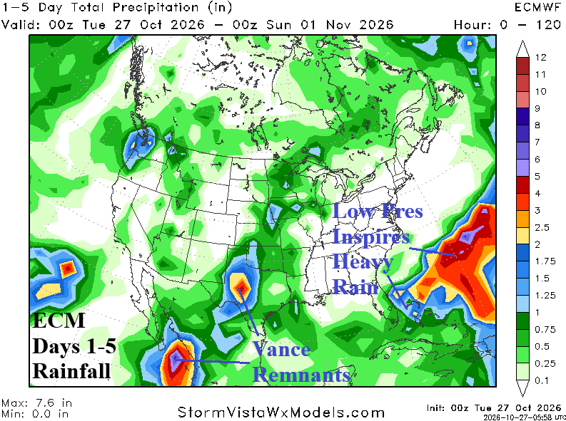
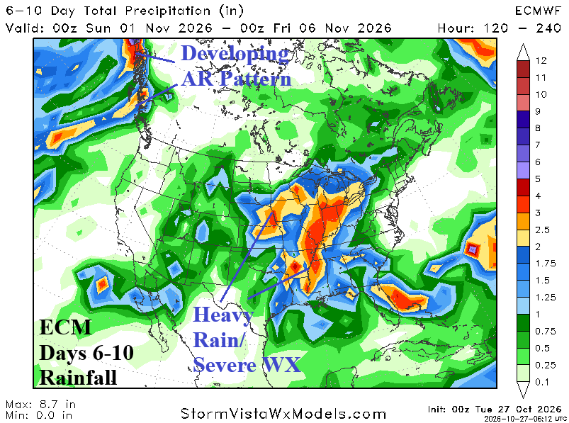
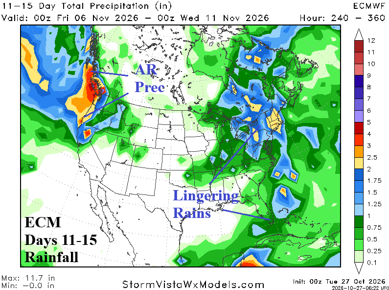
Fig. 1-4: U.S. precipitation anomalies for the past 30 days and ECM 1-15-day rainfall forecast for the U.S.
Discussion: Madden Julian oscillation (MJO) strengthens and shifts east to the Indian Ocean into early November and causes a shake-up in the prevailing precipitation pattern of the past 30 days (Fig. 1) to emerging heavy rain in Texas this week (Fig. 2), widespread heavy rain and severe weather centered on the Midwest next week (Fig. 3) while an atmospheric river pattern shifts into the Northwest Coast by days 11-15 (Fig. 4). The MJO influence maintains a warm U.S. pattern as HDDs stays below the 10-year normal through the first third of November (Fig. 5). The AI consensus and ECMWF “weeklies” forecasts maintain a very warm HDD signature in November (Fig. 6).
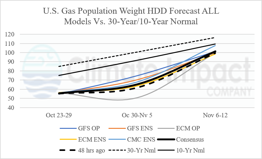
Fig. 5: U.S. gas population weight HDD forecast utilizing all models, their consensus, and comparison with 48 hours ago and 10-year/30-year climatology.
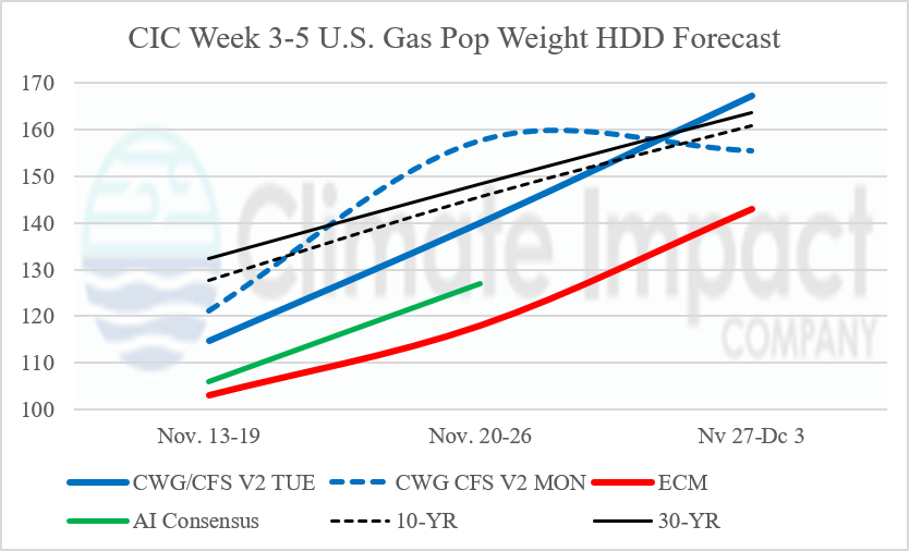
Fig. 6: CWG/CFS V2 analog based CFS V2 U.S. gas population weight HDD forecast for week 3-5 ahead comparing today and yesterday’s forecast plus Climate Impact Company estimated HDD using ECM and AI “weeklies” forecasts.