
What Should I Look at to Identify Increased Pattern Change/Cold Air Risk?
10/25/2026, 10:35 am EDT
Climate Impact Company Week 2-4 Outlook
Australia
Issued: Wednesday October 28, 2026
Highlight: Drivers of unusually wet weather (for El Nino presence) ease but don’t end in November.
Later today: New month 1-4 outlook; Detailed ENSO/IOD discussion.
Chart of the day: Explaining the unexpected wet weather in East Australia.
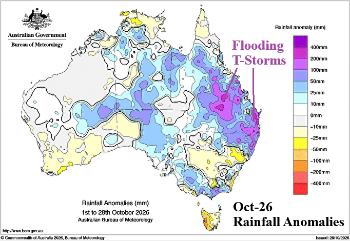
Discussion: The Climate Impact Company opinion causing the surge in heavy rain across Eastern Australia is a mid-October shift to negative phase of the Southern Annular Mode (-SAM) associated with strengthening and eastward shift to the tropical Indian Ocean of the Madden Julian oscillation (MJO) and enhanced by presence of a strong marine heatwave (MHW) off the Southeast Coast of Australia. The SAM returns to positive phase during early November although the MJO and MHW combination linger which presents support for additional wet weather although not as intense as the mid-to-late October regime.
Week-2 Ahead (November 8-15, 2026): Cooler East, low confidence.
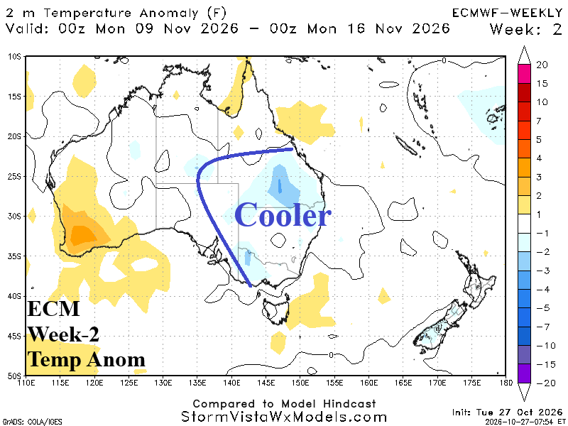
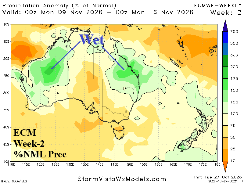
Discussion: Most, not all, forecast models agree on a transiting upper trough bringing cooler weather to Southeast Australia. To generate the trough, -SAM is preferred and not forecast therefore below average forecast confidence. Given the recent over-achieving rainfall events, significant rainfall is likely near the coast of Queensland and northwestern continent.
Week-3 Ahead (November 15-22, 2026): Regenerating heat, increased confidence.
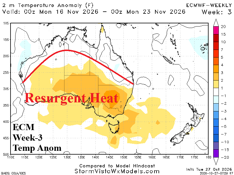
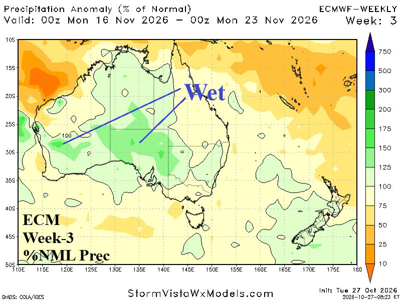
Discussion: Upper trough shifts east and followed by a heat-generating upper ridge for the southern half of Australia. Strong to severe thunderstorms are likely in the northern portion of the anomalous hot weather zone.
Week-4 Ahead (November 22-29, 2026): Wet risk shifts to Southwest/South-central Australia.
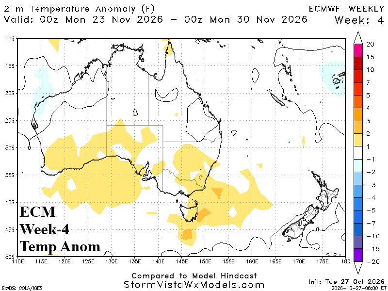
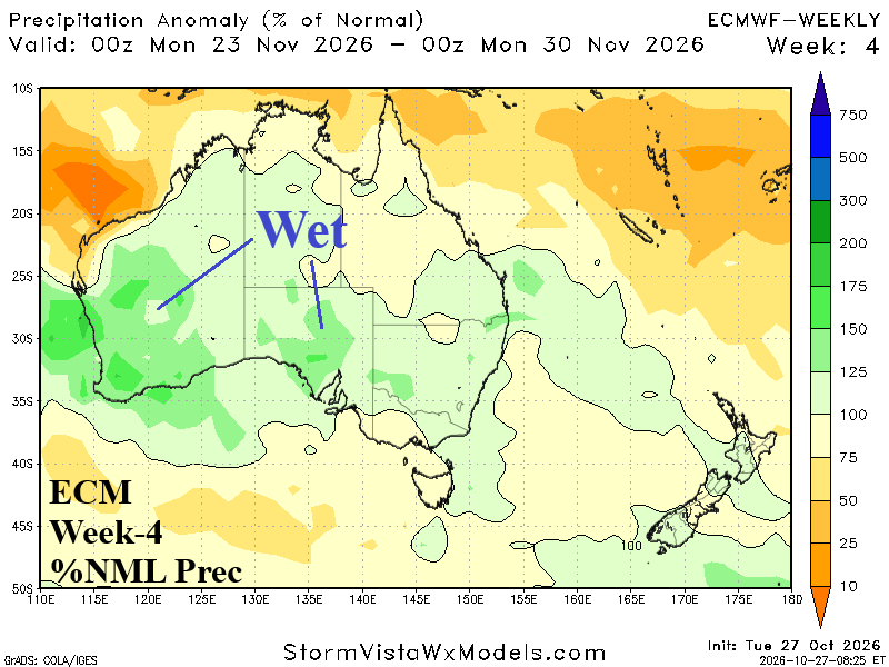
Discussion: Southern Australia heat eases while rainfall risk increases.