
Early Season Advancing Snow Cover
10/19/2026, 8:46 am EDT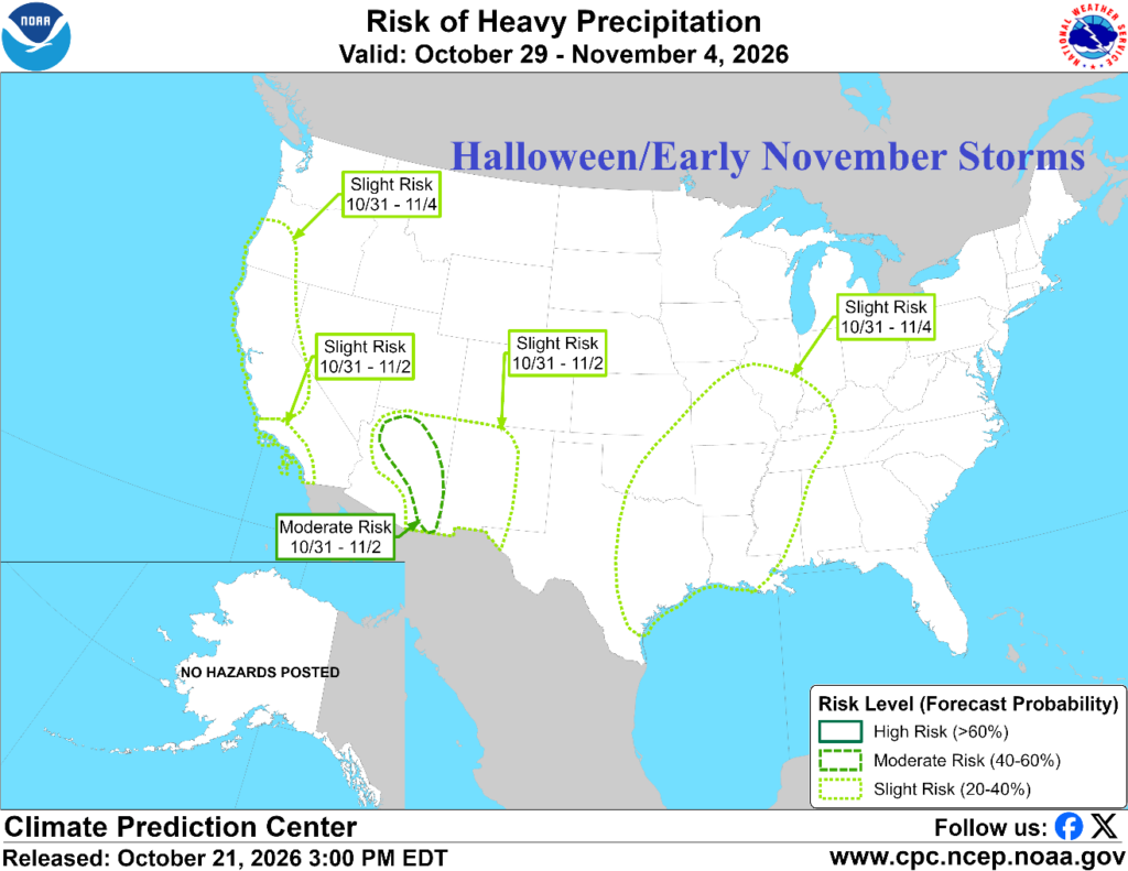

Climate Impact Company North America Medium Range Report
Issued: Thursday October 22, 2026
Highlight: Prohibitive U.S. storm track; California/Southwest U.S. primary target.
Chart of the day: NOAA/CPC project prohibitive storm track for early November.
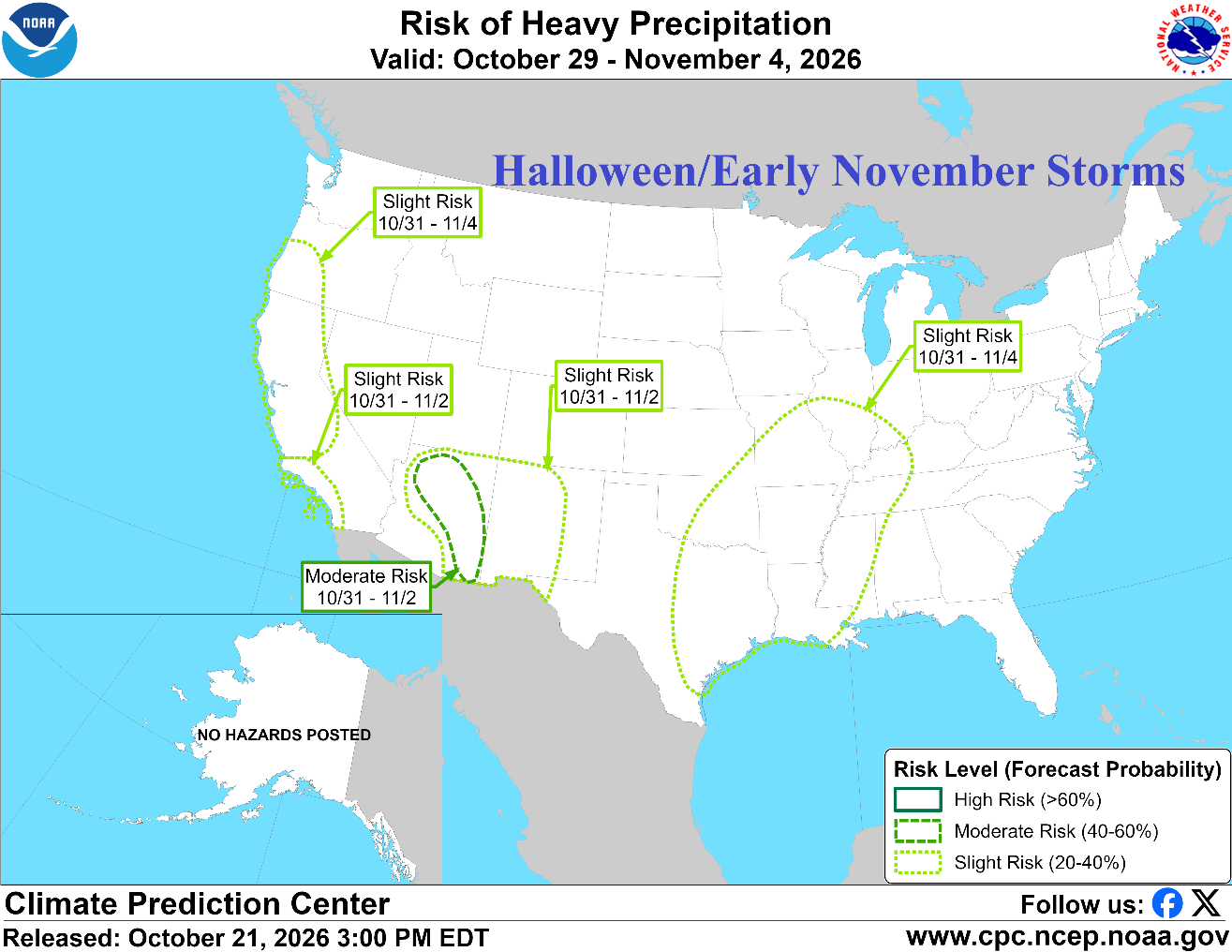
Discussion: Prohibitive West/South U.S. storm tack ahead with NOAA/CPC highlighting risks for Halloween to November 4th. The pattern will become persistent as the Super El Nino winter climate unfolds.
Medium-range 6-10 Day Forecast Valid October 27-31, 2026 (AIFS ENS and 24-hour change)
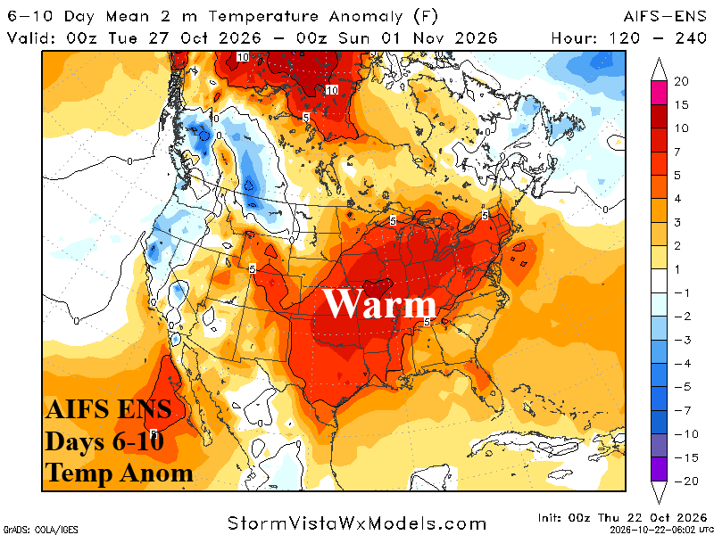
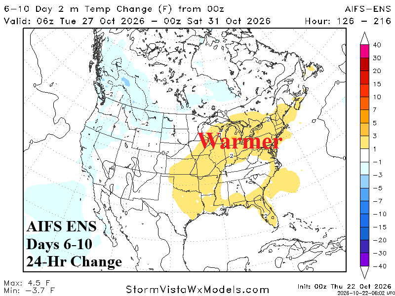
Discussion: Upper ridge piles on the East U.S. driving the warm pattern. The West Coast trough is broadening, storms are potent and suppressing temperature.
Medium-range 11-15 Day Forecast Valid November 1-5, 2026 (AIFS ENS and 24-hour change)
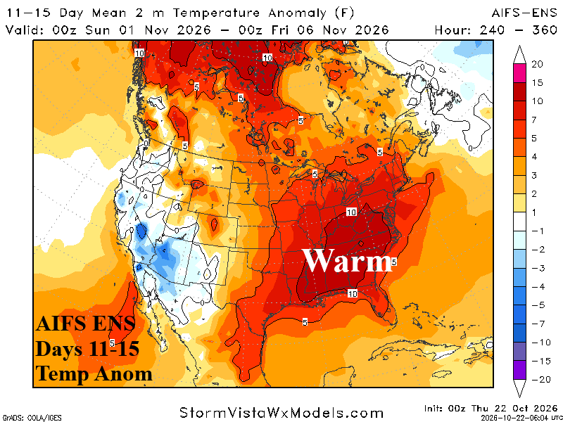
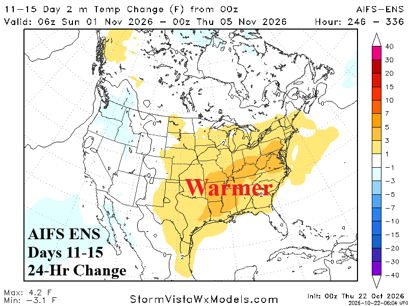
Discussion: Upper trough dives into the Southwest U.S. while East U.S. ridge is fortified. Warmer changes in the East beneath the ridge.
U.S. Medium-range Precipitation Forecast
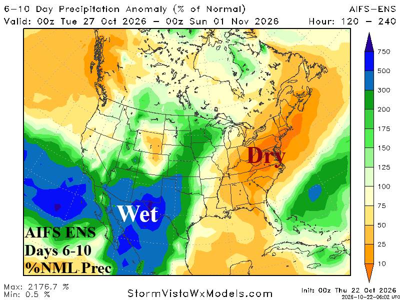
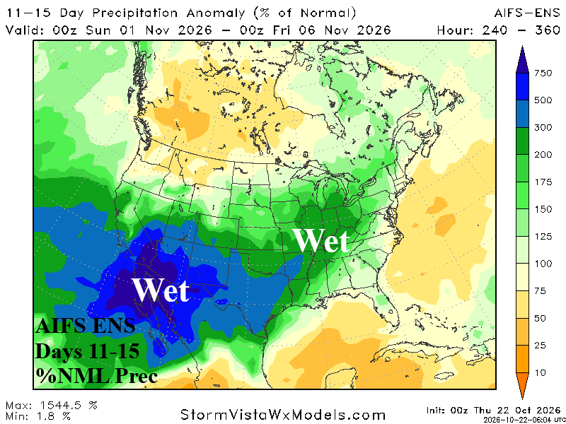
Discussion: The West/Southwest U.S. trough looks ugly and fuels a prohibitive U.S. storm track which expands with time.
Days 16-20 Extended range Temperature Forecast valid-November 6-10, 2026
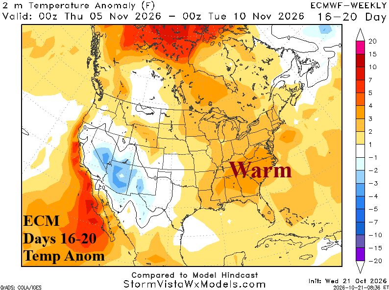
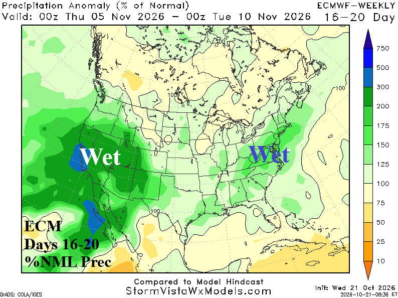
Discussion: Maintaining ECM 16-20-day outlook: Cool/stormy West and warm but also wet in the East.