
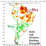
South America Crops at Risk of Drought Q4/2026 Into 2027
09/25/2026, 8:55 am EDT
Climate Impact Company Pacific Decadal Oscillation Report
Issued: Tuesday, September 29, 2026
Highlight: The NEW cool phase Pacific decadal oscillation and winter 2026-27 atmospheric rivers.
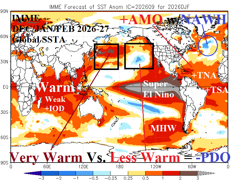
Fig. 1: IMME global SSTA forecast for DEC/JAN/FEB 2026-27 identifying many regions of influence on climate in addition to Super El Nino.
Discussion: Traditionally, the Pacific decadal oscillation (PDO) is based on a simple comparison between sea surface temperature anomalies (SSTA) in the Northeast Pacific (north of 20N) and Northwest Pacific. Warmer Northwest Pacific than cooler Northeast Pacific SSTA regimes = -PDO and visa versa. The entire 2020’s observed persistent cool phase of the Pacific decadal oscillation (-PDO). The AUG-26 PDO was -1.84. The International multi-model ensemble (IMME) global SSTA forecast for DEC/JAN/FEB 2026-27 maintains -PDO (Fig. 1). But! The lengthiest and strongest -PDO (of the 2020’s) on record is not the same as a conventional -PDO regime.
Beginning in 2018, the Kuroshio Ocean Current east of Japan warmed and expanded with the attendant warming reaching across the northern Pacific Ocean. The warming is intense and frequently produces record warm SSTA for that basin. Warming has spread eastward into the Northeast Pacific at times and on average the Northeast Pacific has been warmer than normal during the 8-year period. However, relative to the frequently record-warm Northwest Pacific, the Northeast Pacific is less warm therefore justifying -PDO. The -PDO signal present this entire decade has frequently been record-strength, not because of Northeast Pacific cooling, but because of Northwest Pacific warming.
The IMME global SSTA forecast projects the typical warming off the North America West Coast associated with Super El Nino. However, in response to the persistent warm Northwest Pacific, a cool pool of SSTA is projected northeast of Hawaii for DEC/JAN/FEB 2026-27 and aloft low pressure will persist in this region helping to drive atmospheric rivers into California for winter 2026-27 (Fig. 2). Winter 2026-27 brings a second atmospheric river regime, out of the subtropical southeastern Pacific and northeastward to the U.S. East Coast. California and Florida to Virginia are hit hard by storms this winter season and given the subtropical moisture entrainment of these storm tracks, heavy rain (and flooding) is a frequent problem.
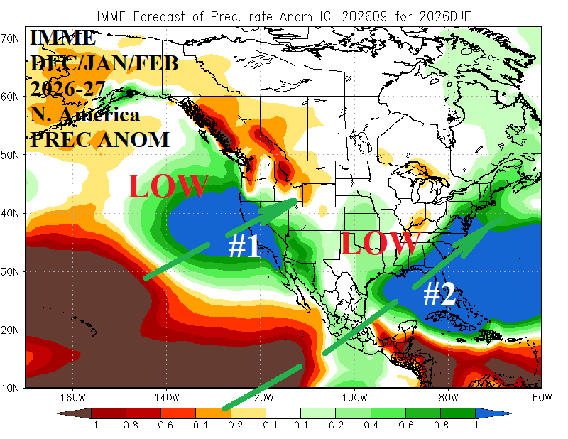
Fig. 2: IMME identifies two atmospheric river patterns for winter 2026-27.
During the previous 3 super El Nino episodes, prior to the Kuroshio Current warming and expansion, +PDO was in place during January mainly due to the warming off the U.S. West Coast versus the cool regime across the Northwest Pacific (Fig. 3-5). Typically, -PDO regimes featured cool SSTA in the Northeast Pacific versus warm SSTA in the Northwest Pacific and the strongest -PDO were almost always associated with La Nina (Fig. 6). The change (in PDO) is so dramatic that infamous climate scientist Michael Mann designated the PDO insignificant (earlier this decade).
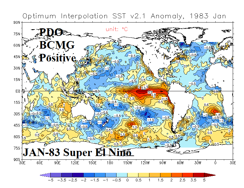
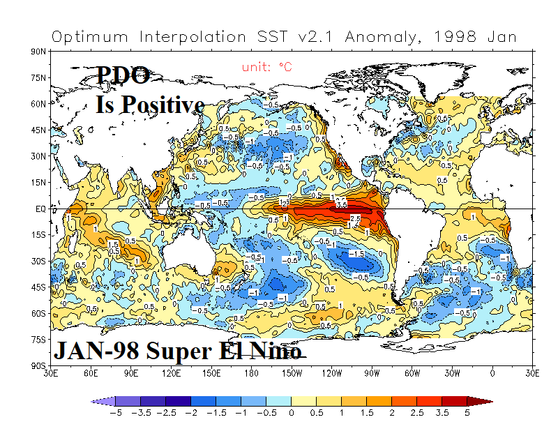
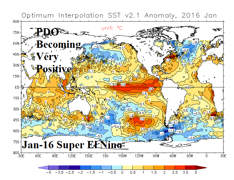
Fig. 3-5: Three previous Super El Nino episodes and the January Pacific decadal oscillation signature.
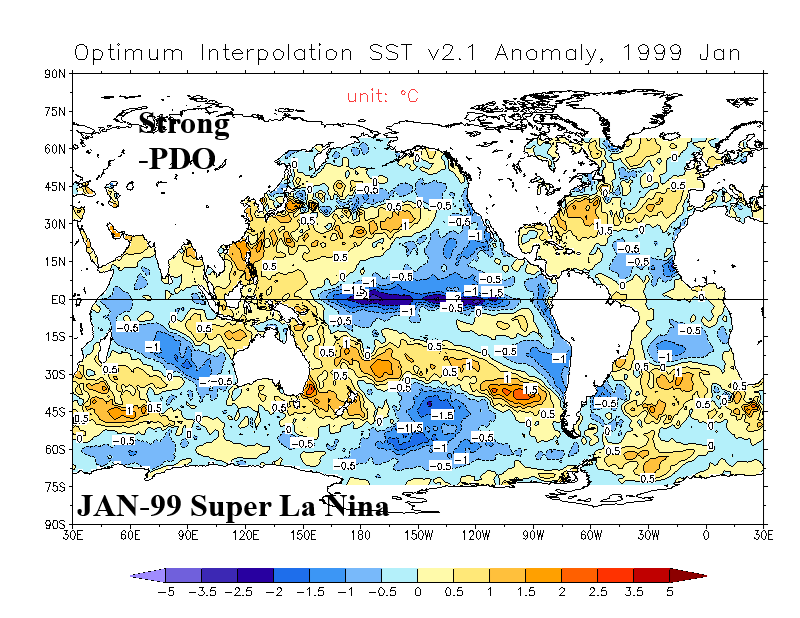
Fig. 6: Classic cool phase Pacific decadal oscillation.