Global Soil Moisture Anomalies Observations and Trend
05/08/2026, 9:50 am EDT
Upper Ocean Heat East of Dateline 2nd Warmest Historically
05/11/2026, 12:33 pm EDT
Climate Impact Company Early AG Market ALERT
Issued: Monday May 11, 2026
Highlight: Dynamics to generate wet weather in Central U.S. align in the 6-10-day period. New concern, 500 MB ridge near the Midwest days 16-30. Europe is wetter, early season chill to southeastern Brazil.
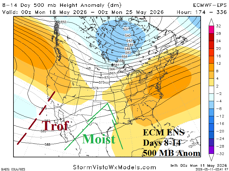
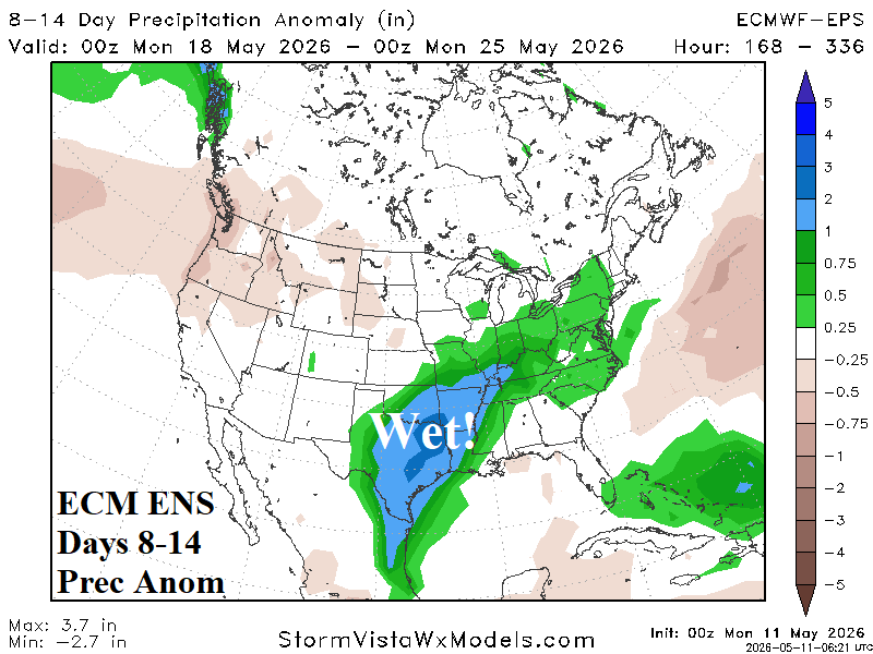
Fig. 1-2: ECM ENS 8-14-day 500 MB anomaly forecast and attendant rainfall anomaly outlook.
Discussion: During the 8-14-day period, an upper trough forms off the Baja California Coast (Fig. 1). A moist southwest flow aloft develops and enables a wet pattern to develop in Northeast Mexico, Texas, and northeastward toward the Ohio Valley (Fig. 2). The prevailing dry pattern of this week is pushed to the northwest Great Plains (and Northwest U.S.). In this set-up, particularly with much warmer than normal SSTA in the Southeast Pacific and Gulf of Mexico, heavy rain/severe weather is likely for Texas to the Mid-south States.
In the 16-30-day period, a precarious upper air pattern forecast features a high -pressure ridge settling on the Great Lakes region with slight differences in location and intensity comparing ECM and AI Graph Cast (Fig. 3-4). If this pattern develops leading into the first third of June, wet weather is steady in Texas (and vicinity) with very warm and drier than normal weather to the north and centered on the East-central U.S.
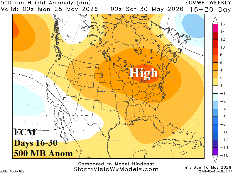
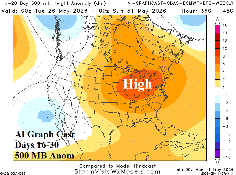
Fig. 3-4: ECM and AI Graph Cast 500 MB anomaly forecast for the 16-30-day period.
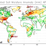
Wet weather is regenerating in Europe following a drier than normal period which allowed soil moisture anomalies to shift drier with widening aerial coverage (Fig. 5). Models have been over-forecasting rain during mid-spring, best demonstrated by GFS from the past 14 days (Fig. 6). However, the recent return of wet weather is likely to carry through the next 10 days covering much of Europe and stretching eastward to the Black Sea region (Fig. 7). In the extended range, Western Europe shifts drier while Black Sea rains will linger (Fig. 8).
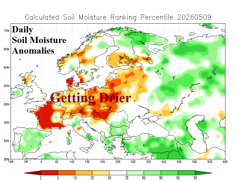
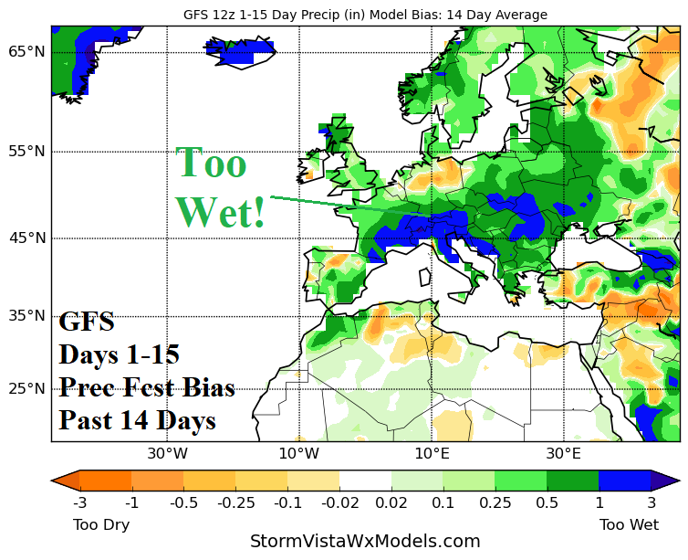
Fig. 5-6: Daily Europe soil moisture anomaly analysis and GFS 14-day rainfall forecast bias across Europe.
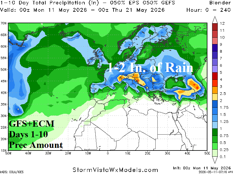
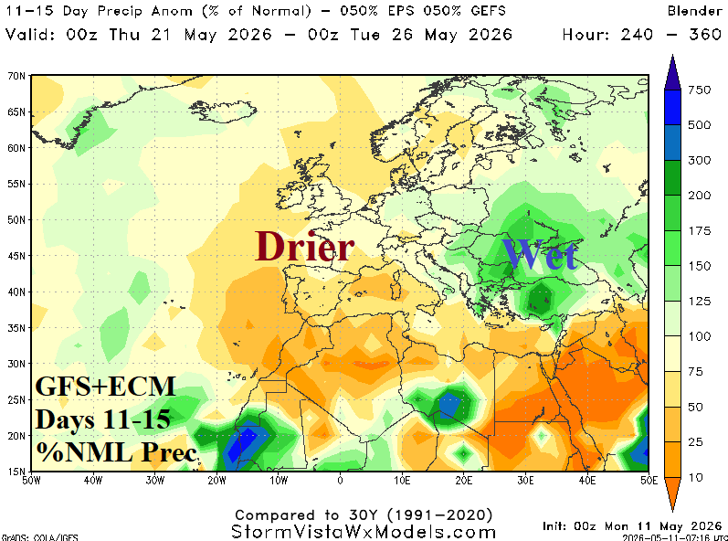
Fig. 7-8: GFS+ECM 1-10-day rainfall amount forecast and the percent of normal rainfall outlook for the 11-15-day period across Europe.
Early season chill pushes into southwest and southeast portions of Brazil to start the week (Fig. 9). The cold spike produces isolated 32F/0C morning temperatures south of the Brazil Coffee Belt. The chill abates in the 6-10-day period while heavy rain is focused on a quasi-stationary frontal system in Southeast Brazil (Fig. 10).
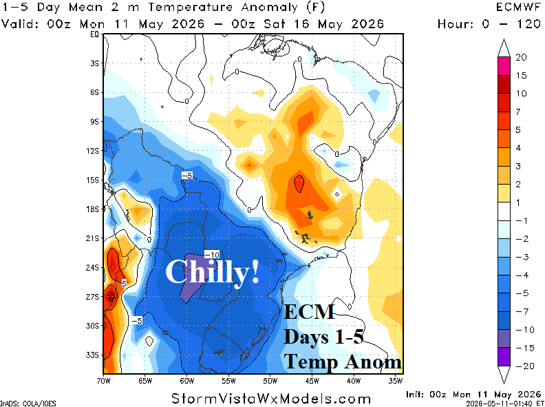
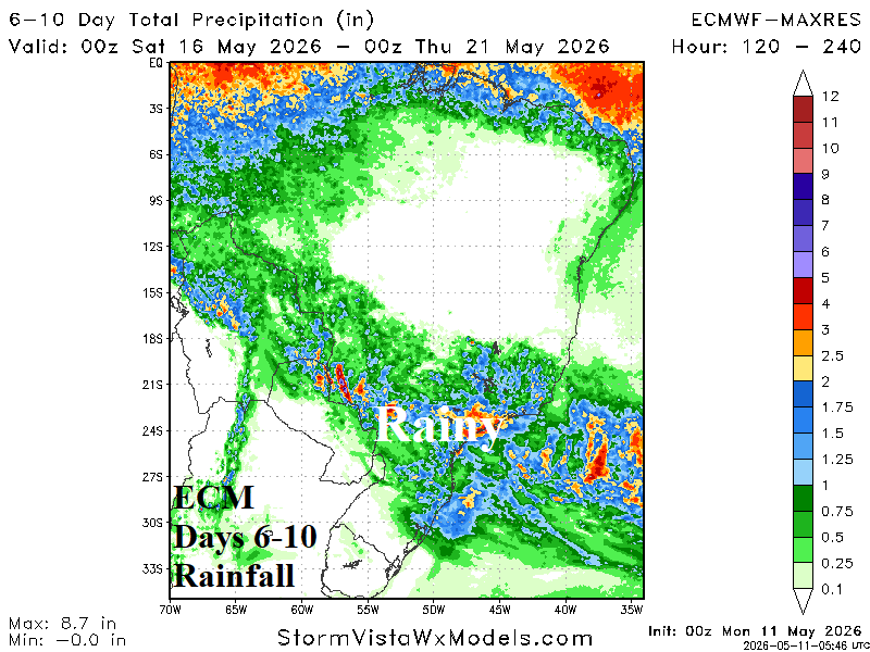
Fig. 9-10: ECM 1-5-day temperature anomaly forecast and 6-10-day rainfall mount outlook for Brazil.
.