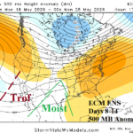
Dynamics To Generate Heavy Rain Texas/Mid-south U.S.; Impressive High Pressure Ridge Days 16-30 Midwest U.S.
05/11/2026, 5:03 am EDT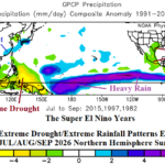
Super El Nino Increasingly Likely. Where are the First (climate) Targets?
05/12/2026, 1:54 pm EDT
Climate Impact Company ENSO Climate Diagnostics
Issued: Monday May 11, 2026
Highlight: Upper ocean heat second-most to the 1997 El Nino; We await El Nino onset followed by explosive (El Nino) intensification.
Discussion: Upper ocean heat index is between +2 and +2.5 for the past 3-4 weeks which is warmest on record for El Nino events EXCEPT for the 1997 episode (Fig. 1). Potential energy for El Nino development and intensification is immense. The weekly Nino SSTA observations for the past 12 weeks indicate warming above the El Nino threshold (Fig. 2). However, the NEW relative Nino34 index is used to identify ENSO phase which remains neutral and forecast ENSO phase ahead which maintains potential for record El Nino strength later this year (Fig. 3). The atmosphere is slow to respond to the buoyant upper ocean heat. Required is a shift of the southern oscillation index (SOI) to steady negative phase which will help to ease or reverse trade winds and allow the subsurface heat to reach the surface. The SOI is currently choppy (Fig. 4) and forecast to remain so through May.
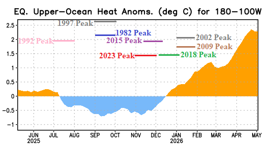
Fig. 1: The upper ocean heat index east of the Dateline compared to past El Nino (episodes) peaks.
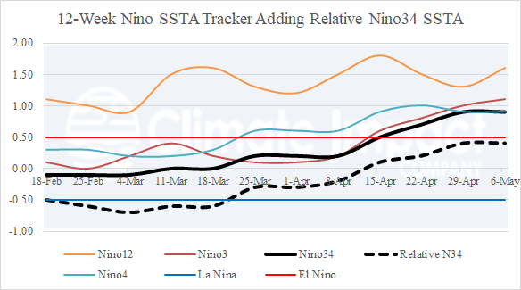
Fig. 2: The Nino SSTA observations for the past 12 weeks plus the new relative Nino34 index.
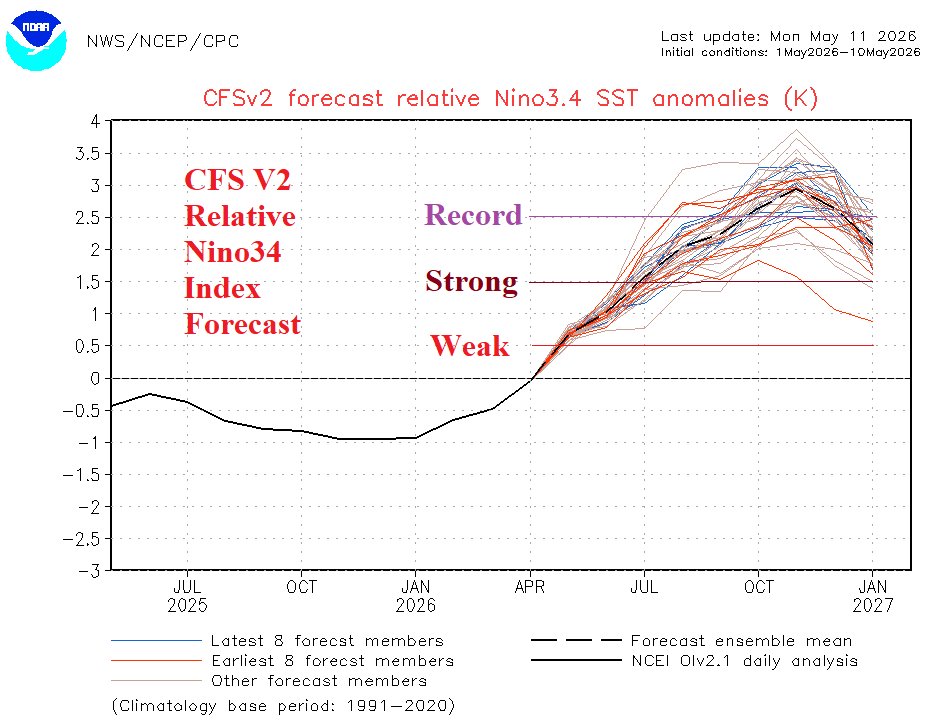
Fig. 3: The NCEP CFS V2 relative Nino34 SSTA forecast..
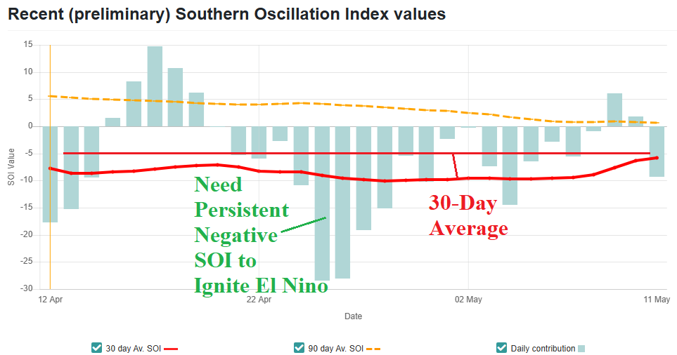
Fig. 4: Daily southern oscillation index observations has been choppy negative.