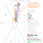
Impactful Convection Phase of the Madden Julian Oscillation is Ahead for Mid-January
01/06/2026, 4:27 am EST
NW HYDRO & The Northeast Pacific “Warm Blob”; U.S. Drought Monitor, Latest EDDI, and CAS Soil Moisture Outlook
01/09/2026, 5:29 am EST
Climate Impact Company U.S. Month 1-3 Ahead Windspeed Probability/Analog Forecast
Issued: Thursday January 8, 2026
Highlight: Interior West/Northern U.S. and Florida are the windy regions for Q1/2026.
Executive summary: ECMWF and CIC-CA U.S. wind forecasts for JAN-26 to MAR-26 are compared to establish forecast confidence. Indicated are above average forecast confidence for greater than normal windspeeds Interior West for the current month with disagreement in the Southeast, especially Florida where ECMWF indicates lighter than normal windspeed and CIC-CA is above normal. During February, both ECMWF and CIC-CA indicate above normal windspeeds for the Interior West and Northern U.S. while CIC-CA indicates a breezy Florida regime. Finaly, March stays windy Interior West with lighter than normal windspeeds across the Central U.S.
Methodology: Going forward, wind climate forecasts extend to 1-3 months for the U.S., Europe, and Australia and are issued following the Climate Impact Company month 1-4 constructed analog outlooks for each region. Accompanying the CIC-CA Outlook are the wind speed probability forecasts from ECMWF. The wind climate forecast from CIC-CA is presented using zonal (west-east) and meridional (north-south) directional wind speed anomalies.
December 2025 verification: Last month, wind speed anomalies were strongest from the westerly direction across the Northern U.S. The Central/Midwest U.S. wind speed anomalies were near normal. Potentially, there may have been a lack of full data set due to government/NOAA shutdown the previous month.
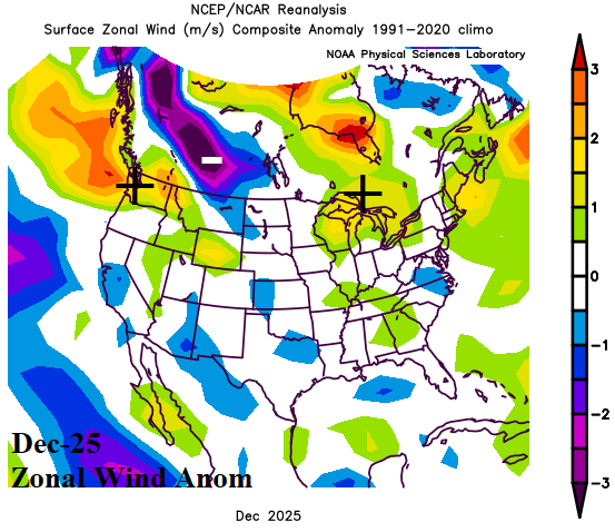
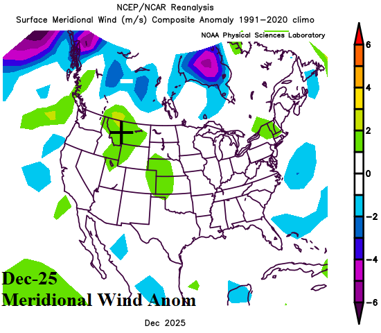
Fig. 1-2: The observed DEC-25 U.S. zonal and meridional wind speed anomalies.
January 2026: ECMWF projects above normal risk of greater than normal wind speeds across the Interior West and northern Great Plains plus Quebec during JAN-26 (Fig. 3). The CIC-CA forecast indicates above normal wind speeds, primarily zonal (westerly) during JAN-26 (Fig. 4). Wind speeds are below normal in the Midwest/Great Lakes region. Above normal windspeed is forecast for the Southeast U.S. during JAN-26 equally dispersed between both north and south directions (Fig. 5).
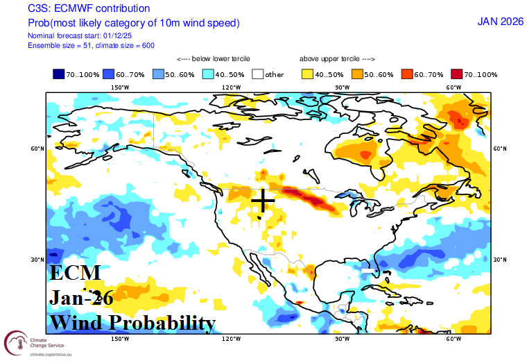
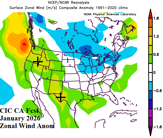
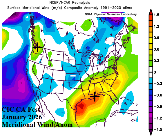
Fig. 3-5: ECMWF 10-meter wind speed probability forecast for JAN-26 compared to the Climate Impact Company constructed analog.
February 2026: ECMWF maintains an above normal wind speed probability during FEB-26 for the Northern U.S. stretching from WA/ID to the Upper Midwest and most of Canada (Fig. 6). The CIC-CA forecast is agreeable with above normal wind speeds, primarily from the west, across this region (Fig. 7). Above normal wind speed is forecast in the East equally dispersed between the north and south direction during FEB-26 (Fig. 8).
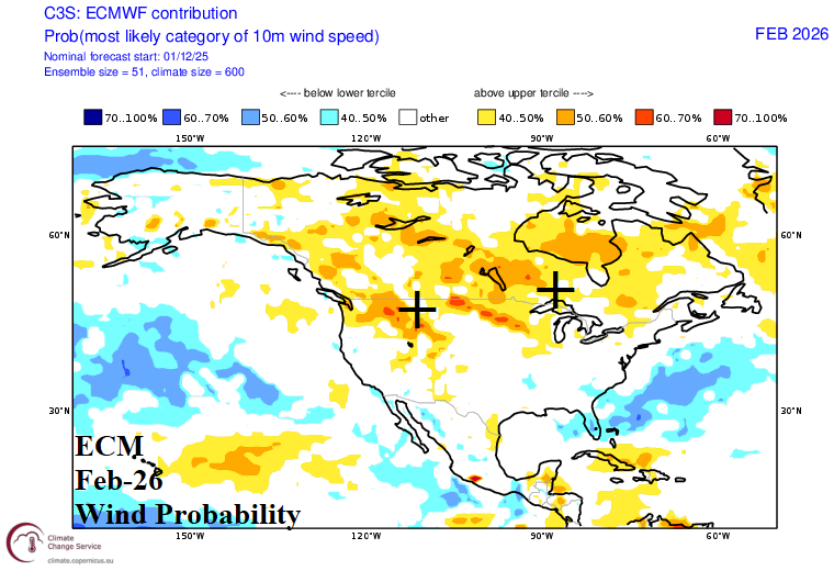
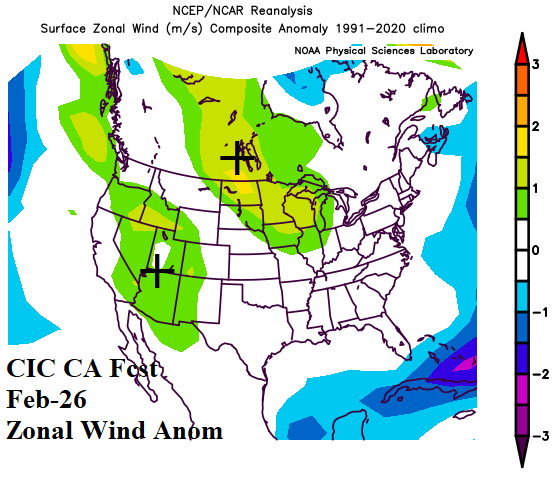
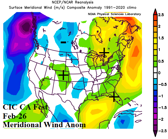
Fig. 6-8: ECMWF 10-meter wind speed probability forecast for FEB-26 compared to the Climate Impact Company constructed analog.
March 2026: ECMWF indicates above normal wind speed probability for the Interior West and Great Lakes region during MAR-26 (Fig. 9). Additionally, the Texas Coast has a marginal above normal risk of stronger than normal wind speed. The CIC-CA forecast indicates below normal wind speed across the Great Plains and Florida with above normal wind speeds in California to the Great Basin (Fig. 10-11).
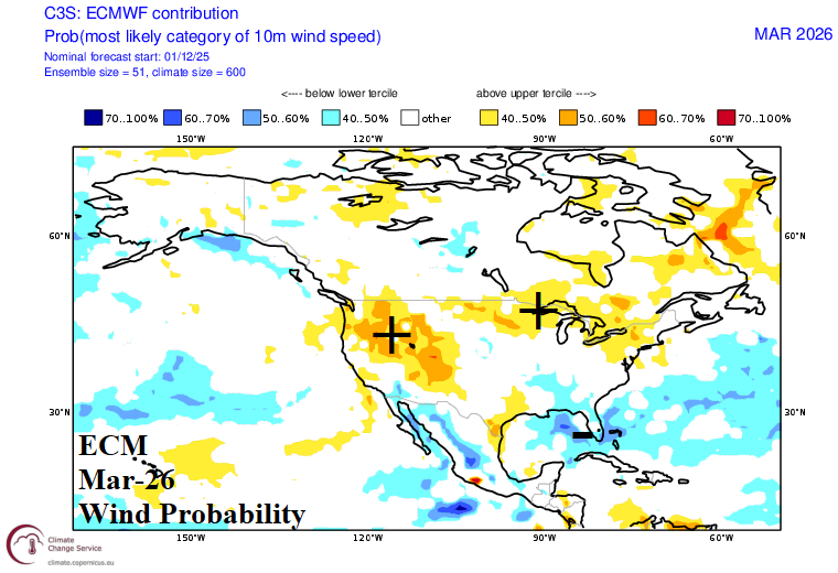
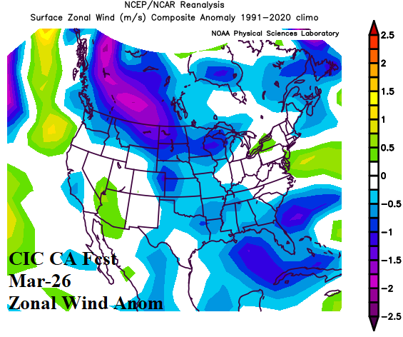
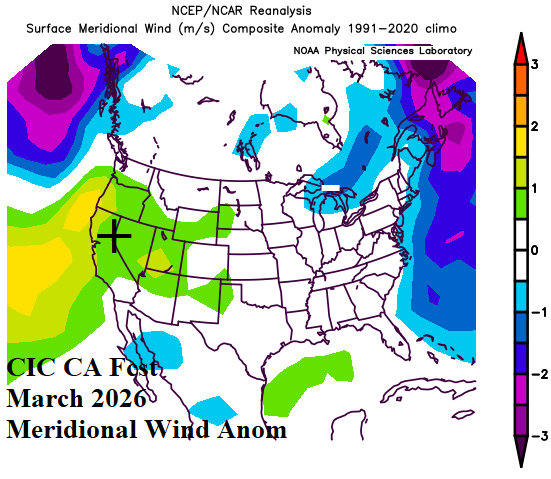
Fig. 9-11: ECMWF 10-meter wind speed probability forecast for MAR-26 compared to the Climate Impact Company constructed analog.
January 2025 observations: Last January, the Upper Midwest/Great Lakes region observed notably higher than normal windspeeds (Fig. 12). Meridional wind speeds were (generally) lighter than normal (Fig. 13).
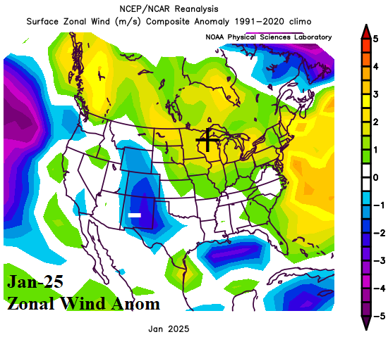
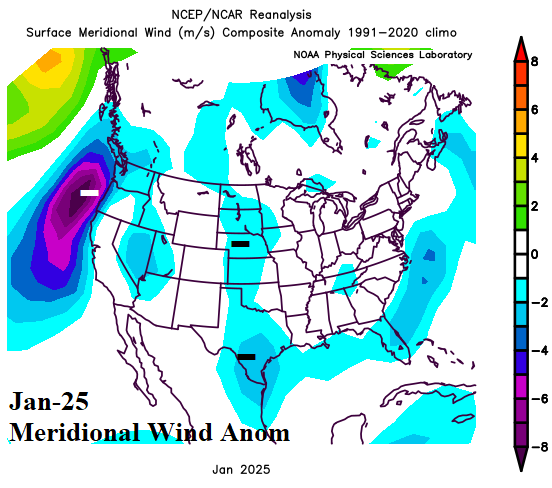
Fig. 12-13: Observed zonal and meridional wind speed anomalies for last January.