
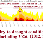
La Nina Climate Key to Intense U.S. Dry Regimes
07/26/2026, 8:45 am EDT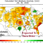
Mid-south U.S. Drought Development Ahead
07/31/2026, 1:42 pm EDT
Climate Impact Company ENSO Climate Diagnostics
Issued: Wednesday July 29, 2026
Highlight: Ahead of schedule…evolution of the strongest El Nino on record!
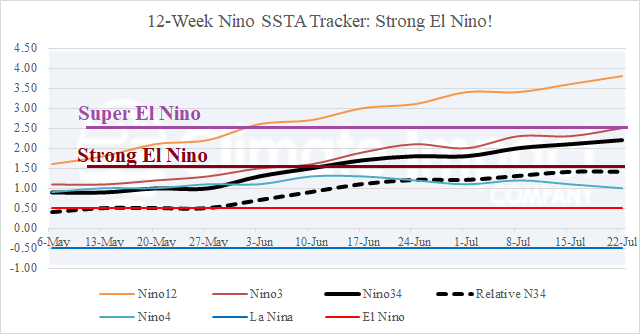
Fig. 1: The 12-week Nino SSTA regions observations. Strong El Nino is attained!
Discussion: The relative Nino34 SSTA index held steady at +1.4C during the past week, just beneath the +1.5C strong El Nino threshold (Fig. 1). However, the conventional Nino34 SSTA index warms to +2.3C. Climate Impact Company is now classifying El Nino 2026 in the “strong” category. Upper ocean heat east of the Dateline is the warmest on record with resurgent warming observed in recent weeks (Fig. 2). Subsurface temperature anomaly analysis reveals +10C at 100-meter depth, easily the warmest on record (Fig. 3). The El Nino climate is stronger than the oceanic (El Nino) status as the southern oscillation index (SOI) has consistently registered near or below the -2.5 SOI super El Nino threshold (Fig. 4). The latest NOAA/CPC relative Nino34 SSTA index continues to indicate super El Nino, the strongest on record, for quarter 4 of 2026 (Fig. 5).
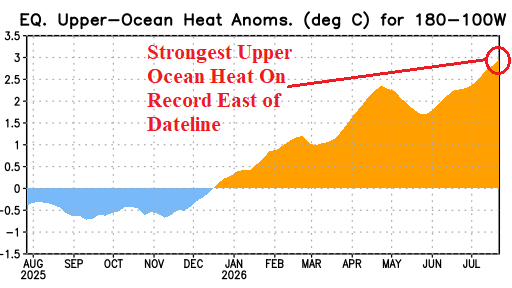
Fig. 2: The warmer than normal upper ocean heat temperature anomalies east of the Dateline reach record strength.
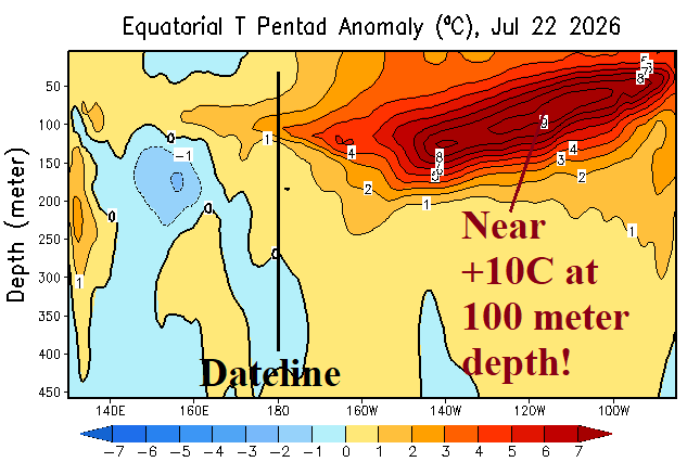
Fig. 3: Subsurface eastern equatorial Pacific Ocean temperature anomalies reach a record +10C at 100 meters.
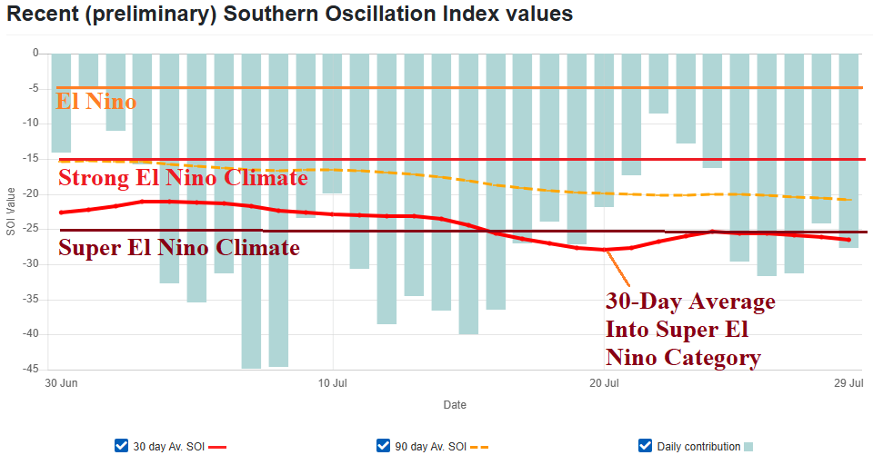
Fig. 4: The daily southern oscillation index indicates the El Nino climate is already bordering on super El Nino.
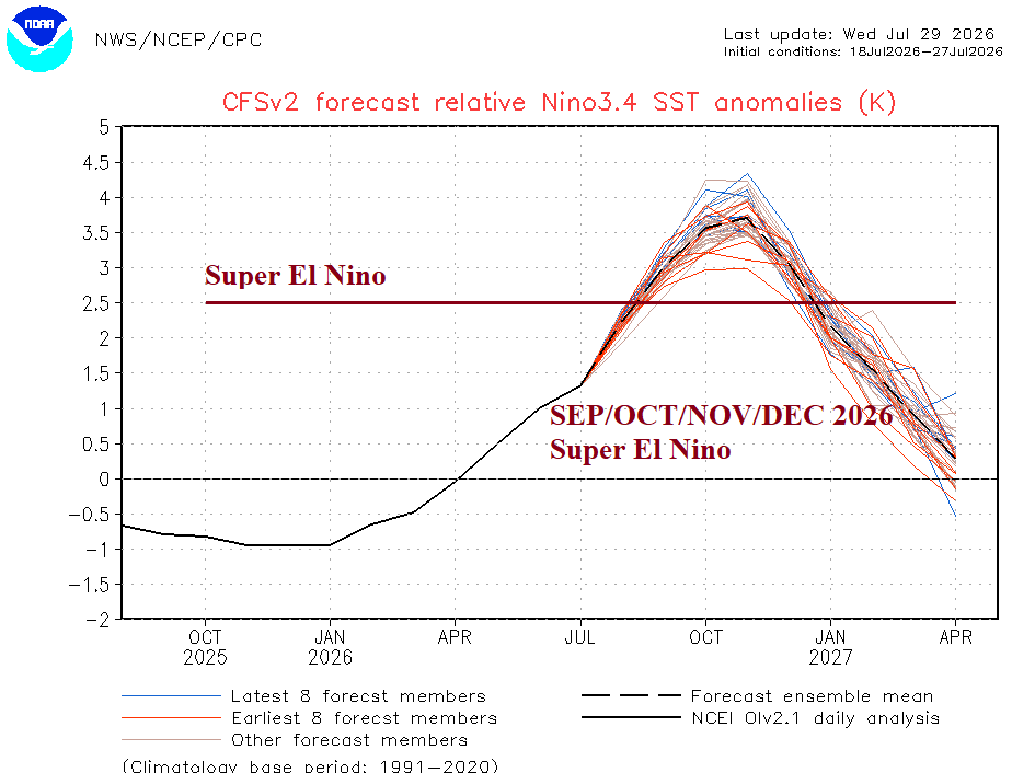
Fig. 5: NOAA/CPC relative Nino34 SSTA forecasts smash the record for strongest El Nino on record later this year.