Subsurface Equatorial Pacific Continues to Warm Impressively
04/02/2026, 8:27 am EDT
Is Wet Forecast for the Central U.S. too wet? Western Plains Trend Drier.
04/07/2026, 8:16 am EDT
Climate Impact Company ENSO Climate Diagnostics
Issued: Monday April 6, 2026
Highlight: Neutral ENSO continues.
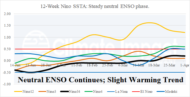
Fig. 1: The weekly SSTA observed in the Nino regions for the past 12 weeks.
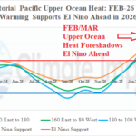
Discussion: The Nino SSTA regions observed no change last week as neutral ENSO persists (Fig. 1). The waters have warmed near the Dateline reaching the El Nino threshold while Nino34 remains neutral. Upper ocean heat in the equatorial East Pacific accelerated earlier this year and lowered slightly in early March (Fig. 2). However, upper ocean heat east of the Dateline in the equatorial region has re-intensified and is strongly supportive of an El Nino event ahead. Sustained negative southern oscillation (SOI) index is required to shift the atmospheric climate pattern to El Nino phase. However, the recent -SOI may return to positive phase for much of the next 2 weeks (Fig. 3) implying the lingering La Nina climate is weakening very slowly. In conclusion, potential energy for El Nino is robust. However, the atmospheric conditions required to realize the potential is not (yet) in place.
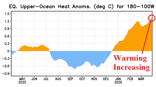
Fig. 2: Tracking the 12-month upper ocean heat anomalies east of the Dateline in the equatorial Pacific Ocean.
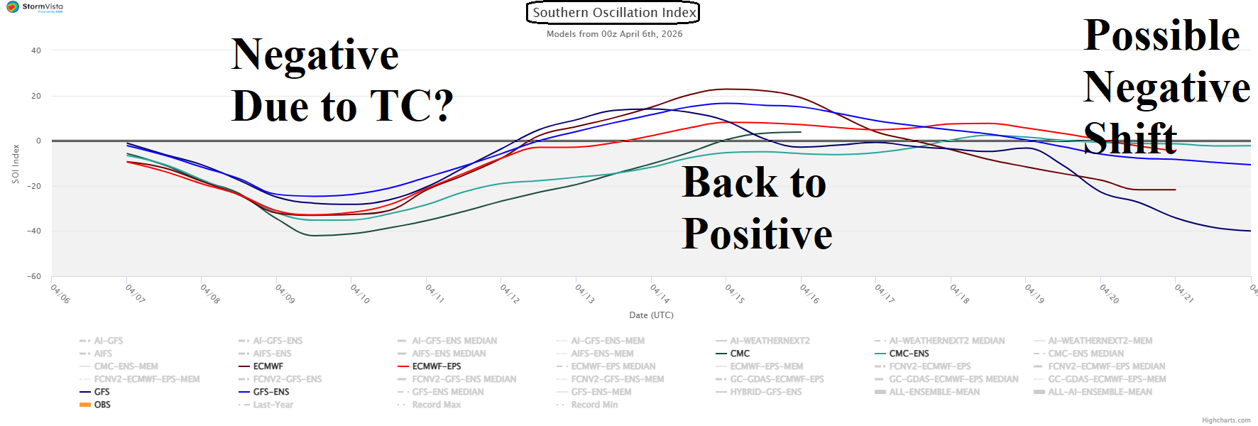
Fig. 3: Persistent negative southern oscillation index is required to generate an El Nino climate. The short-term -SOI may be due to tropical cyclone activity north of Australia. +SOI is forecast to redevelop next week.