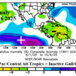
Caribbean/Gulf Subsidence/Dry Air Suppressed North Atlantic Seasonal Tropical Cyclone Activity
10/09/2025, 5:26 am EDT
Early Season Hefty Snow Cover, Causes Cold Air Mass, Release Into China Next Week
10/15/2025, 7:04 am EDT
Climate Impact Company Week 2-4 Outlook
North America
Issued: Monday, October 13, 2025
Highlight: The warm pattern reverses cooler in the East late OCT/early NOV.
Charts of the day: Developing Interior East U.S. trough late OCT/early NOV.
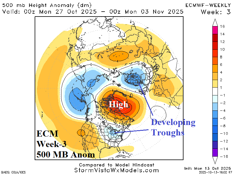

Discussion: ECM projects the Greenland Block to continue and finally produce cool troughs into the Ohio Valley/Mid-Atlantic States and Northwest Eurasia late this month into early November. Expect a cooler U.S. pattern especially in the East, as November approaches.
Week-2 Ahead Forecast valid October 19-26, 2025: Warm Central/East persistence.


Discussion: Vigorous upper trough maintains the cool pattern in the West easing late period. The upper trough also spawns rain and snow for the Interior Northwest to Southern Canada. To compensate, persistent warmth remains Central and East.
Week-3 Ahead Forecast valid October 26-November 2, 2025: Turning cooler East.

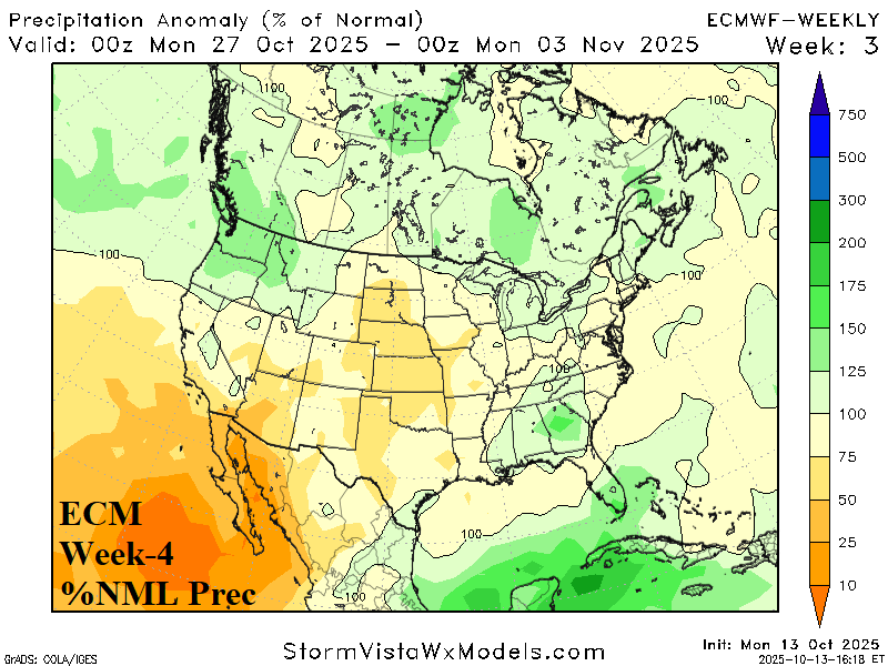
Discussion: The pattern changes during late October as an upper trough cools the East and Central warmth abates while the chilly weather in California reverses warmer. The Central U.S. stays dry while tropical cyclone risk generates in the Northwest Caribbean Sea.
Week-4 Ahead Forecast valid November 2-9, 2025: Cooling continues East.
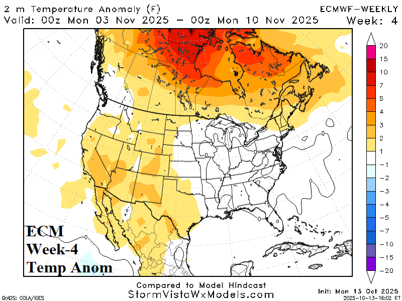

Discussion: Upper trough in the East could deliver a cooler attendant regime compared to the ECM forecast. Warmth and dryness settle on the Southwest.