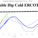
Out Of Control U.S. Cold Including A Double Dip Across ERCOT
01/22/2026, 12:36 pm EST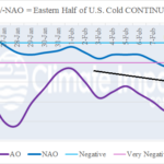
Historic -AO, Strengthening -NAO, Cold Pattern Expands in February for U.S.
01/26/2026, 4:29 am EST
Climate Impact Company Week 2-4 Outlook
North America
Issued: Friday, January 23, 2026
Highlight: East to stay cold.
Charts of the day: Looking for an East U.S. warm-up in the extended range? Think again!
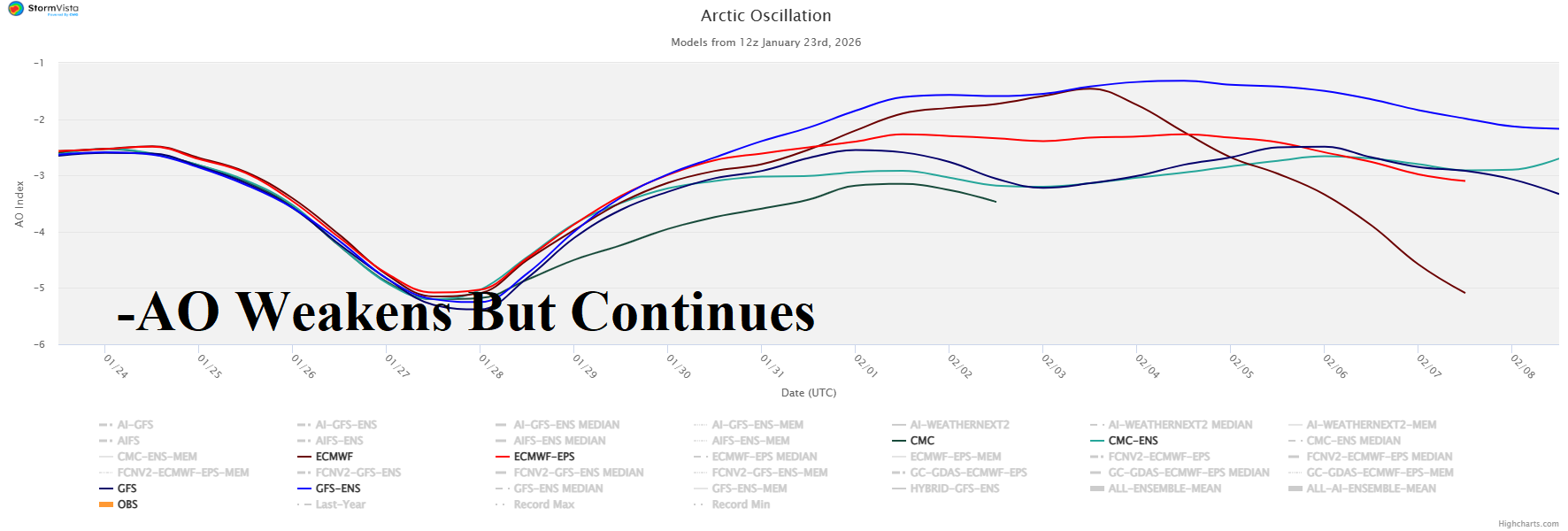
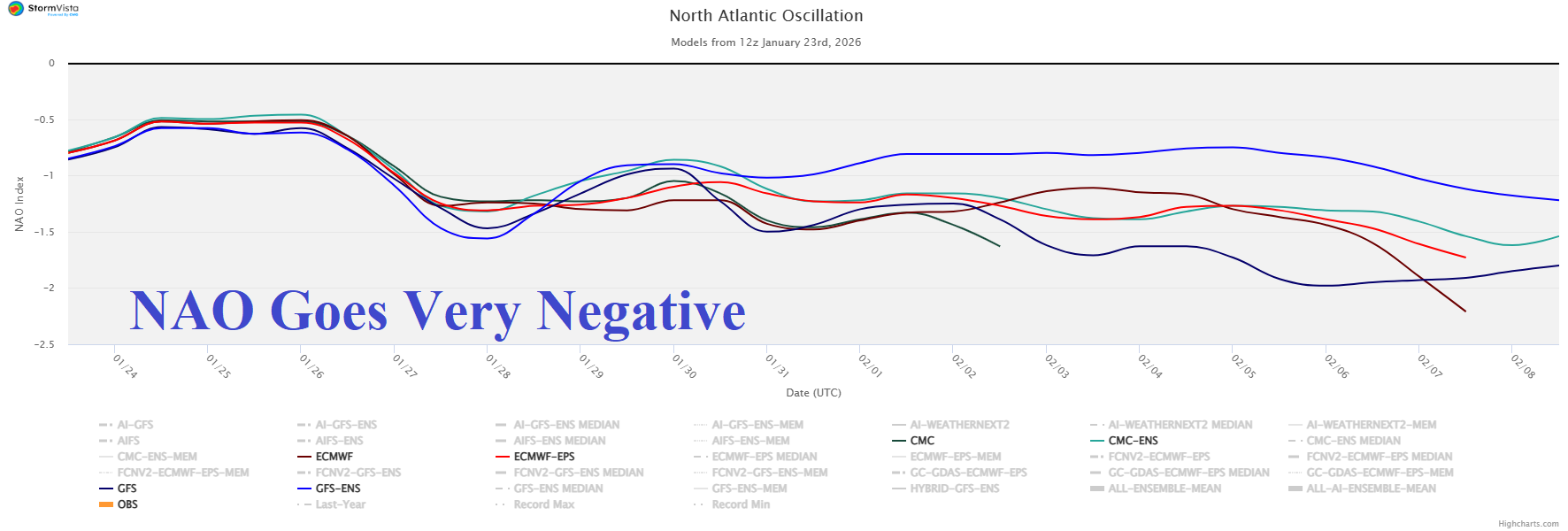
Discussion: The ongoing intense negative arctic oscillation responsible for the East U.S. arctic outbreak weakens but does not end through 15 days. Meanwhile, the negative North Atlantic oscillation is forecast to strengthen. The -AO and strengthening -NAO regime supports East U.S. cold continues well into February.
Week-2 Ahead Forecast valid February 1-8, 2026: Cold East continues.
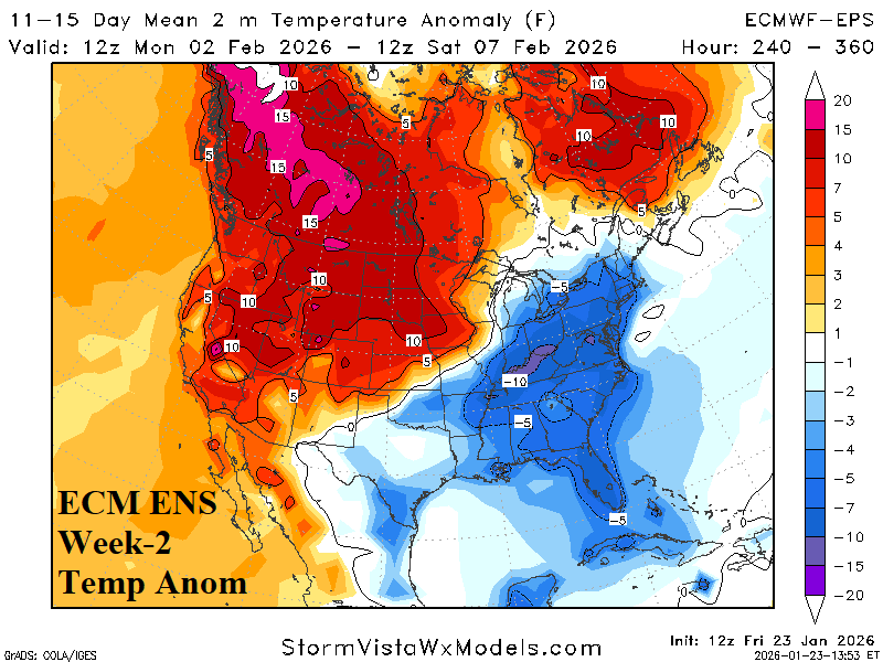
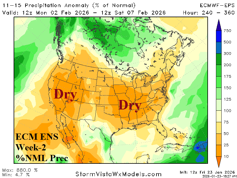
Discussion: MJO shift through the Atlantic longitudes helps to inspire a Greenland Block (-NAO) and keeps the East U.S. colder than normal. +PNA pattern sustains the mild regime across the West. A lack of storms is indicated by ECM ENS.
Week-3 Ahead Forecast valid February 8-15, 2026: Colder Northeast again.
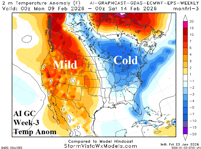
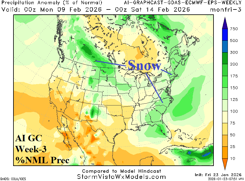
Discussion: A new surge of cross polar arctic air develops. Ontario to the Northeast U.S. is cold (and snowy). Mild and dry weather stays in the West.
Week-4 Ahead Forecast valid February 15-22, 2026: Back to normally cold.
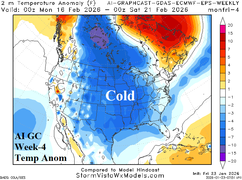
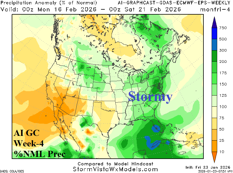
Discussion: Expect another cold pattern to develop featuring cross-polar arctic air. The East Coast is stormy and features substantial snow away from the coast.