Extended-range U.S. Forecasts Rebuilds The Cold
01/23/2026, 3:12 pm EST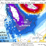
The “Caveat” Forecast…A Case for Regenerating Cold
01/28/2026, 5:04 am EST![]()
Climate Impact Company Daily Feature
Issued: Monday, January 26, 2026
Highlight: Historic -AO, strengthening -NAO, cold pattern does not break, instead expect expansion in February.
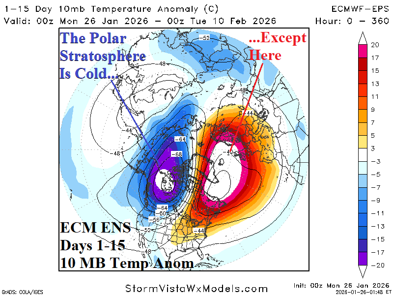
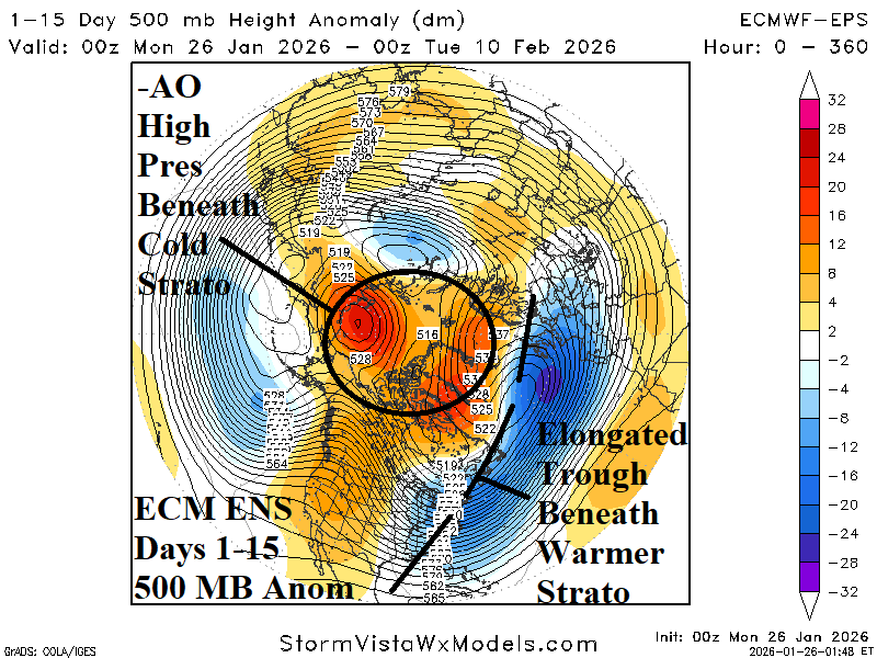
Fig. 1-2: The ECM ENS 15-day 10 MB temperature anomaly forecast and attendant 500 MB anomalies.
Discussion: The mid-winter stratosphere averages colder than normal with westerly wind. However, the details are different, and supportive of the vigorous cold in the East U.S. now which is likely to continue. The 15-day 10 MB temperature anomaly forecast indicates a split, a frigid stratosphere on the Alaska side of the North Pole while the Greenland side is warm (Fig. 1). The reflection of this scenario is vividly displayed in the 15-day 500 MB anomaly outlook, an elongated cold trough from West Europe to the Eastern U.S. while widespread high pressure is in the polar region (Fig. 2). In this scenario, the arctic oscillation (AO) is impressively negative dipping to -5.3, middle of this week. The ongoing -AO is joined by an intensifying negative North Atlantic oscillation (-NAO) during the next 2 weeks (Fig. 3). The -AO/-NAO combination is a recipe for East U.S. cold to continue well into February (Fig. 4). The projected AO for February is about -2.6 which is historically negative. Similarity was observed in 1985, 1998, 2010, and 2011 when the following February maintained the cold U.S. trough (Fig. 5). The modern day -AO analog (2010 and 2021) was slightly less effectively cold (Fig. 6). The analogs suggest the East U.S. cold expands westward with time during February.
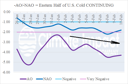
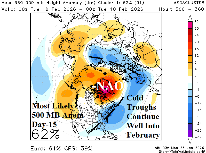
Fig. 3-4: The 16-day arctic oscillation and North Atlantic oscillation forecast plus the mega-cluster ensemble most likely day-15 500 MB anomaly projection.
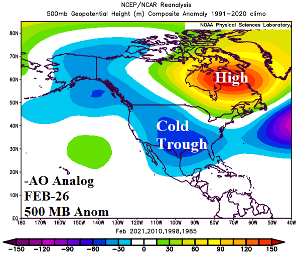
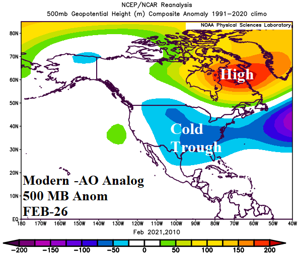
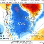
Fig. 5-6: When the January arctic oscillation is stronger than -2.0, the following February 500 MB anomalies favor a cold U.S. trough.