
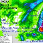
Major Storms Ahead! Snowstorms Included!
11/20/2026, 9:04 am EST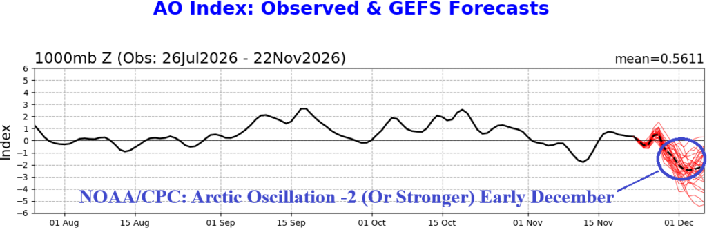


Climate Impact Company U.S. Sunday Report
Issued: Sunday, November 22, 2026
Highlight: Storms Northwest and Northeast; Emerging -AO.
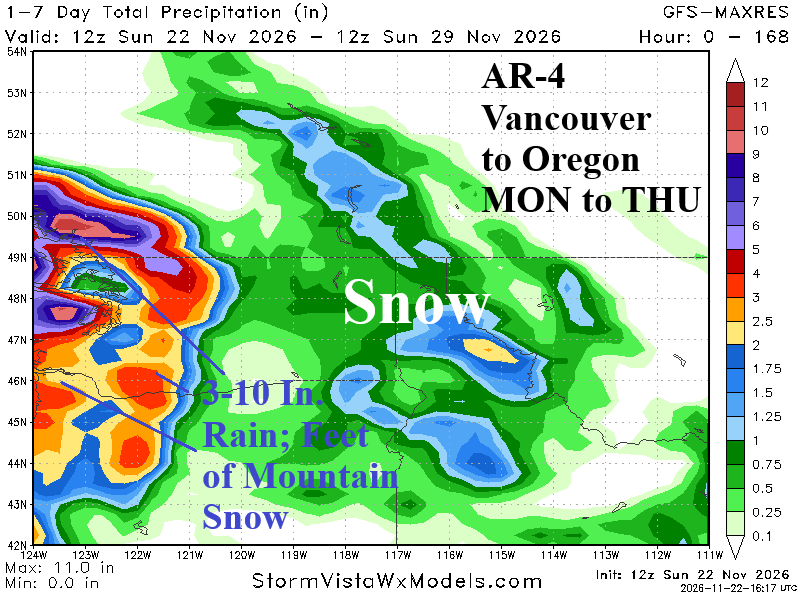
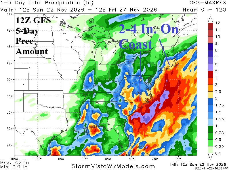
Fig. 1-2: The midday 12Z GFS precipitation amount forecast for this week in the Northwest and East U.S.
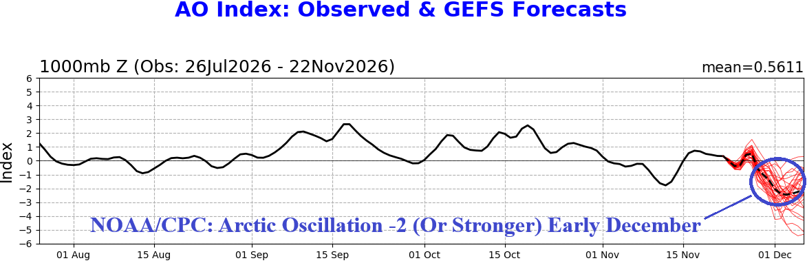
Fig. 3: The 2026 (since August) daily arctic oscillation index and 15-day forecast which indicates emerging strong negative phase.
Discussion: This week, atmospheric rivers remain thematic of the Coastal Southwest Canada/Northwest U.S. weather pattern (Fig. 1). Indicated are AR Level- 4 intensity events for Vancouver to Coastal Oregon centered on Monday through Thursday. The storm track is sufficiently intense to produce 4-8 inches of snow with a few higher spots Interior Northwest Mountain Areas to the Northern Divide. On the East Coast, two storms are likely this week (Fig. 2). A heavy rainstorm pounces of the Northern Mid-Atlantic States/New England tonight with a second event on the Thanksgiving Day.
Of interest, is an emerging strong negative phase arctic oscillation (-AO) in the 8-14-day period (Fig. 3). -AO represents high latitude high pressure blocking forcing the polar vortex southward to cause mid-latitude chill. This time, North America ais left out while the Europe forecast has been shifting colder (Fig. 4).
In the U.S., despite some chilly weather driven by this week’s storm tracks, the consensus maintains (nationally) lower than normal heating demand within the 2-3-week range of operational models (Fig. 5). The extended-range forecast consensus (also) favors below normal national heating demand. In the midday 12Z GFS 8-14-day U.S. temperature anomaly forecast, the model was much warmer and now features widespread MUCH ABOVE normal (Fig. 6).
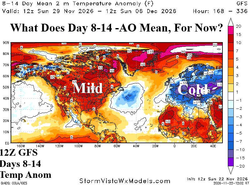
Fig. 4: The 12Z GFS 8-14-day temperature anomalies forecast for North America and Europe.
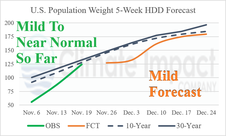
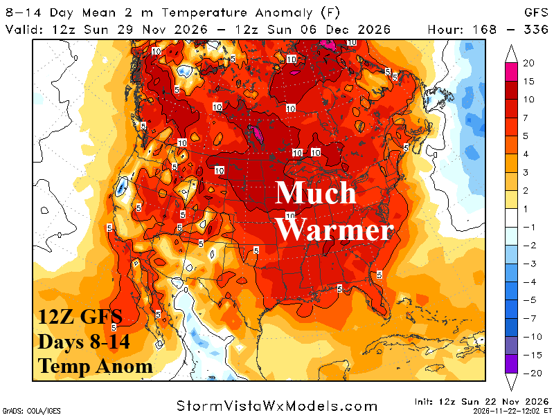
Fig. 5-6: Considering ALL U.S. population weight HDD forecasts, a consensus through the next 5 weeks compared to normal, is depicted. U.S. gas population weight HDD for each week of the cold season so far is also indicated. Also, the very warm 8-14-0day 12Z GFS North America outlook.