
Strong to Super El Nino 2026 Continues to Strengthen
09/16/2026, 8:41 am EDT

Climate Impact Company U.S. Sunday Report
Issued: Sunday, September 20, 2026
Highlight: Areas of heavy rain this week including late week Northeast Corridor coastal storm.
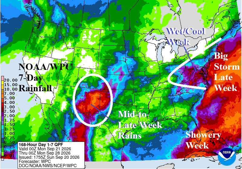
Fig. 1: NOAA/WPC 7-day quantitative precipitation forecast.
Discussion: This week, several areas of heavy rain are forecast. Mid-to-late week monsoon moisture brings a heavy rain/flood threat to New Mexico and the southwest Great Plains where rainfall is desperately needed (Fig. 1). A showery regime is forecast across Florida. A cold front brings rain and sustains cool weather across the Northeast/Mid-Atlantic region this week. The front stalls offshore and a low-pressure system develop and stalls and then create a large swath of high wind, coastal flooding, and moderate-to-heavy rain for late week/next weekend most impressively projected by ECM (Fig. 2). The cool-down in the East lasts through the 6-10-day period while the hot weather anchors over Texas (Fig. 3). In the 11-15-day period, moderate warm air emerges in the East while Texas and the southern Great Plains cool to near normal (Fig. 4). In the subtropical North Atlantic basin, Tropical Storm Faye could reach minimal hurricane strength this week southwest of the Azores. Faye is likely to stay in the eastern portion of the subtropical North Atlantic basin all week. Elsewhere, GFS and ECM indicate increased potential for tropical cyclone development for late SEP/early OCT but no specific threats.
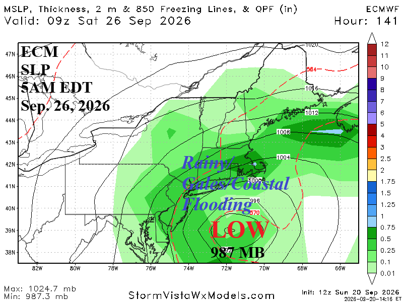
Fig. 2: ECMWF projects a significant ocean storm late this week off the northern Mid-Atlantic coast.
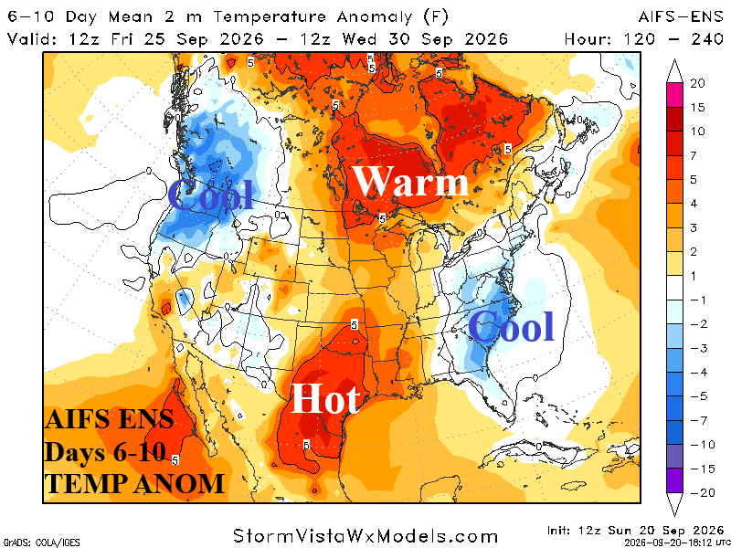
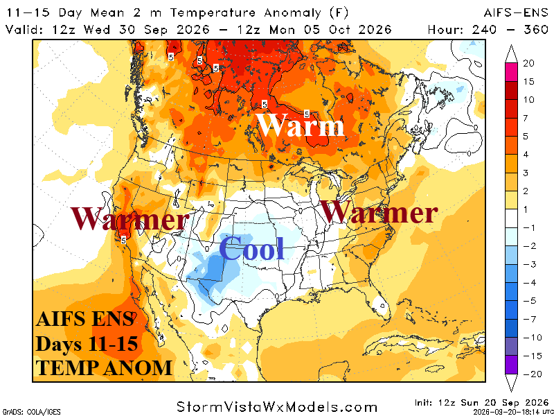
Fig. 3-4: AIFS ENS U.S. medium-range temperature anomaly forecast.