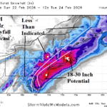
Northeast U.S. Blizzard; High Wind/Coastal Flooding/Widespread Power Outages
02/22/2026, 1:26 pm EST
MJO Supports Warm Expansion of the U.S. Pattern
02/25/2026, 8:15 am EST
Climate Impact Company U.S. Medium Range Report
Issued: Monday February 23, 2026
Highlight: Overall trend is warmer U.S.
Charts of the day: Ongoing memory of the winter 2025-26 upper air pattern.

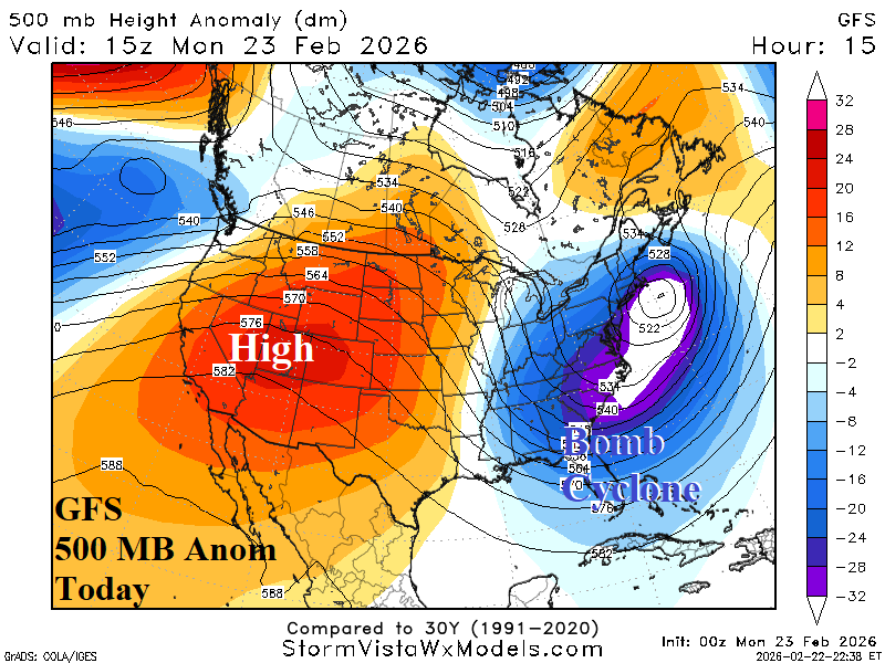
Discussion: Memory of the winter 2025-26 upper air pattern has featured a semi-permanent polar vortex over the Northeast U.S. Once again, another potent storm within that semi-permanent trough pattern today batters the Northeast U.S. as a blizzard.
Medium-range 6-10 Day Forecast Valid February 28-March 4, 2026 (ECM ENS and 24-hour change)
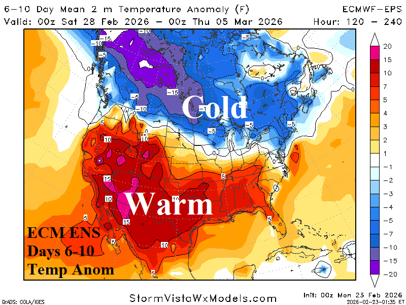
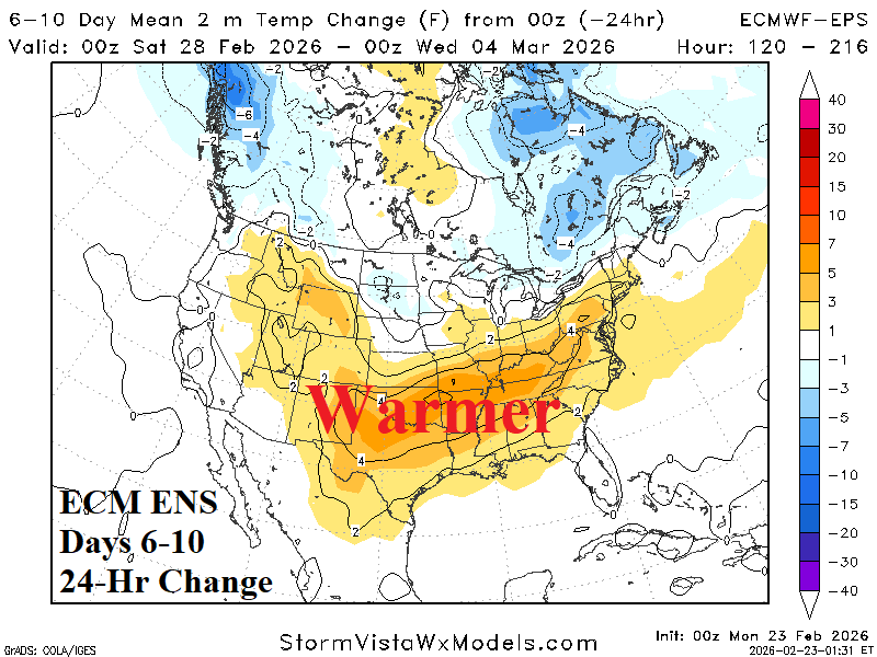
Discussion: Canada remains very cold while the anomalous warmth to the south covers most of the U.S. with warmer changes for the Gulf States and Southeast U.S.
Medium-range 11-15 Day Forecast Valid March 5-9, 2026 (ECM ENS and 24-hour change)
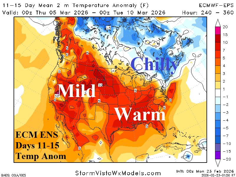
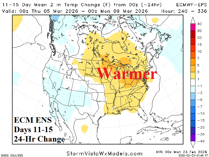
Discussion: The cold arc from Canada into the Northeast U.S. is weaker while much of the eastern half of the U.S. shifts milder from 24 hours ago.
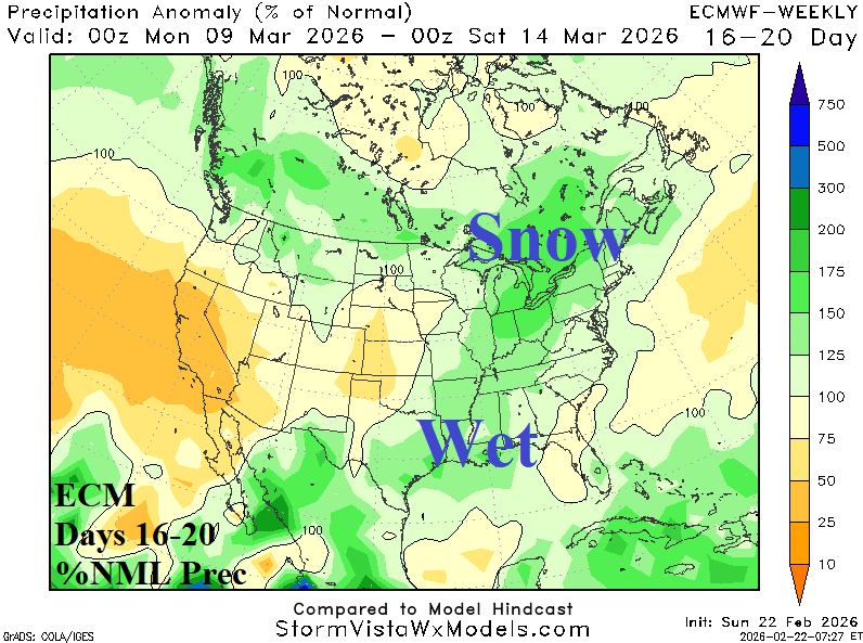
U.S. Medium-range Precipitation Forecast
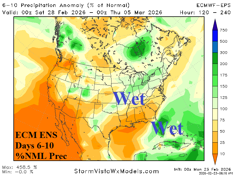
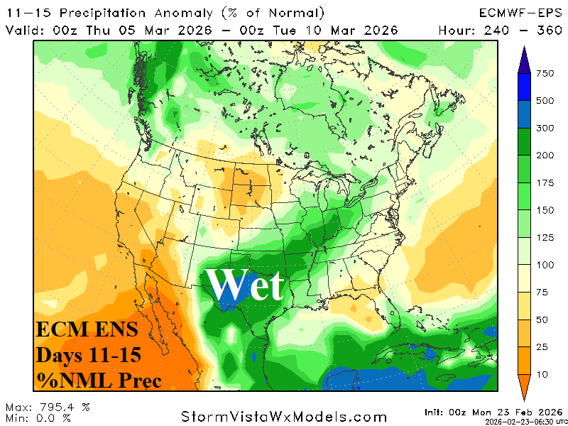
Discussion: Most interesting is the gathering significant rainfall across Texas and vicinity in the 11-15-day period. The West shifts drier during the medium range.
Days 16-20 Extended range Temperature Forecast valid March 10-14, 2026
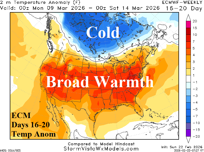
Discussion: All models are very warm across the U.S. in the extended range while Canadian chill persists.