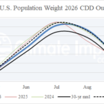
The 2026 U.S. Population Weight CDD Forecast
03/19/2026, 8:18 am EDT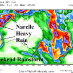
Narelle To Re-Intensify; Strikes West Coast Late Week
03/23/2026, 9:59 am EDT
Climate Impact Company U.S. Medium Range Report
Issued: Friday March 20, 2026
Highlight: MJO involvement…Hot West to break down, Central to turn wetter, briefly colder Northeast days 6-10 (then warmer).
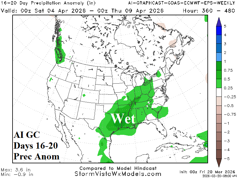
Charts of the day: Wet first half of April East-central/Mid-South U.S.
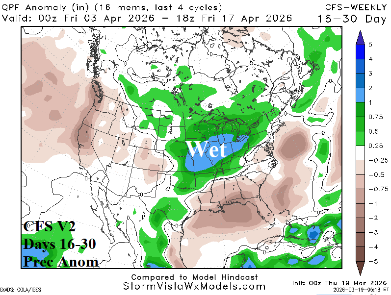
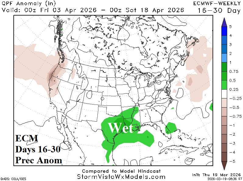
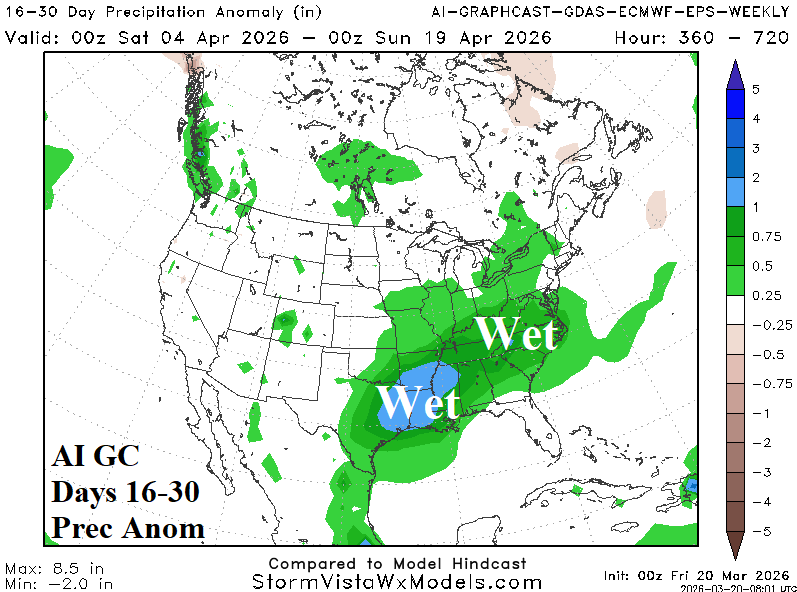
Discussion: The wetter pattern change begins to emerge in the 11-15-day period, has developed in the 16-20-day period, and expands in the 16-30-day period. The core of the heavier rain is unclear based on the latest CFS, ECM, and GC forecasts.
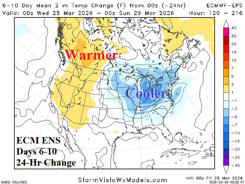
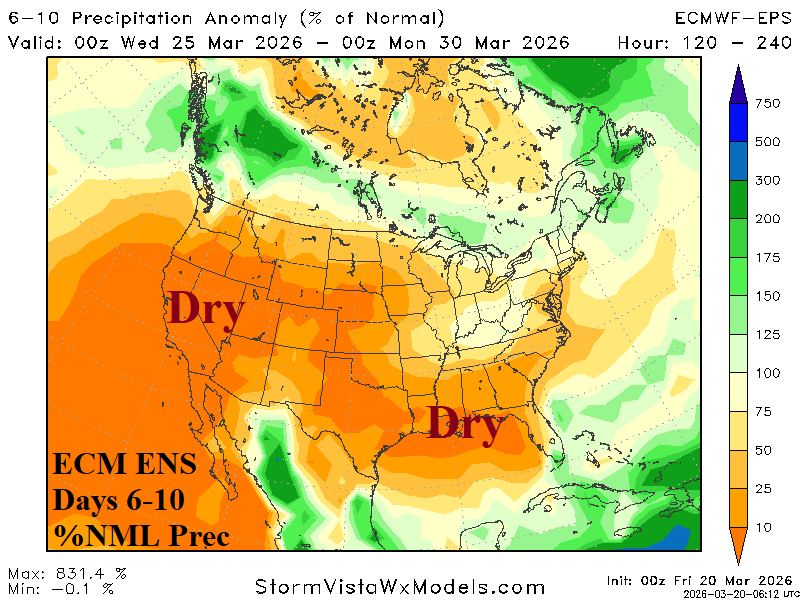
Medium-range 6-10 Day Forecast Valid March 25-30, 2026 (ECM ENS and 24-hour change)
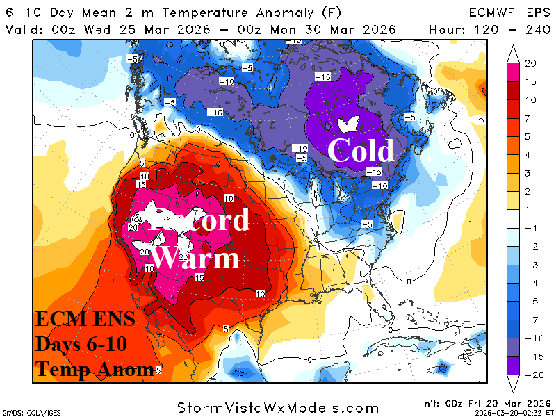
Discussion: The Canadian chill dips into the Northeast U.S. in the 6-10-day period. Meanwhile, the record warmth in the West continues.
Medium-range 11-15 Day Forecast Valid March 31-April 4, 2026 (ECM ENS and 24-hour change)
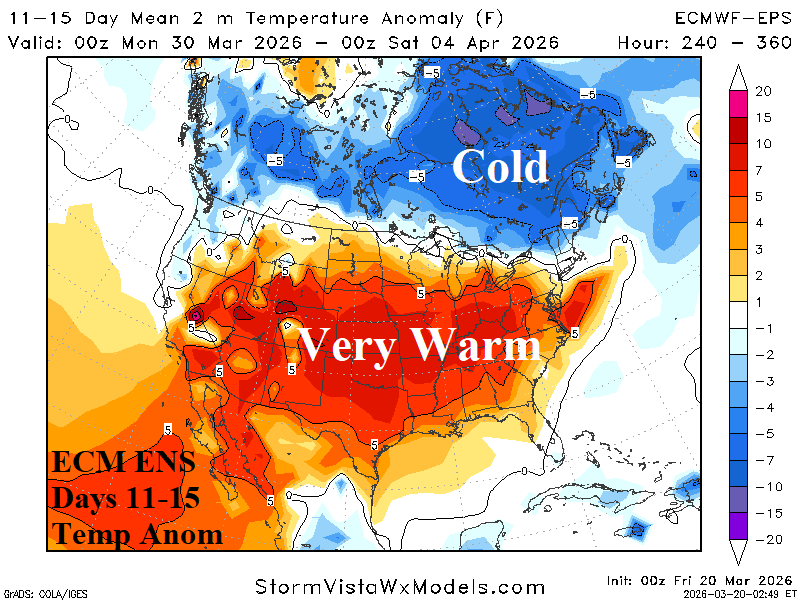
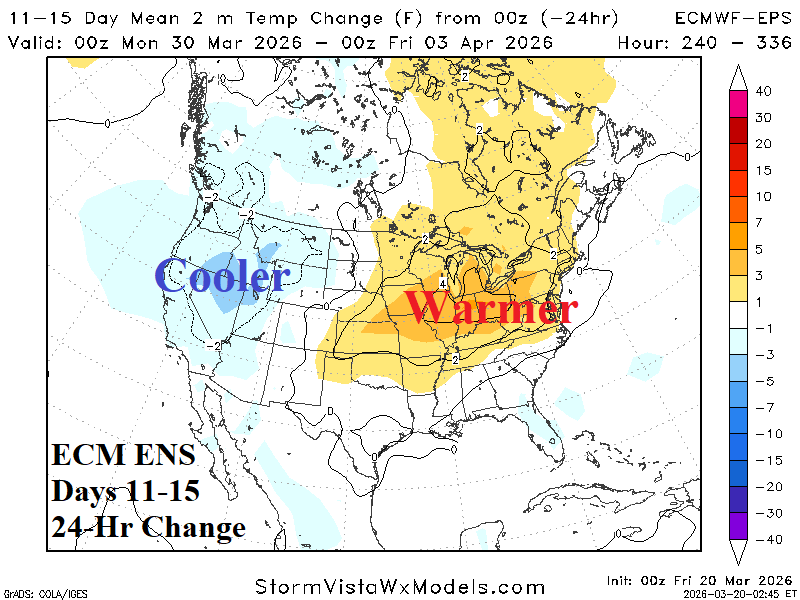
Discussion: MJO involvement allows the warm pattern to extend eastward with somewhat warmer 24-hour changes indicated across the interior northeast quadrant of the U.S.
U.S. Medium-range Precipitation Forecast
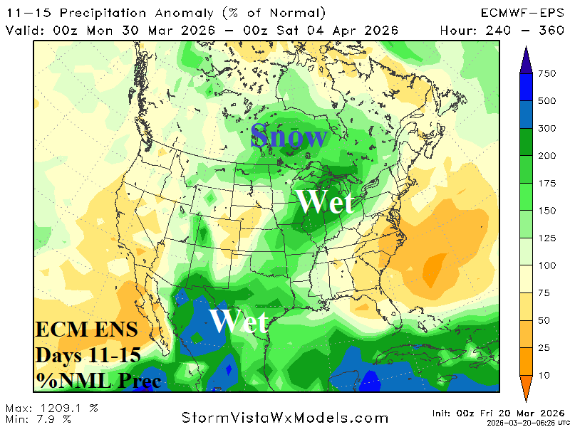
Discussion: Influence of Madden Julian oscillation (MJO) initiates a wet weather pattern change in the 11-15-day period including Texas, East-central U.S., and snowy in Canada. Note the stormy pattern into the Southwest Canadian Coast shuts off in the 11-15-day period.
Days 16-20 Extended range Temperature Forecast valid April 5-9, 2026
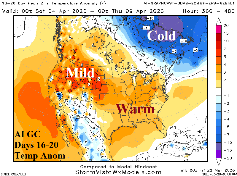
Discussion: Wet weather extends from Texas to the Ohio Valley tempering East U.S. warmth, causing the Southwest to cool, and forcing warmest anomalies into the Northwest States.