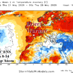
Cool/Wet Pattern in Europe Reverses Very Warm Western Europe Days 8-14
05/14/2026, 8:25 am EDT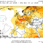
Developing/Broadening Warm/Dry Pattern Ahead for Europe
05/19/2026, 12:54 pm EDT
Climate Impact Company Early U.S. Notes
Highlight: Reviewing the CDD projections; Central U.S. severe weather and heavy rain pattern.
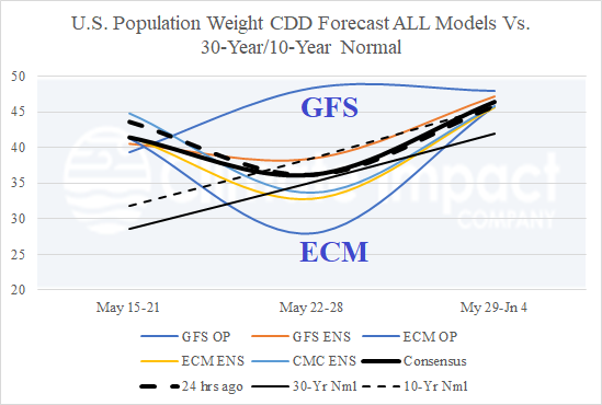
Fig. 1: The AIFS ENS 11-15-day 500 MB anomaly forecast indicates two significant upper troughs in the subtropics.
Discussion: Today’s U.S. population weight CDD forecast utilizing all models indicates the previously forecast very warm spike for the next week followed by a cooler reversal to near normal and some rewarming for the week ending June 4 (Fig. 1). Note the extreme and opposite forecast result for the last week of May with a hot GFS and cool ECM projection. 2-meter temperature forecast skill scores continue to rank traditional operational models (GFS and ECM) last while ensembles (and AI models) are routinely ranked much higher. The estimated U.S. population weight CDD forecast indicates dynamic models ECM and CFS stay warmer than normal in the week 3-5 outlook while AI models are warmer than ECM/CFS in early June and much cooler for mid-June (Fig. 2). Climate signals support the heat spike in the East, peaking early next week as North Atlantic oscillation (NAO) shifts from positive to negative phase. A reverse fluctuation, -NAO to +NAO supports a warmer shift during late May with weak -NAO possibly returning around the 10th of June to cause cooler CDD results as shown by AI CDD projections. The potential fluctuating NAO (and other climate signals) in June is a low confidence projection. ECM and CFS maintain warm persistence in June.
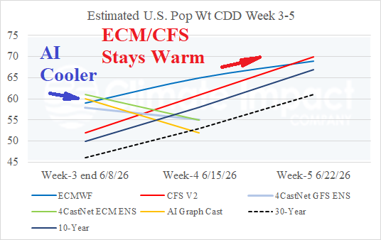
Fig. 2: The estimated U.S. population weight CDD for week 3-5 ahead comparing CFS and ECM to 3 AI models.
Set-up for severe weather in the Central U.S. is present today well into next week. Severe thunderstorms stretch from Oklahoma to Iowa today (Fig. 3), Nebraska to Iowa tomorrow (Fig. 4), and followed by a major outbreak featuring widespread tornado risk on Sunday for Kansas, Nebraska, and Iowa (Fig. 5). A repeat of the Sunday event is indicated Monday (Fig. 6).
NOAA/WPC identifies the migration of heavy rain zones during the next 7 days implicating the Upper Midwest this weekend (Fig. 7), Upper Midwest to Mid-south U.S. early next week (Fig. 8), and Texas middle of next week (Fig. 9)
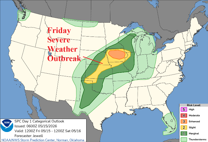
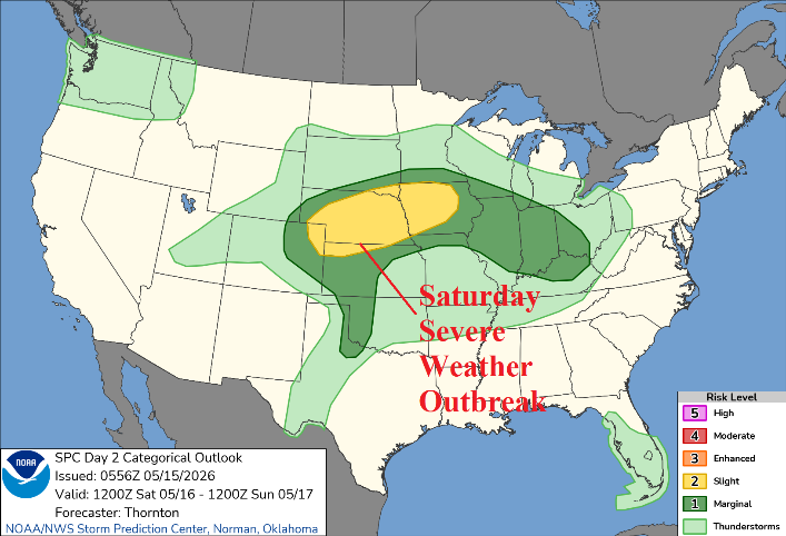
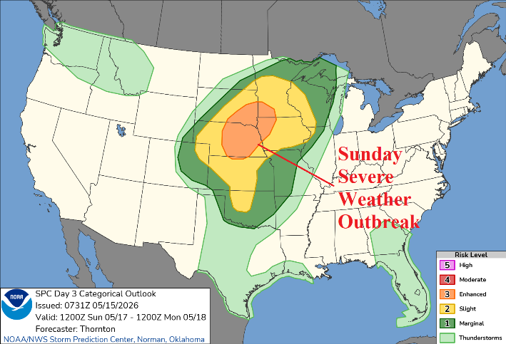
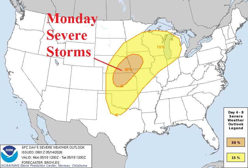
Fig. 3-6: NOAA/SPC severe weather forecasts for today through Monday.
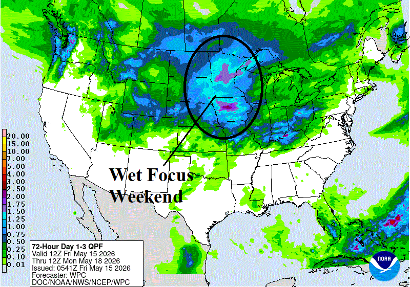
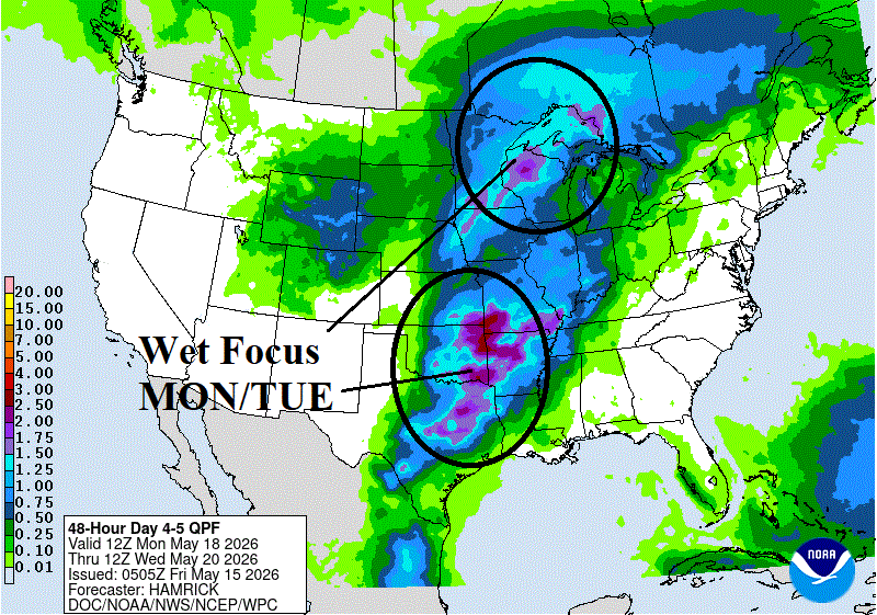
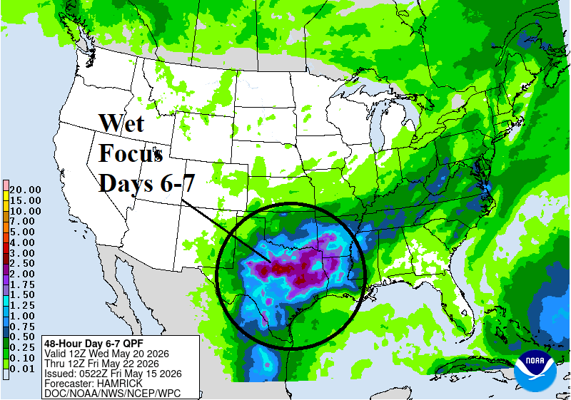
Fig. 7-9: NOAA/WPC 7-day rainfall amount forecast identifies the migration of the heavy rain zones.