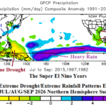
Super El Nino Increasingly Likely. Where are the First (climate) Targets?
05/12/2026, 1:54 pm EDT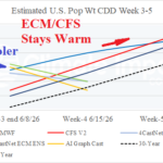
ECM/CFS Warm June (CDD’s); AI Shifts Cooler
05/15/2026, 9:19 am EDT
Climate Impact Company Early AG Market ALERT
Issued: Tuesday May 14, 2026
Highlight: Incoming rains for the Central/South-central U.S.; Early season chill across Argentina/Wet Brazil; Warmer Europe pattern-change week-2 ahead.
New week 2-4 forecasts issued today. EU/RU climate forecasts ahead.
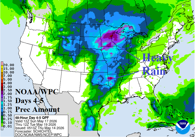
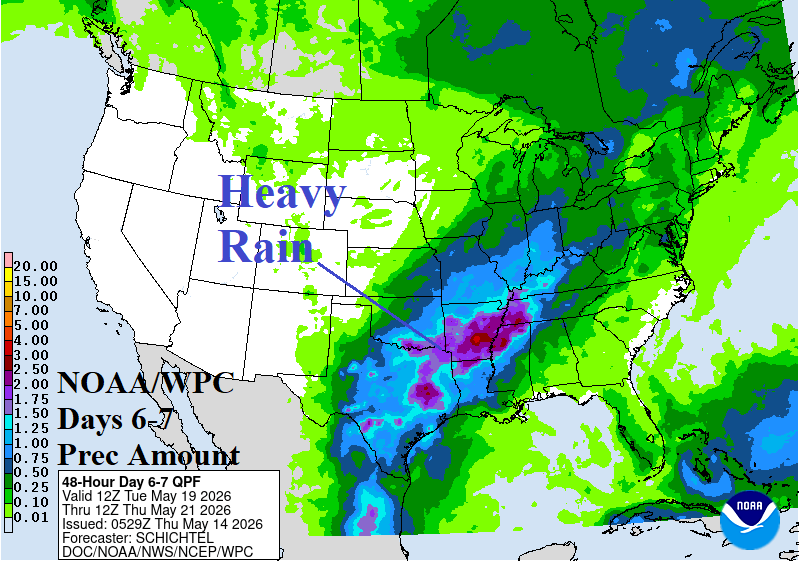
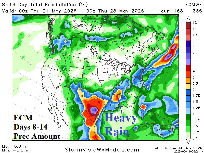
Fig. 1-3: NOAA/WPC 4-5-day and 6-7-day U.S. precipitation forecasts plus the ECM 8-14-day precipitation outlook.
Discussion: Wet weather regenerates in full-force beginning this weekend into early next week across the Upper Midwest to Mid-south U.S. (Fig. 1) shifting to Texas and the Mid-south into middle of next week (Fig. 2) and consolidating in Texas during the 8-14-day period (Fig. 3). Severe storms are prominent beginning late this week in the central Great Plains and persisting in the same region into early next week. On the back side of the weekend storm, snow is likely across the northwest Great Plains. The upper air forecast favors the heavier rainfall amount forecast by ECM for Texas in the 8-14-day period.
In South America, unusual early season chill affects Argentina and reaches Southern Brazil much of the next 2 weeks (Fig. 4). However, an early season freeze for Brazil Coffee is not indicated. The rainfall forecast features buoyant amount in Brazil (Fig. 5).
In Europe, a cool and wet weather pattern will persist into early next week followed by a significant warm-up for Western Europe in the 8-14-day period (Fig. 6-7). Note the usage of CMC ENS, the top skill score for temperature forecasts so far in May!
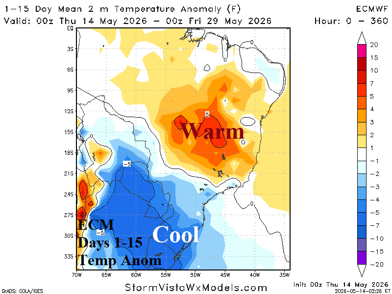
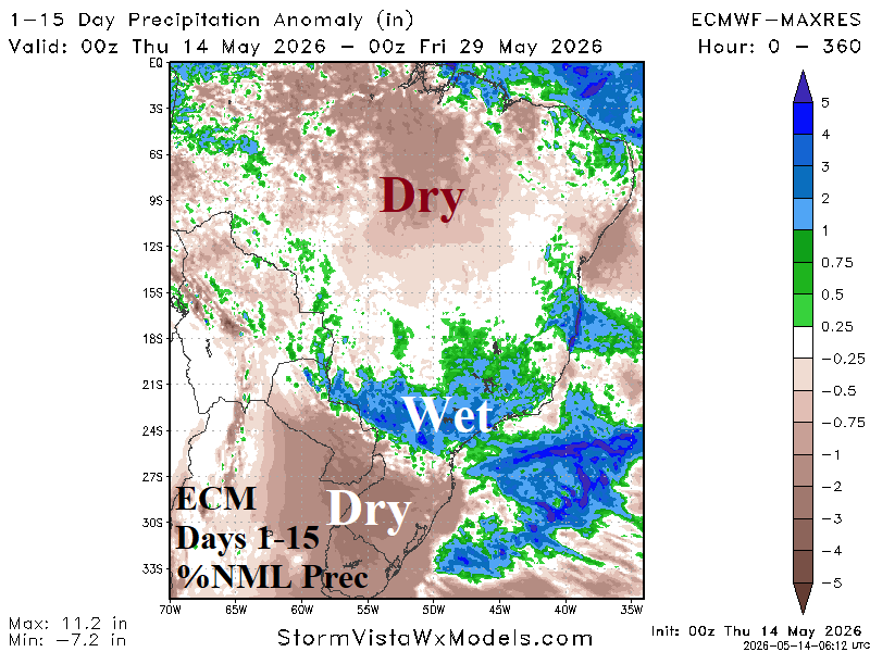
Fig. 4-5: ECM 15-day temperature and precipitation anomaly forecast for South America.
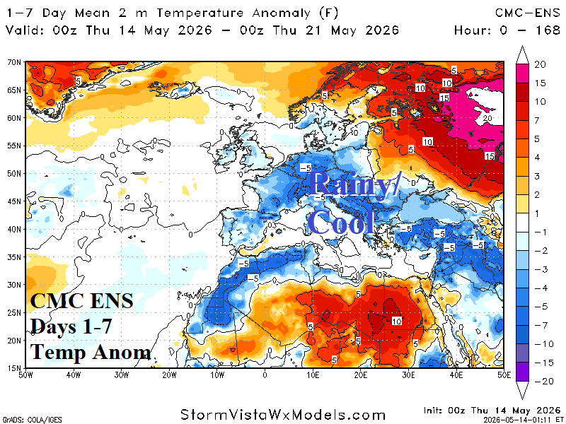
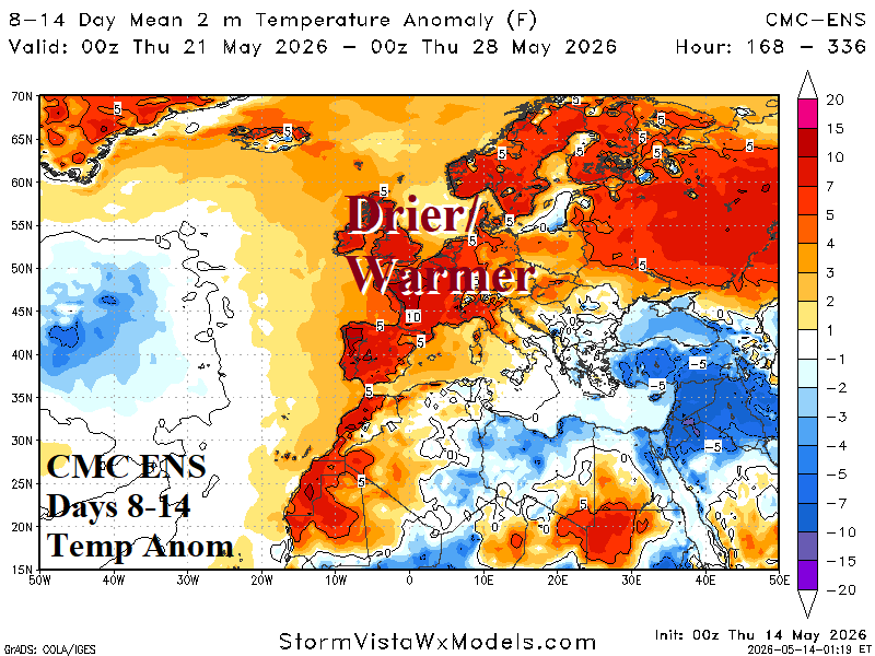
Fig. 6-7: CMC ENS 1-7-day and 8-14-day temperature anomaly forecasts across Europe.