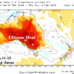
Extreme Heat Continues Southeast Australia; Temporary Break Early Next Week, Hot Again Days 11-15
01/28/2026, 8:09 am EST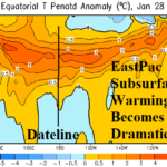
Major East Pacific Subsurface Warming…La Nina to End, El Nino Ahead
02/02/2026, 5:56 am EST
Climate Impact Company Early U.S. Notes
Issued: Friday January 30, 2026
Highlight: GFS continues to back off Northeast U.S. coastal snowfall although maintains high wind. Alberta Clippers ahead!
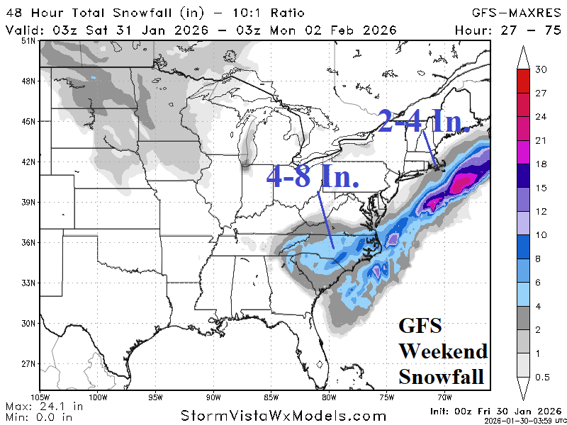
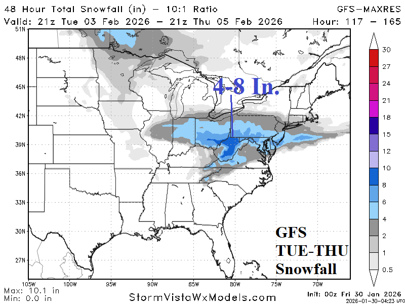
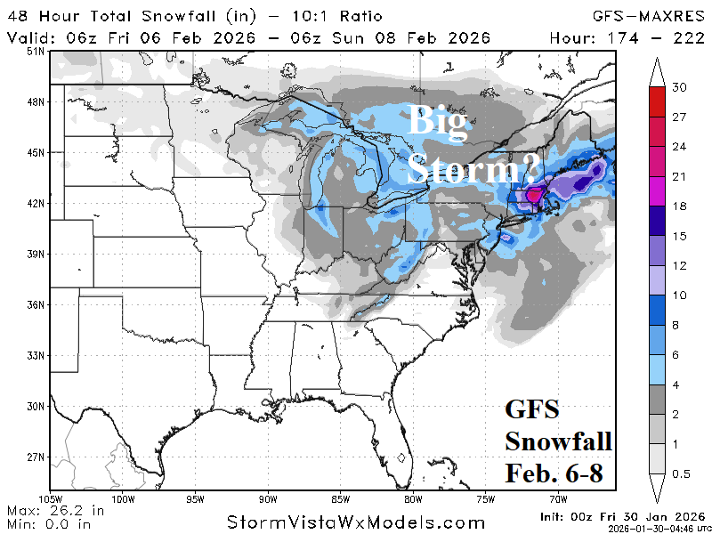
Fig. 1-3: GFS snowfall events over the next 10 days.
Discussion: The GFS was the first model to doubt significant Northeast Corridor coastal snowstorm this weekend. Overnight, GFS continues to push the bulk of the snow offshore especially in the Northeast (Fig. 1). A hefty 4-8 inches of snow remains in the forecast for the Carolinas while much of Virginia will miss the snow. While we’re in a -AO/-NAO climate pattern, inevitable is more snow events likely “Alberta Clipper” style in character. Another moderate snow event is forecast during middle of next week across the Ohio Valley/Northern Mid-Atlantic (Fig. 2) with a potential major New England snowfall event Feb. 6-8 (Fig. 3).
A larger concern for the Northeast Corridor Coast this weekend is high wind propelling high sea conditions as the offshore system produces hurricane force wind with 50-60 MPH gusts reaching the coast and 40+ mph away from the coast (Fig. 4-5).
NOAA/NWS has issued a Hurricane Force Wind Warning off the North Carolina Coast, Storm Warning for the Mid-Atlantic Coast, and Gale Warning for the Northeast Coast (Fig. 6). A Winter Storm Warning covers the Carolinas and warnings, watches, and advisories extend across the South and East U.S. for the ongoing very cold weather.
The latest 15-day temperature forecasts for the PJM and ERCOT System reveal short term cold spikes followed by moderation although staying colder than normal in PJM with potential colder return later in the 15-day forecast while ERCOT moderates to near to above normal (Fig. 7-8).
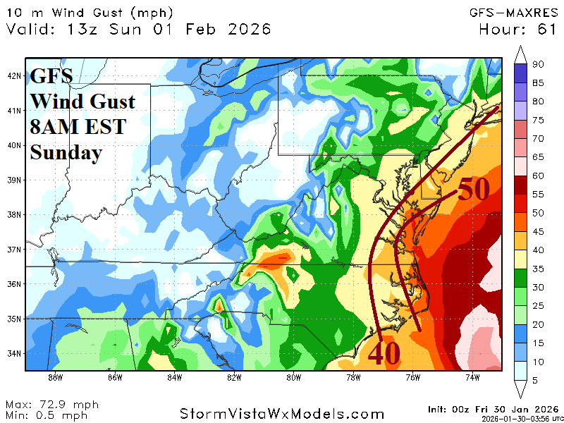
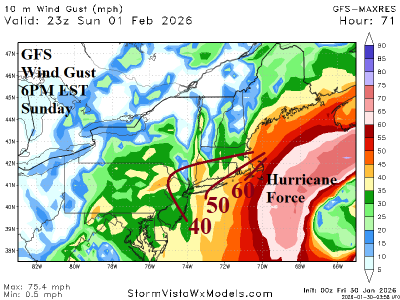
Fig. 4-5: GFS maximum wind gusts for the Mid-Atlantic and New England Coast on Sunday.
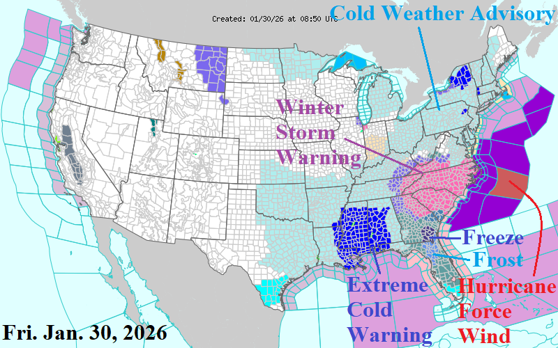
Fig. 6: Latest NOAA/NWS weather watch, warning, and advisory areas.
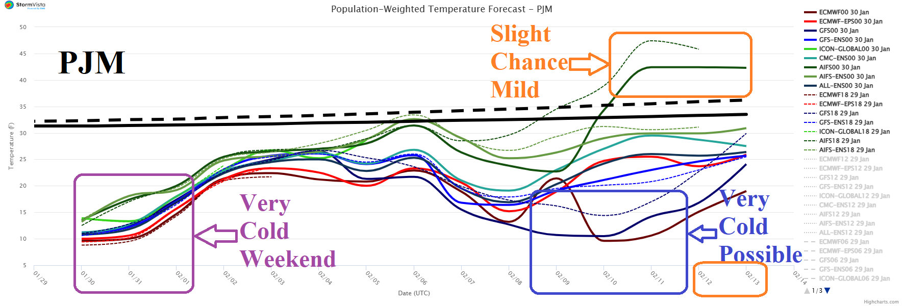
Fig. 7: PJM 15-day population weight daily average temperature forecasts utilizing all models.
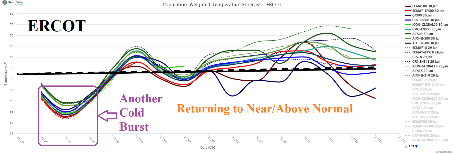
Fig. 8: ERCOT 15-day population weight daily average temperature forecasts utilizing all models.