Active East Pacific MJO + -AO/-NAO = Atlantic Coast Weekend Snowstorm
01/26/2026, 3:59 pm EST
High Wind Event This Weekend Northeast/Mid-Atlantic Coast
01/30/2026, 5:05 am EST
Climate Impact Company Early AG Market ALERT
Issued: Wednesday January 28, 2026
Highlight: Southeast Australia heat eases early-to-middle next week and then returns, MJO moisture into Brazil, ongoing Europe chill.


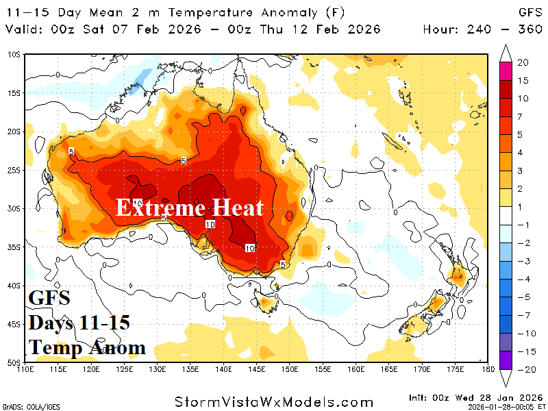
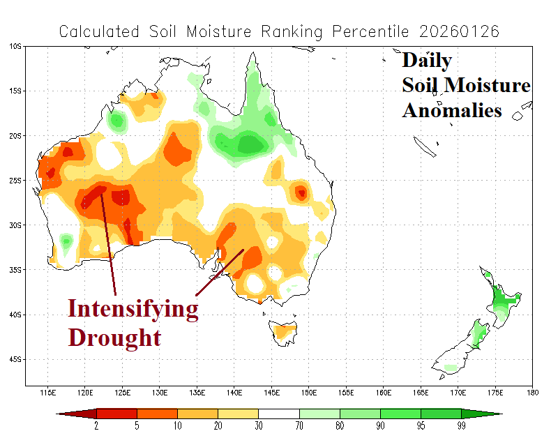
Fig. 1-4: The daily soil moisture anomalies analysis across Australia and 15-day (GFS) temperature anomaly forecast.
Discussion: Record heat in New South Wales and Victoria is ongoing this week (Fig. 1). A temporary break in the heat for the Southeast Coast is projected for early-to-middle next week while extreme heat shifts north to Queensland (Fig. 2). In the 11-15-day forecast, GFS indicates the extreme heat returns to Southeast Australia (Fig. 3). The regenerating extreme heat in the Southeast is inspired by the intensifying drought in this region (Fig. 4).
The South America 15-day percent of normal rainfall forecast identifies a connection between Madden Julian oscillation (MJO) generated convection in the eastern tropical Pacific Ocean arcing southeastward into Brazil (Fig. 5). The MJO is influencing both North America and South America weather patterns into early February. The 24-hour change, utilizing ECM ENS, indicates the Southern Brazil trend is wetter (Fig. 6).
Northern hemisphere negative arctic oscillation (-AO) is historically intense and ongoing well into February continuing to support widespread cold air masses. Included is Europe where the 15-day forecast is very cold except for Southwest Europe (Fig. 7). The 24-hour change indicates the Black Sea region/Southwest Russia trends much colder since yesterday (Fig. 8). This zone is a source region to maintain Europe chill into the middle third of February.


Fig. 5-6: ECM ENS 15-day percent of normal rainfall forecast across South America and the 24-hour change.
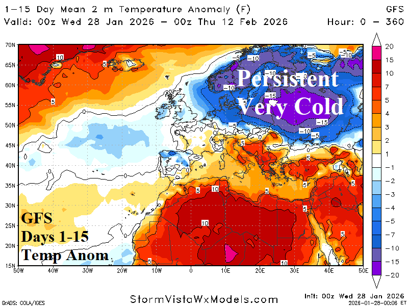

Fig. 7-8: GFS 15-day temperature anomaly forecast across Europe and the 24-hour change.