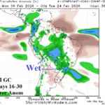
ECM and AI Graph Cast Agreeable to Wet 16-30-day Forecast for Brazil
01/25/2026, 3:38 pm EST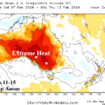
Extreme Heat Continues Southeast Australia; Temporary Break Early Next Week, Hot Again Days 11-15
01/28/2026, 8:09 am EST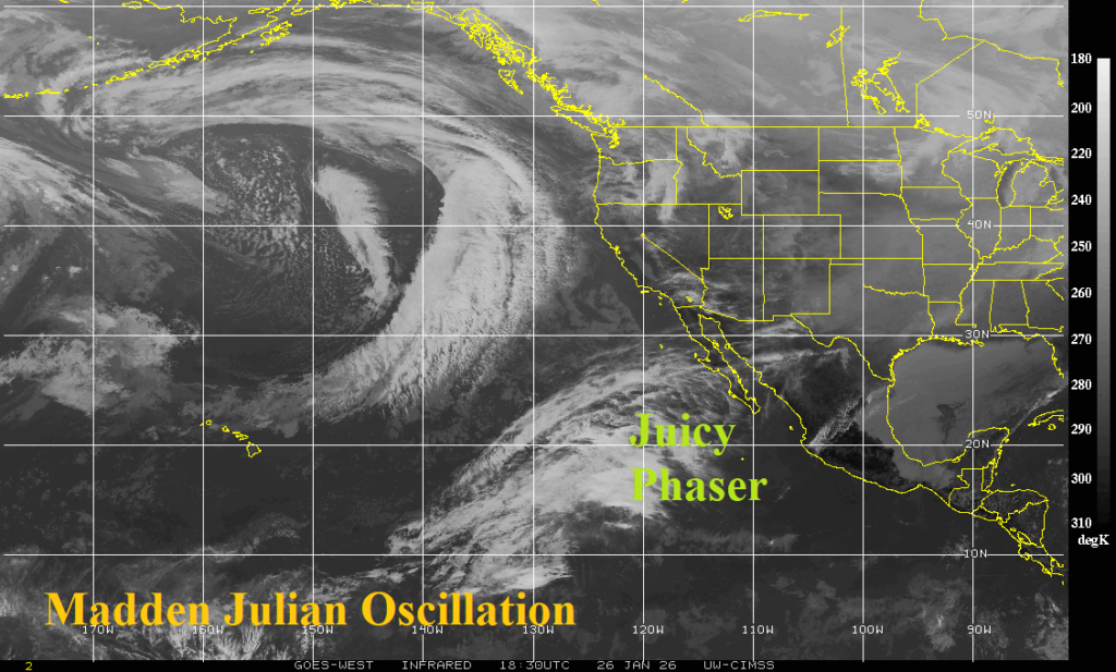

Climate Impact Company U.S. Daily Report
Issued: Monday January 26, 2026
Highlight: Active East Pacific MJO + -AO/-NAO = Atlantic Coast weekend snowstorm.
Discussion: The convection phase of the Madden Julian oscillation (MJO) remains active in the East Pacific as identified by tropical convection near the equator and a streak of energy associated with the subtropical jet stream pointed at Baja California (Fig. 1). Given presence of negative arctic oscillation (-AO) and negative North Atlantic oscillation (-NAO) coupled with the active MJO, the emerging coastal storm indicated by the 12Z GFS and 12Z ECM have excellent support. In fact, EXPECTED is evolution of another significant storm. Currently, NBM snowfall projections are in the 4-8-inch range for the Mid-Atlantic to New England stretch (Fig. 2). An expected trend is for a warmer solution with rain/snow near the coast and heavier snow for inland locations. The potential for another major storm is there for this weekend for the East Coast. Remember the renegade heavy snowstorm 12Z GFS model run last week?
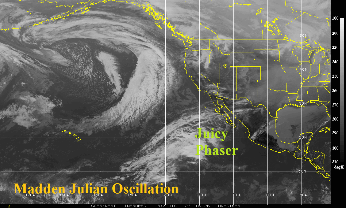
Fig. 1: The East Pacific satellite view which identifies presence of the convection phase of the Madden Julian oscillation.
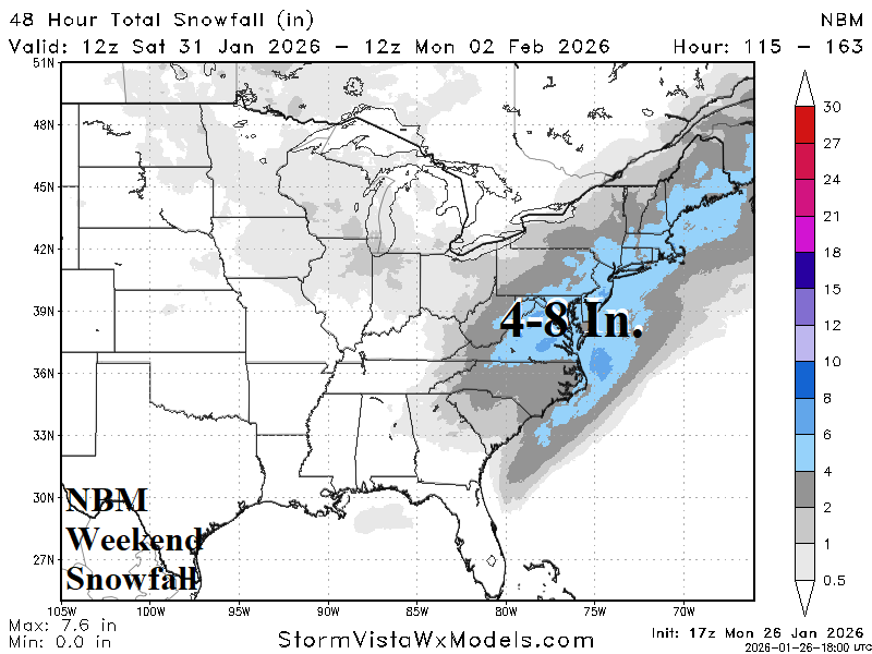
Fig. 2: PRELIMINARY weekend snowfall for this weekend by NBM model.