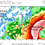
High Wind Event This Weekend Northeast/Mid-Atlantic Coast
01/30/2026, 5:05 am EST
The Asia/Bering Sea/North America Pattern Shifts and Warms The U.S.
02/05/2026, 8:40 am EST
Climate Impact Company Early AG Market ALERT
Issued: Monday February 2, 2026
Highlight: Major East Pacific subsurface warming…La Nina to end, El Nino ahead. Warm-up for the Great Plains ahead! Northeast Argentina dryness continues.
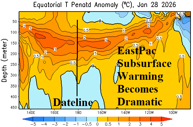
Fig. 1: The subsurface equatorial Pacific Ocean upper ocean heat anomalies.
Discussion: Significant warming is observed in the equatorial Pacific Ocean subsurface during late January (Fig. 1). The observation and trend support a rapid ending to La Nina in February with increased risk of El Nino developing during the northern hemisphere spring season.
A significant snow and river ice melt is ahead in the Great Plains and Midwest U.S. The GFS indicates temperatures surge to 10-15F warmer than normal in the 8-14-day period (Fig. 2). Daytime temperatures surge to 43 in Chicago, 49 in Des Moines, and 60 in St. Louis by the 12th of February. A warm-up is (also) forecast for Southern Europe in the 8-14-day period, a much warmer change compared to weekend forecasts (Fig. 3). Northwest Eurasia will stay extremely cold.
Extremely dry climate has developed across Northeast Argentina, Eastern Paraguay, and Uruguay (Fig. 4). In this zone during the past week, temperatures averaged 2-4C hotter than normal. Combining GFS and ECM, the 10-day rainfall forecast maintains Northeast Argentina/Paraguay dryness while East Brazil is very wet (Fig. 5).

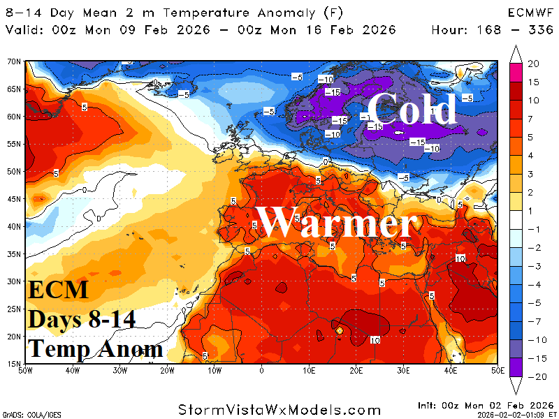
Fig. 2-3: The GFS 8-14-day temperature anomaly forecast for the U.S. and ECM temperature anomaly outlook for days 8-14 across Europe.

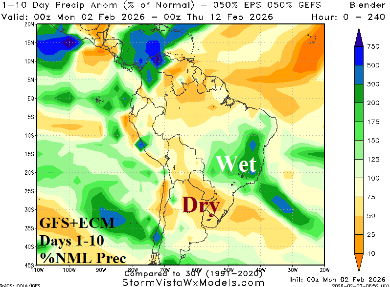
Fig. 4-5: The 7-day percent of normal rainfall observations across South America and GFS+ECM 10-day percent of normal rainfall outlook.