
Positive Arctic Oscillation = Polar Vortex Evolution
10/08/2026, 10:31 am EDT
Positive Indian Ocean Dipole Is Strengthening
10/12/2026, 8:35 am EDT
Climate Impact Company Early U.S. Report
Issued: Friday October 9, 2026
Highlight: Excessive rainfall in the forecast.
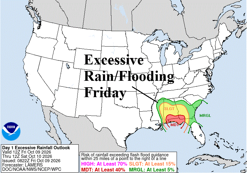
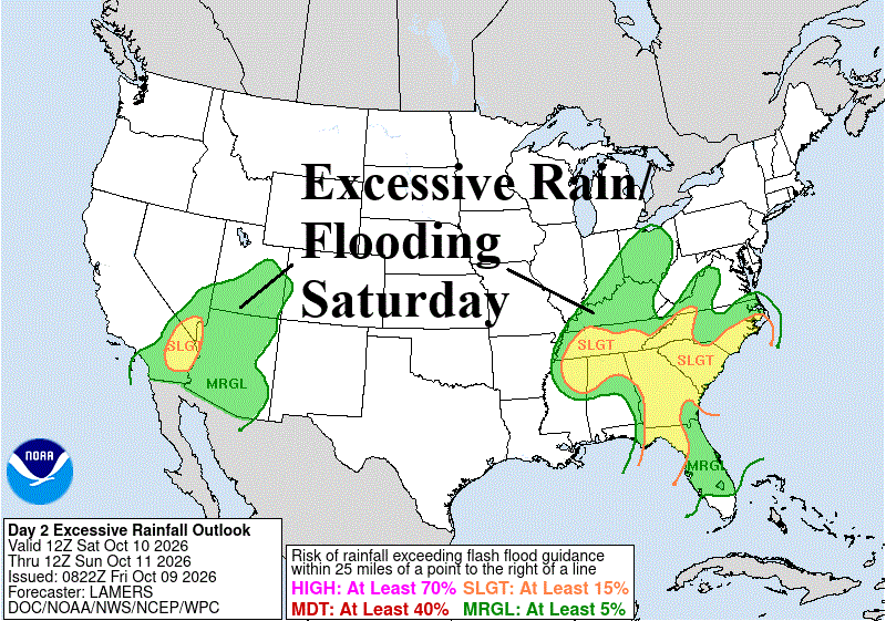
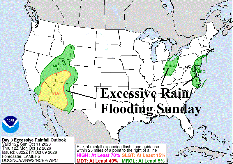

Fig. 1-4: NOAA/WPC excessive rainfall/flood risk areas for the next 4 days.
Discussion: Excessive rainfall and severe thunderstorms associated with the remains of inland-moving Isaias and Rachel are on display in the Southeast and West into early next week. Excessive rain and flooding is widespread in the Southeast U.S. today (Fig. 1) expanding toward the Mid-Atlantic region tomorrow (Fig. 2). Excessive rain and flood risk appears in the Southwest U.S. tomorrow. On Sunday, the Southwest U.S. flooding event expands and could be life threatening (Fig. 3). The Southwest flooding shifts to the Great Basin on Monday (Fig. 4).
Tornado risk is indicated centered on the Florida Panhandle due to the arrival of Isaias later today (Fig. 5) shifting across Georgia to South Carolina tomorrow (Fig. 6). Severe storms are likely in the Mid-Atlantic region Sunday (Fig. 7).
The U.S. population weight HDD forecast indicates near normal after the current very warm week (Fig. 8).

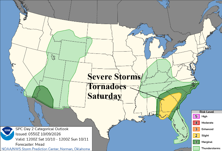
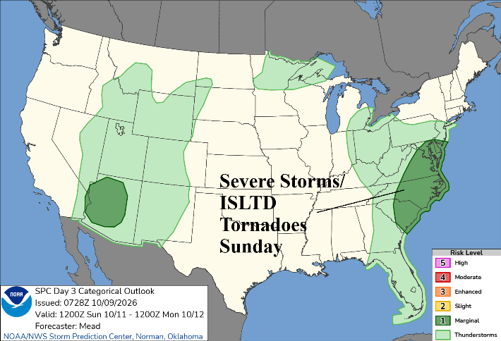
Fig. 5-7: NOAA/SPC severe weather risk areas through the weekend.

Fig. 8: U.S. gas population weight HDD forecast utilizing all models, their consensus, and comparison with 24 hours ago and 10/30-year normal.