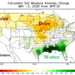
So Far in May, Midwest U.S. Soils are Drier. Wet Weather to Return!
05/15/2026, 9:24 am EDT
U.S. Daily Energy Report: Leading indicators are -PNA and emerging MJO.
05/19/2026, 10:06 am EDT
Climate Impact Company Early U.S. Notes
Highlight: Dry soils enhance East heat early-to-middle week; Severe storms Midwest/East-central States MON-TUE; Heavy rain Texas mid-to-late week.
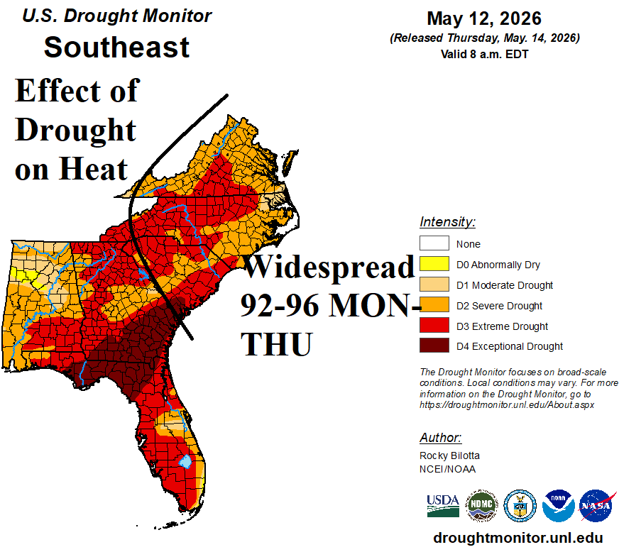
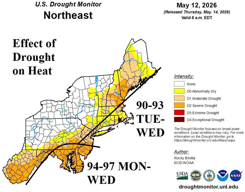
Fig. 1-2: Dry-to-drought soil conditions enhance hot weather risk this week.
Discussion: An example of a cresting high pressure over a drought area as the warm season arrives is presented this week on the East Coast. Harsh D2-D4 drought conditions dominate the Southeast/Mid-Atlantic States (Fig. 1) while a D1-D2 drought scenario spreads through the Coastal Northeast Corridor (Fig. 2). An amplified high-pressure ridge settles over these regions early-to-middle of this week causing widespread 90’s and the season’s first major heatwave occurring more than one month before calendar summer arrival. About 75% of the U.S. is encountering dry-to-drought conditions now and with springtime passing difficulty erasing drought increases. Combining SPI6 and CAS soil moisture anomaly forecasts for July (Fig. 3-4), an ALERT for excessive heat across ongoing or developing drought areas in the Mid-Atlantic/Southeast States and Great Plains is issued.
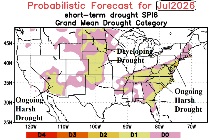
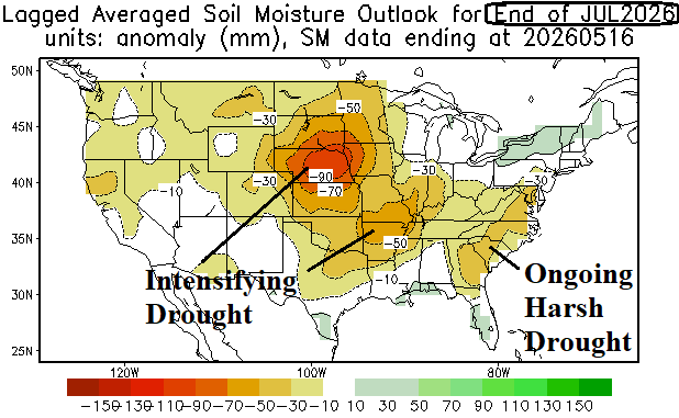
Fig. 3-4: Trouble ahead…SPI6 and CAS drought regions projected for July 2026. Expect excessive heat enhancement risk in these areas.