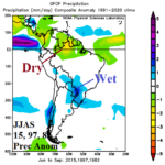
Cool Season Precipitation Pattern Across South America During Super El Nino
05/13/2026, 3:58 pm EDT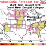
ALERT Great Plains/Southeast U.S. for Drought/Extreme Heat Risk Mid-summer
05/18/2026, 5:50 am EDT
Climate Impact Company Early AG Market ALERT
Issued: Friday May 15, 2026
Highlight: Wet weather returns to Midwest this weekend. A lot of severe weather in the Great Plains. Drier Western Europe medium range. Chill reaches Brazil.
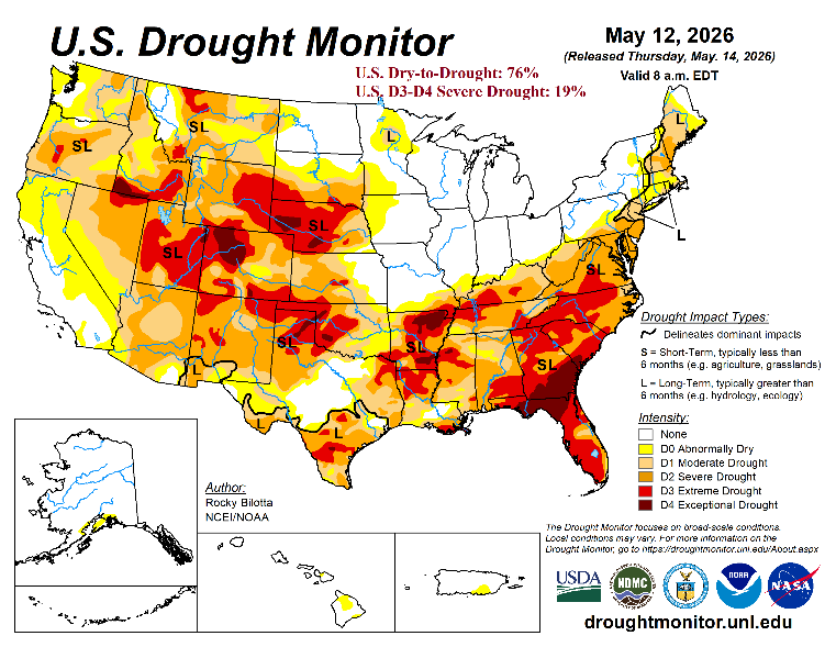
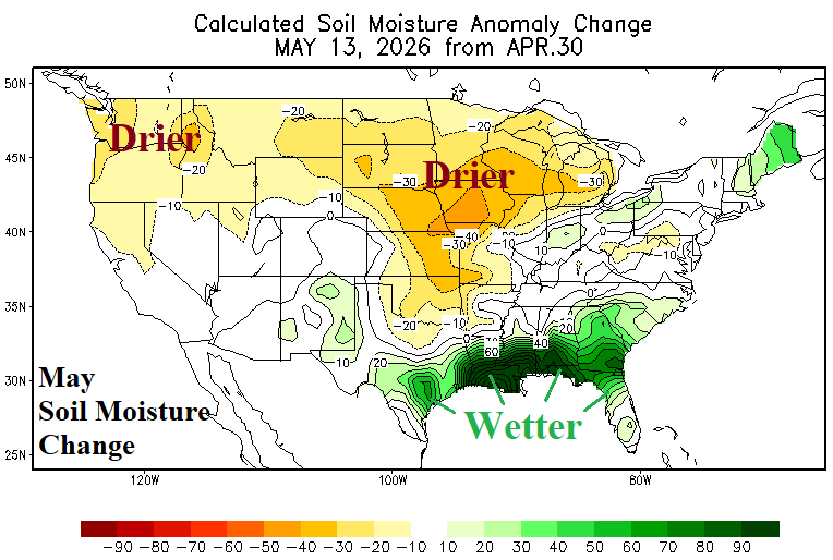
Fig. 1-2: The Weekly U.S. Drought Monitor analysis and soil moisture change analysis for May (so far).
Discussion: The U.S. Weekly Drought Monitor analysis (Fig. 1) reveals a slight increase (76%) from the previous week in aerial coverage of dry-to-drought soil moisture conditions while severe (D3-D4) drought remains unchanged at 19%. During May so far, U.S. soil moisture tendency is much drier across the Midwest States and much wetter in the Gulf region (Fig. 2). The latest quantitative precipitation forecasts (QPF) from NOAA indicate a wet zone centered on the Upper Midwest/Midwest States through the weekend (Fig. 3) extending to the Mid-south U.S. early next week (Fig. 4) and consolidating in Texas days 6-7 (Fig. 5). Combining the GFS and ECM reveals a wet southern half of the U.S. wet pattern in the 8-14-day period and shifting drier across the North-central U.S. plus the upper Midwest (Fig. 6).
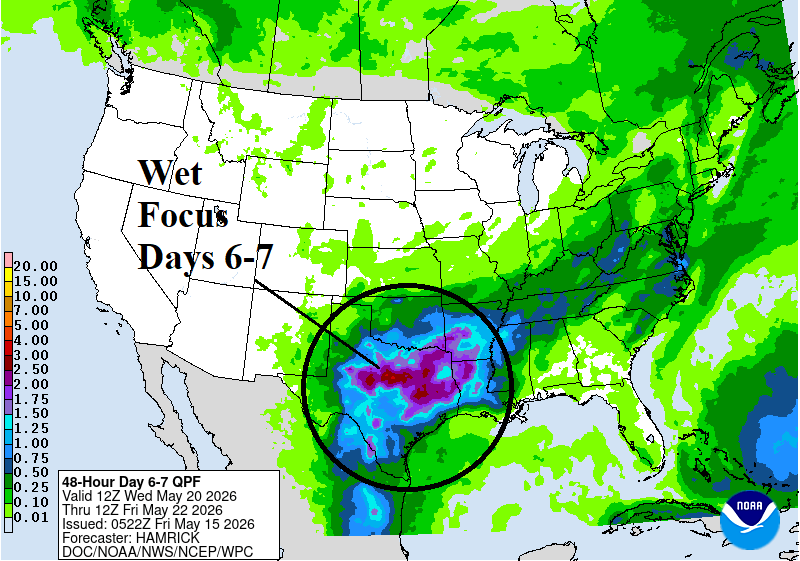
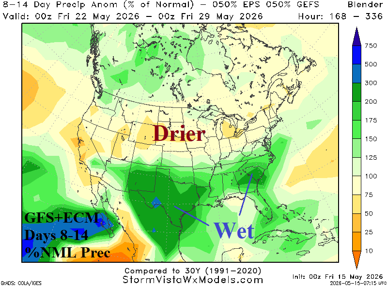
Fig. 3-6: NOAA/WPC 1-7-day quantitative precipitation forecasts for the U.S. plus the GFS/ECM 8-14-day percent of normal rainfall outlook.
In Europe, a wetter weather pattern has emerged (Fig. 7) although staying mostly dry in France and U.K. The Black Sea region has shifted drier in recent days. The outlook is broadly wet this week with rainfall convening in the Black Sea region during the medium range while Western Europe shifts much drier (Fig. 8). West/Central Europe shifts much warmer in the 8-12-day period.
In South America, pulses of unusually cool weather continue. GFS projects a chilly 6-10-day forecast across Argentina extending to southwest/southeast Brazil (Fig. 9). A slight risk of <32F for far Southeast Brazil is indicated (Fig. 10). A stalled frontal system inspires heavy rain near and east of Paraguay during the 15-day forecast period (Fig. 11).
In Australia, the 15-day precipitation outlook indicates periods of heavy rain on the East/Southeast Coast including a wet regime on the northwestern coastal region (Fig. 12). In the 6-10-day period, a cooler pattern emerges centered on northern continent (Fig. 13).
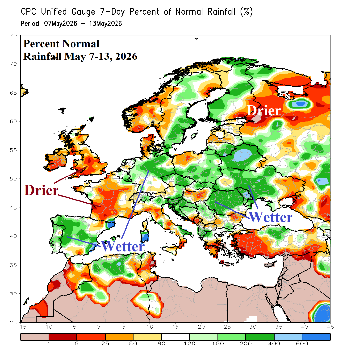
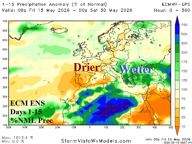
Fig. 7-8: Europe 7-day percent of normal rainfall observations and 15-day percent of normal rainfall outlook.
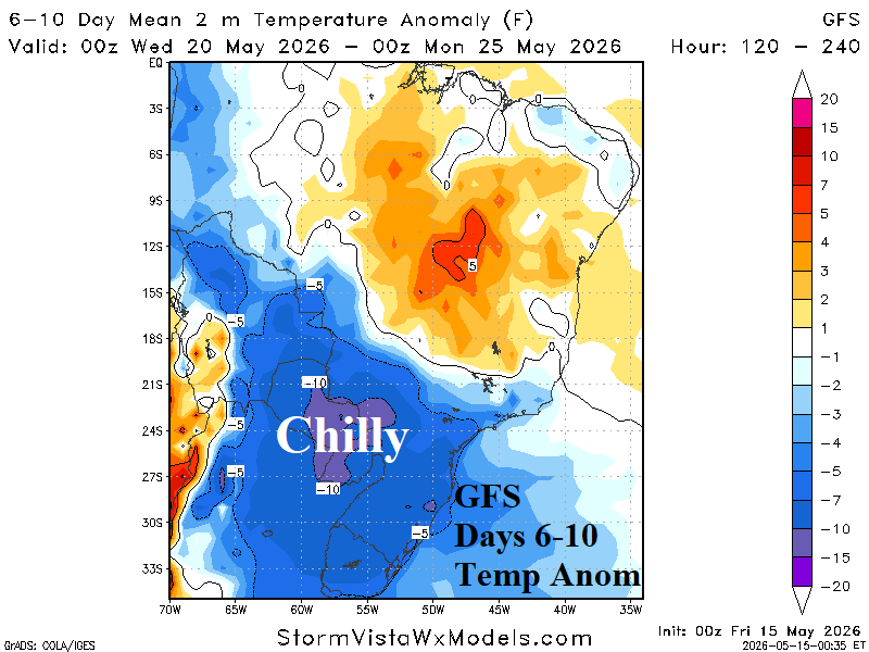
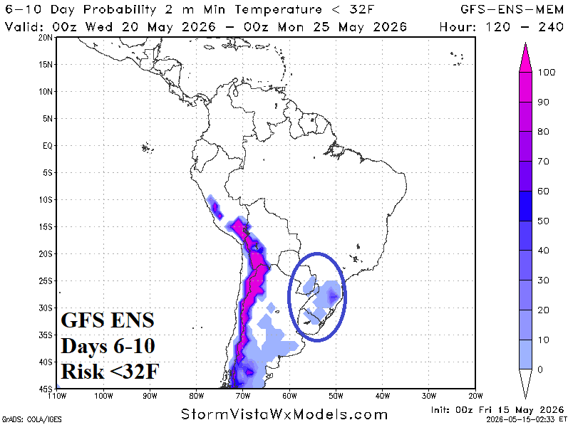
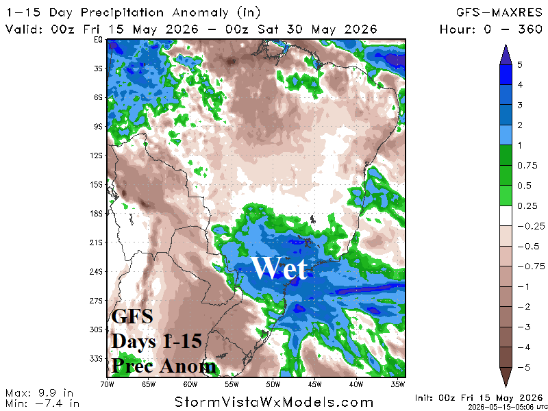
Fig. 9-11: The GFS 6-10-day temperature anomaly forecast is chilly and features a slight risk of <32F in Southeast Brazil. Heavy rain persists in Southeast Brazil.
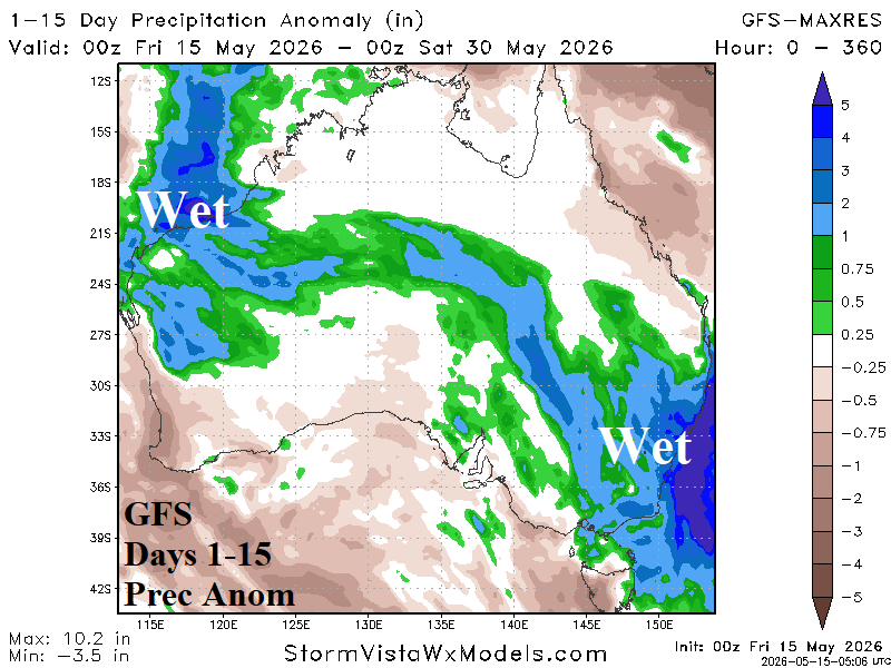
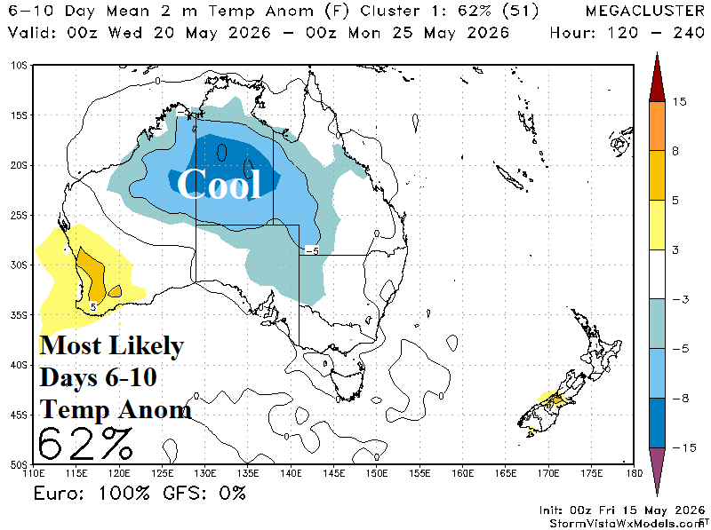
Fig. 12-13: The GFS 15-day rainfall anomaly forecast across Australia and the cooler pattern change indicated in the 6-10-day period.