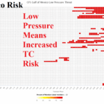
GFS Eager to Forecast Low Pressure During The Medium-range in Gulf of Mexico
06/17/2025, 9:30 am EDT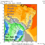
Southern Brazil Cold Coffee Risk TUE/WED
06/22/2025, 1:33 pm EDT
Climate Impact Company North Atlantic Basin 10-Day Monitor
Issued: Thursday June 19, 2025, 8:40AM EDT
Highlight: Know where the 31C/87F SST is located! Very warm SST fueled last minute category-4 major hurricane intensification for Erick. North Atlantic stays ALL CLEAR.
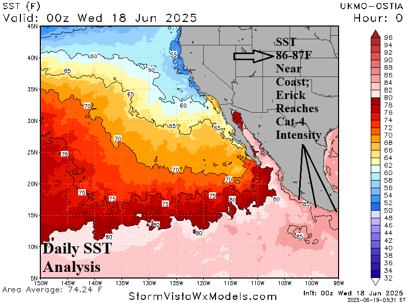
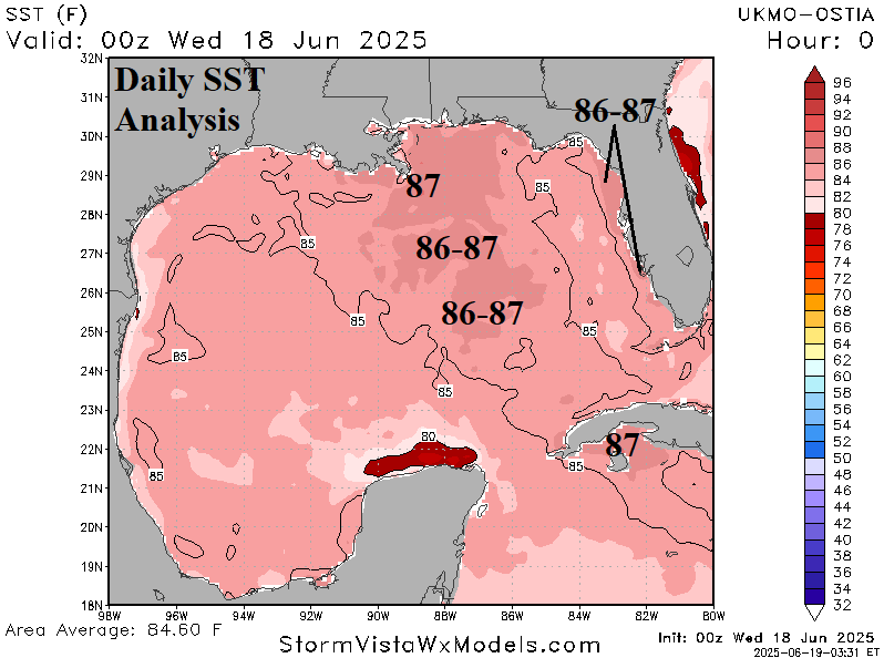
Fig. 1-2: The morning North Atlantic basin weather satellite view.
Discussion: Erick intensified rapidly to a category-4 major hurricane overnight approaching the south coast of Mexico. A leading contributor to the rapid intensification was the available upper ocean heat which increased dramatically on approach to the coast as indicated by the increase in sea surface temperature (SST) to 86-87F (Fig. 1). The 86-87F SST (or warmer) has been a strong indicator of rapid increase to major hurricane potential in the North Atlantic basin during the 2016-24 active period. Currently, 86-87F SST has evolved southeast of Louisiana and southeastward to the East-central Gulf of Mexico near the LOOP Current (Fig. 2). Knowing where the exceptionally warm SST are located during the 2025 tropical cyclone season is a good indicator for where potential rapid intensification to powerful major hurricanes is likely to occur.
The North Atlantic basin is ALL CLEAR this morning thanks to a strong upper shear axis across the Yucatan Peninsula and eastward through the Caribbean Sea and outer Atlantic (Fig. 2). The upper shear is enhanced by the outflow pattern from Major Hurricane Erick. A consensus of operational models through 15 days indicates the tropical North Atlantic stays ALL CLEAR. During the 2016-24 active period in the North Atlantic, only one year (2019) produced the first tropical cyclone of the year after July 1 which is likely in 2025.

Fig. 2: The North Atlantic basin weather satellite view.