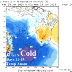
Cold Risk Southeast Brazil 11-15 Days Out; West Africa Cocoa Continues Wet Pattern
06/14/2026, 10:14 am EDT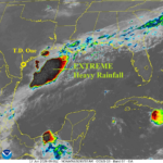
Tropical Depression One is a Trouble-maker
06/17/2026, 8:41 am EDT
Climate Impact Company North Atlantic Basin 10-Day Monitor
Issued: Tuesday June 16, 2026
Highlight: Expecting Arthur to form off Central Texas Coast tomorrow, most of the attendant weather (heavy rain/high wind) east of the center.
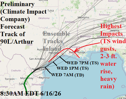
Fig. 1: Preliminary forecast track of 90L/Arthur for tomorrow.
Discussion: Low pressure area (90L) in Southern Texas will shift northeastward and organize into a center, likely a tropical depression, by 7AM EDT tomorrow of the central Texas Coast. Water temperatures are supportive (83F). Following ECMWF which takes this system northeast-to-north into Galveston Bay tomorrow evening. NOAA/NHC indicates 60% chance of an upgrade to a tropical storm (Arthur) while offshore and prior to reaching Galveston Bay. Forecast models indicate most of the attendant weather, as this system organizes, is east of the storm center. Heaviest rain and highest wind will be east of the storm center most of tomorrow afternoon and evening with the northern portion of tropical storm wind risk reaching the upper coast of Texas, mostly east of Houston, and the southwest/south coast of Louisiana.
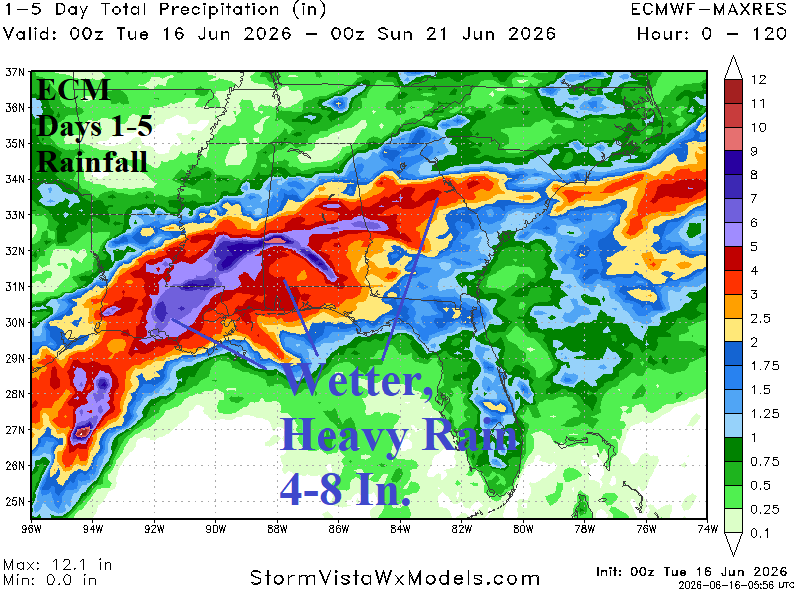
Fig. 2: Most of the heavy rain and high wind associated with Arthur is east of the storm center including an eastward shift of the heavy rain to Louisiana and eastward.
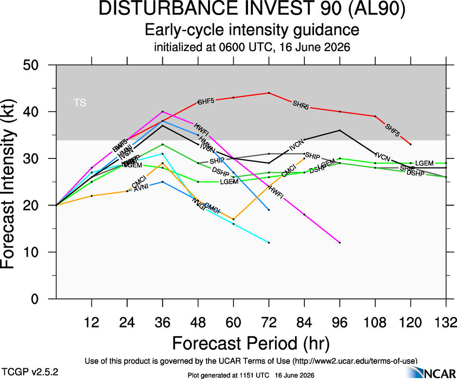
Fig. 3: NOAA/NHC tropical cyclone forecast models indicate risk of an upgrade to a tropical storm (Arthur) tomorrow.